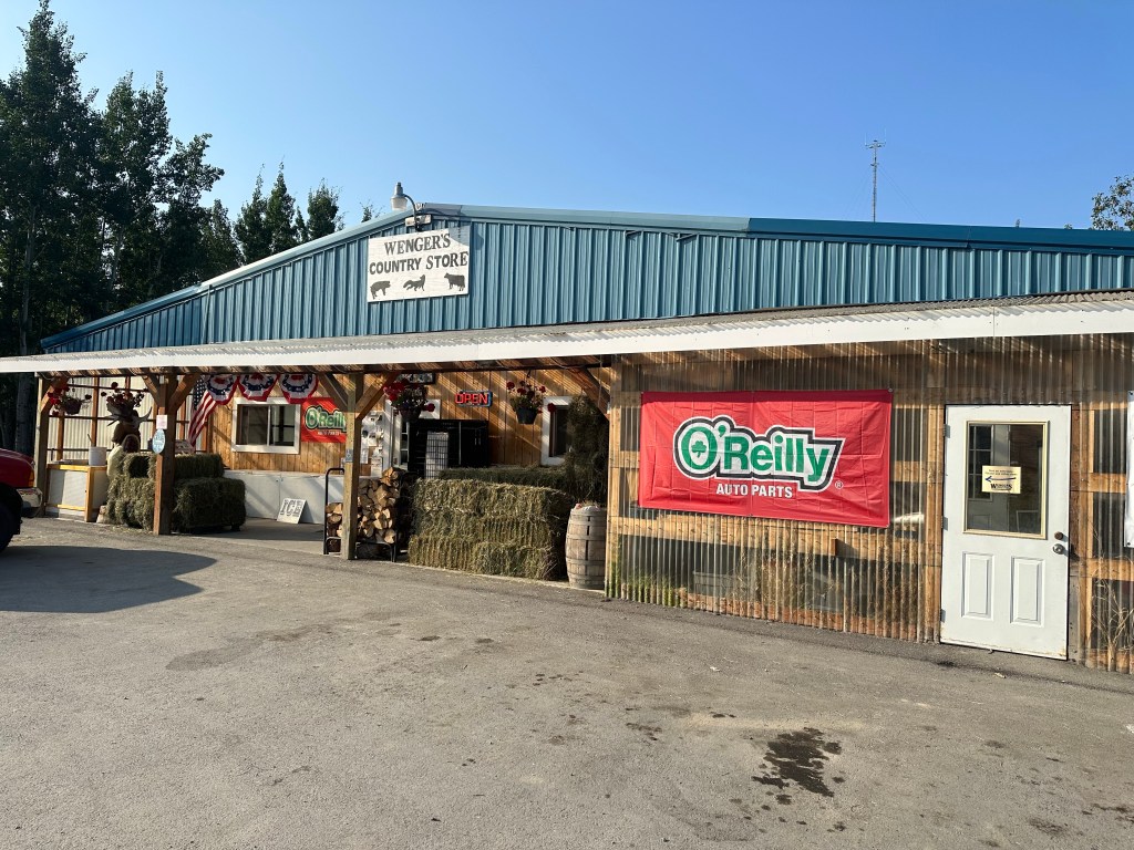
This morning we stopped at Wengers Country Store, more for a look than needing anything. The advert in our brochures says “You’ll find a little bit of everything” groceries, hardware, auto parts, pet care, farm and garden supplies, propane, ice, snacks, souvenirs and dip nets. Just about everything. The front verandah was stacked with hay and firewood. Inside was a surprise. Yes it had everything listed and more. Good supply of groceries, fresh fruit and veg, frozen meats and breads and dry goods of all descriptions. Anything a homesteader in this area could want. (P- Or for a couple of Aussies wandering around in a truck camper with very few pre made plans- Just gotta love the “Country Stores”
We made a stop at a “Fish Camp” at Copper Centre on the Klutina River where Lee and Claudia (who we met fishing in Valdez) were staying in their RV. We spent several hours with them watching the river flow past their campsite. The previous day Claudia had caught a 19.7 pound King Salmon just off the boat launch.
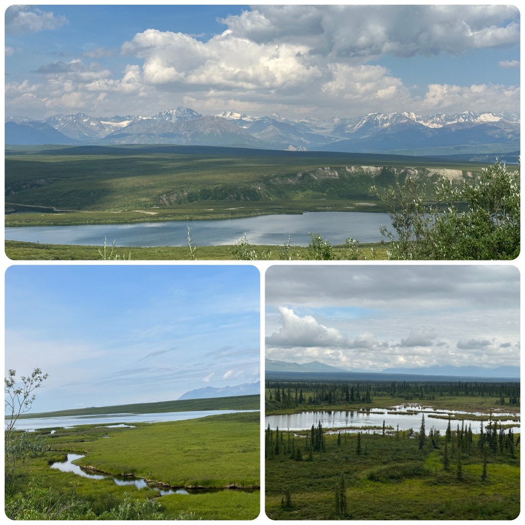
From here we headed up to Paxon where we turned west onto the Denali Highway. This is a summer road and is closed in winter. The scenery is spectacular with the Alaska Range becoming more prominent the further we travel. Mountains soaring to 16-18000 feet. Snow capped summits and glaciers, tundra, multitudes of lakes and ponds, beaver dams and glacial ridges. We stop for the night at Tangle Lakes Campground. The Tangle Lakes are a series of long, narrow lakes connected by the Tangle River that forms the headwaters of the Delta River.
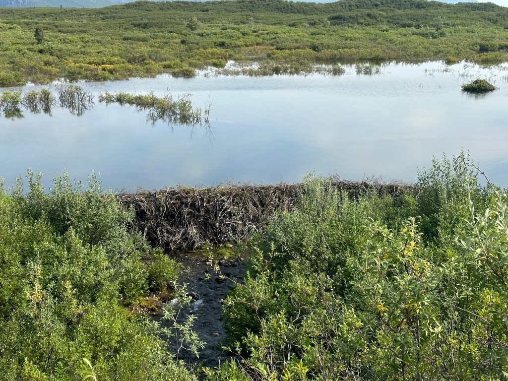
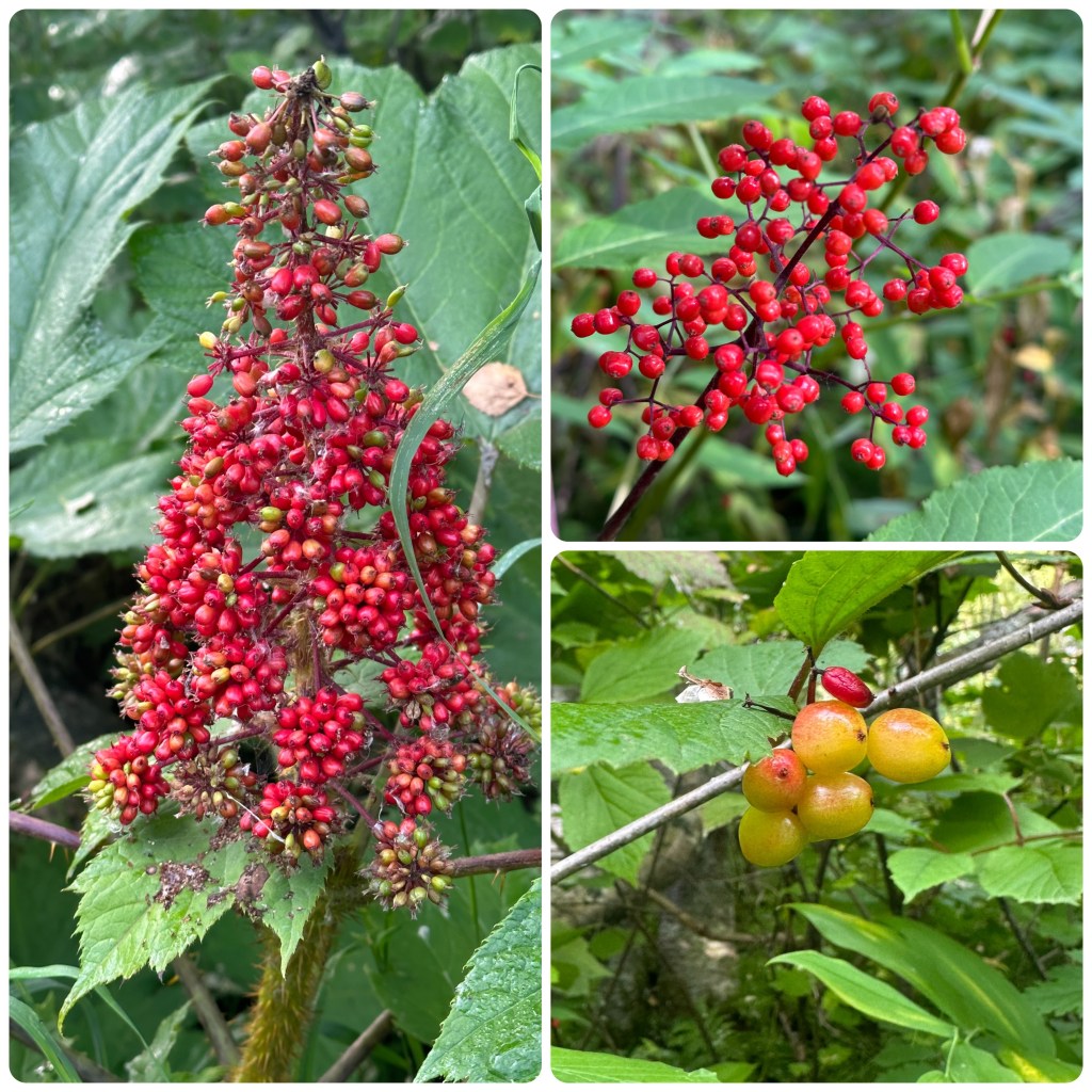
Stopped on the side of the road to check out a beaver dam. An amazing structure. Dam wall was about 5 feet high and held back a huge amount of water. Not often you can get right up to a beaver dam without getting your feet wet.
Low cloud stopped us getting any views of Denali but we enjoyed the trip across the Highway. Quite different to what we had expected. It was more open tundra land, big river valleys where the McLaren and Susitna Rivers run and huge mountains in the distance. (P- most of the road was on top of a ridge so we could drive with a vantage point view- Judith tells me they are Eskers ( yep she read it in a book!)
We turn onto the Parks Highway and head south. First stop along here is to check out Hurricane Gulch Bridge. This bridge is 260 feet above Hurricane Creek, not as high as the railroad bridge that spans the gulch. (P- Hurricane gulch holds a special memory for me as it was one of the places we stopped when we toured here with my late sister Eileen and her Husband Ross. We went for a stroll up a forest trail and I am sure Eileen developed 360 degree vision on that walk and others we did in Alaska in the year 2000. That was a fun trip with my bestest sister a trip that always bought back memories and still does).

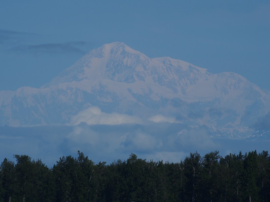
There are places to stop as we head south to view Mt McKinley, Denali, but the cloud is low and no views are visible today. Hopefully we will get another chance later in the trip.
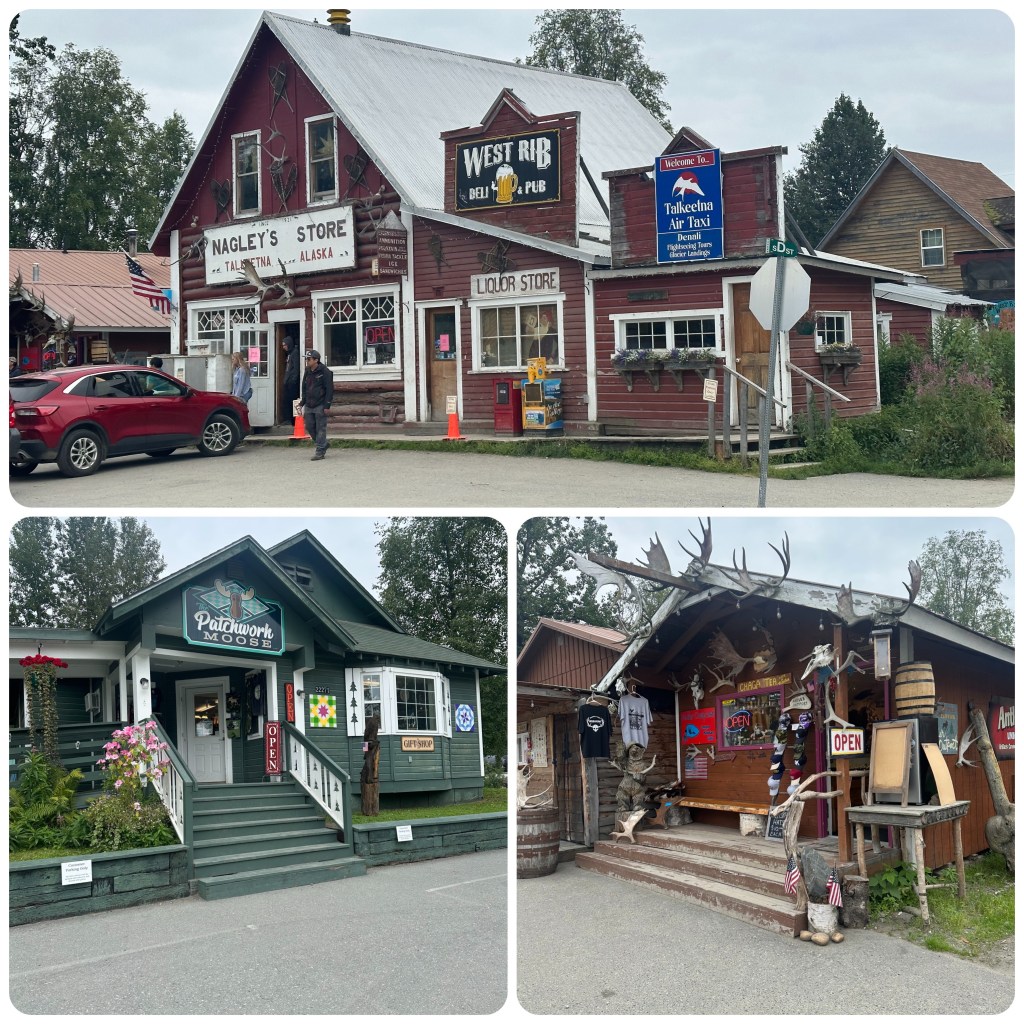
We continue on to Talkeetna where we find a campground for the night. Once we set up we walk into town through a short bush track from the park, across a gravel road and the railway tracks and through the rail yard. It’s a beautiful late afternoon and there are lots of people about. Free music at the sound shell and people are gathering on the grassed area ready to listen. We wander along the street checking out the shops and restaurants and people watching. Walking down to the rivers edge the view of Denali is still covered in cloud. Back up the other side of the street and Philip has spotted “The Patchwork Moose” and even though it’s almost 7pm it’s still open, so we just have to go in. It’s a lovely shop with lots of gorgeous kits and fabrics, souvenirs and quilts. Some of which is coming home with me. (P- NB not that I am counting but that’s #3 quilt shop Phil has found! One good thing about dropping in is I can usually extract some local “what’s to see” gossip from the proprietor ( even if it took almost 90 minutes to extract at the last one). I have often commented quilting is a refined form of an excuse to have a catch up and gossip! )
We wander back to the RV via the boat launch where families are just heading out for the evenings fishing. They are running jet boats here because the rivers are shallow. In the campground one large group are setting up for a wedding tomorrow and it looks like most of the guests are staying in RV’s or campers. Should be a fun weekend for them.
5th August.
We are up and out for a walk before packing and leaving. We walk back round the road into town and although not as busy as last night, this morning there are quite a few tourist from the train about. A few of the main shops are open which we wander through again before heading to the end of the road and the river to see if Denali is visible yet. Stopping on the way for some Spinach Bread. This is quite a popular spot and is well know around these parts. It’s served out of a quaint Airstream Trailer. Tons of garlic, spinach and cheese on spent grain bread cooked while you wait. It was delicious. (P- and cost me another 10,000 steps that day to walk it off!)
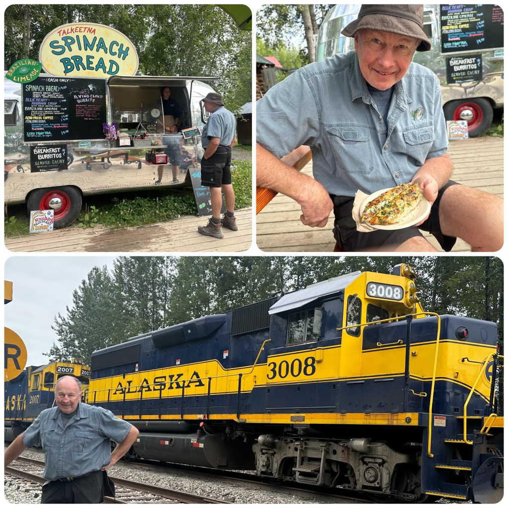
Then back to the RV to pack up and head out of town. At the end of the street we are suppose to turn right but the airstrip is to the left so Philip just has to go that way to check out the planes. Then as we head back we get a very brief glimpse of the mountain so decide to drive back down to the river viewing spot. (P- incorrect -Judith spots Mt McKinley looking up the railway line as we return from the airfield and says let go to the view point for Mt McKinley (Denali). – Thanks Phil for going to look at the planes)! We park up and walk to the river and line up along the banks along with many others as Denali slowly emerges from the cloud. 30 minutes or so later the mountain is clear and we become two of the 30% of people that see it with no cloud. This is actually the 3rd time we have seen it since 2000.
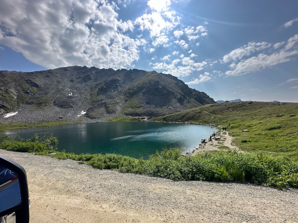
Once we leave Talkeetna we head toward Hatcher Pass. This is a popular recreation area for locals from around Anchorage. The road initially follows the Little Susitna River before climbing up over the Pass. Today there is a 50 mile marathon happening so there are runners (walkers, plodders and persistent participants ) all along the road. The road winds up to 3465 feet with steep drop offs and hairpin bends with spectacular views of the valley and the mountains. Summit Lake is the highlight of the drive to the top but there are so many vehicles parked in every available space that we don’t stop. People are hiking to the peaks and around the lake. There are also paragliders floating around on the thermals.
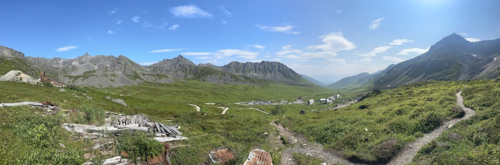
We continue on down the other side, very steep and narrow road to Independence Mine. This was one of Alaskas largest gold mining operations and is now an abandoned gold mine in a spectacular setting. Many of the buildings have been held in what the National Parks here call “Arrested Decay”. Meaning they repair so that it doesn’t decay any further. We have been here previously so rather than spend time wandering around the buildings we do a hike 5 k round the back of the site. It a great little hike and gets the heart rate up. There are people here everywhere, hiking the many trails around the area. People are making the most of the great weather we are having, the best they have had so far this summer. Let’s hope it continues.

Great blog. I remember watching out to se the top of my McKinley
LikeLike
I meant Mt Mckinley
LikeLike