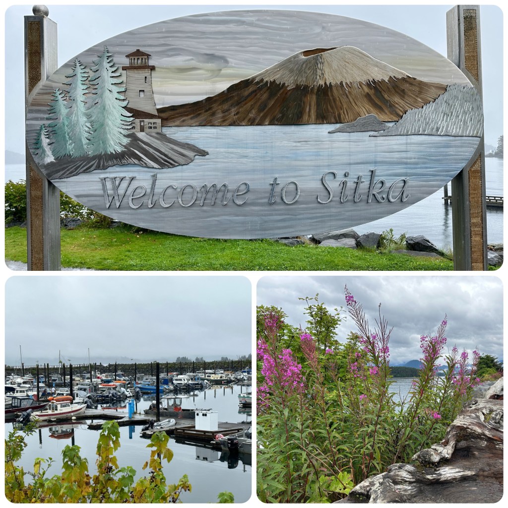
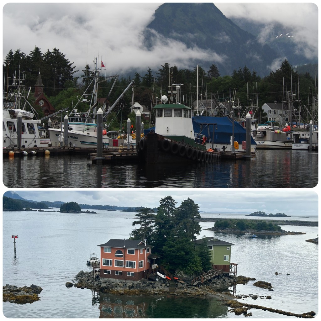
A travel day today so an extra early morning for us, at 4am we left our camper at the Go North Depot before catching a taxi to the airport for a 7 am Flight to Juneau then onto Sitka arriving around 11 am. We were met at the airport by an Uncruise Representative who delivered us to the Westmark Hotel for the next two nights. Downtown Sitka (2 Streets) is closed off today as when there are more than 4000 people in town they close the streets and have street food and entertainment. There are two cruise ships in today, The Westerdam and Qantum of the Seas, thus more than 4000 people. We stop for some Salmon Chowder before heading back to our room to don our wet weather gear. The rain is getting heavier and we want to walk around the docks and foreshore. It’s the first serious rainy day of our vacation so far. Once in our gear and looking stunning we head back out and grab a couple of crab rolls which are delicious then check out some of the shops along the Main Street. Some pretty fancy Alaskan craft shops and the usual touristy souvenir spots. Eventually we find a cafe and stop for a hot drink and a break from the rain.
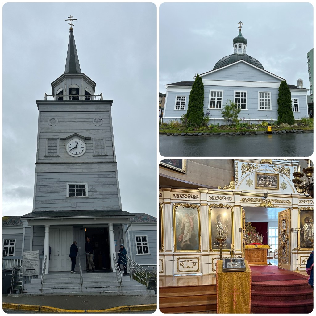
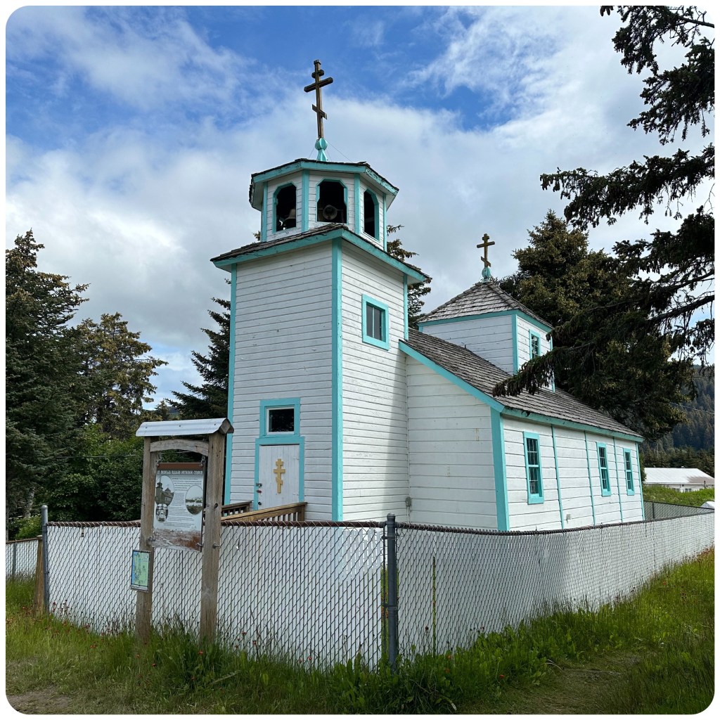
Later as the rain eases we head out for another walk and check out the Japonski bridge and more of the commercial dock areas. Sitka is a quaint fishing port with a Russian Influence. It was still part of Russia until 1867. We check out the Russian Orthodox Church on the Main Street which is a timber church and very ornate inside. Of course we have to check out all the fishing boats in the harbour and as the rain has stopped we wander along the waterfront and over the bridge.
Russian Orthodox Church
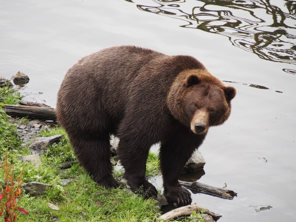
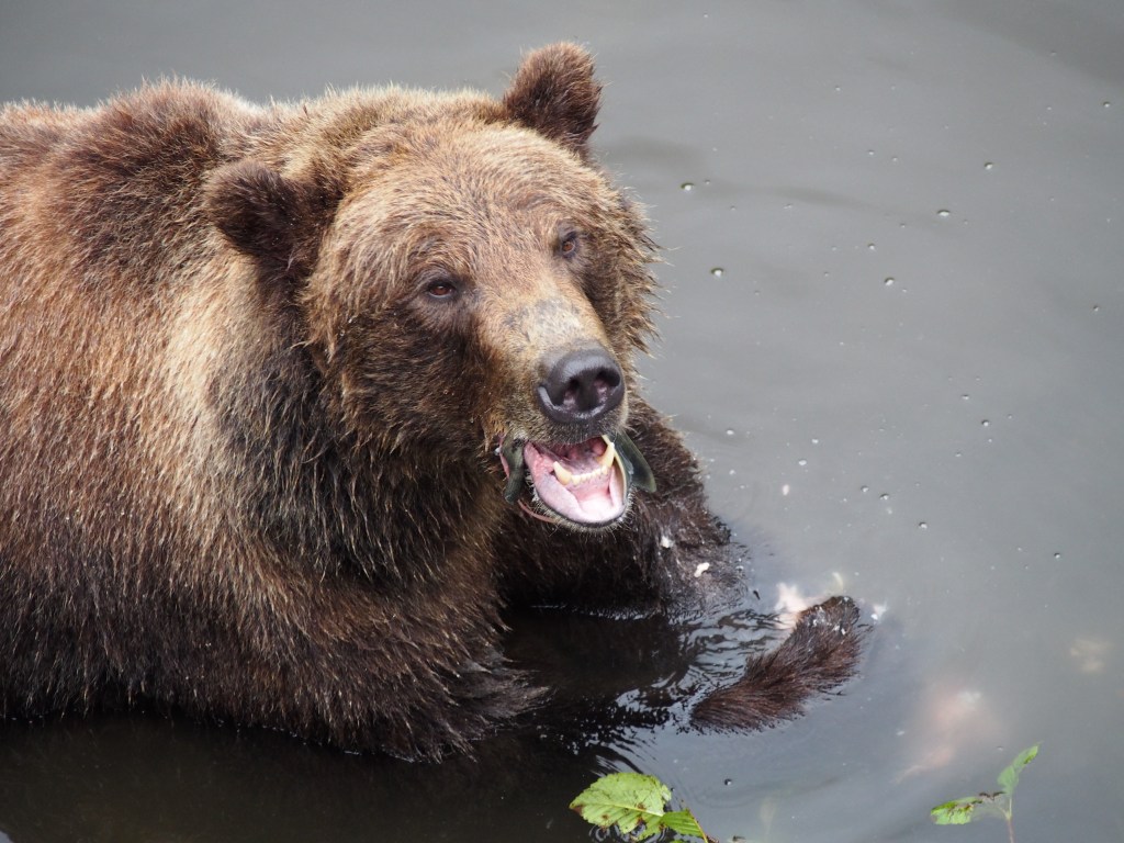
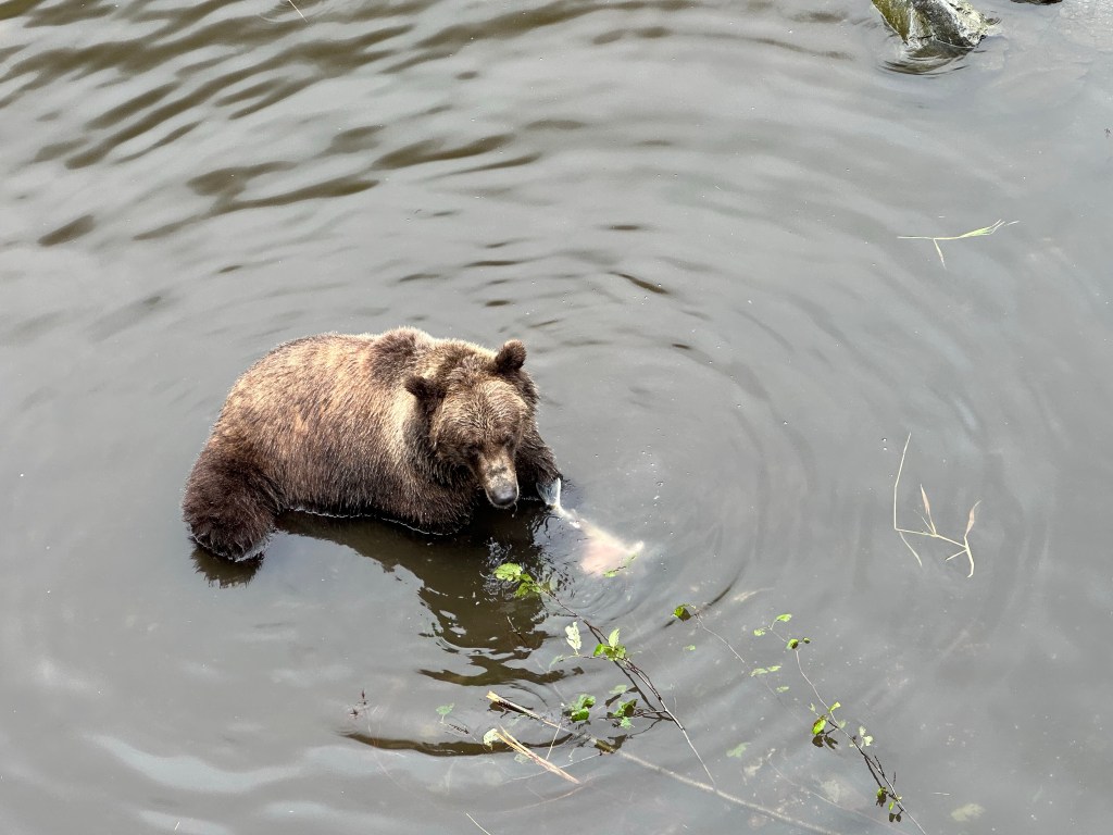
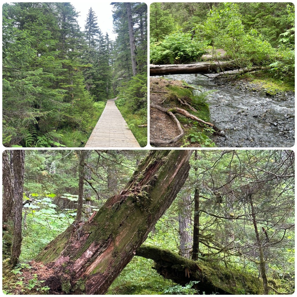
Friday morning we meet Helen and Ian at the Blue Bus Stop for the ride out to Fortress of the Bear Park. This bus does a loop around the town before taking the road out of town. Good way to see the surrounds. We spend an hour watching the bears before heading back to our accommodation to get rain jackets again. Then we all walk along to the Totem Park, watching salmon swimming upstream to spawn and eagles feeding. It’s a lovely walk through the forest area with the totem poles dotted along the walk. Then up to the Raptor centre to see the rehabilitation centre for bald eagles, golden eagles, owls etc.
Native Totem PolesFortress of the Bears
Walking back into town we stop at the National Cemetery before finding a cafe for a cuppa. Philip and Ian continue walking while Helen and I head back to our rooms to read and relax for a while.
(P- Sitka was a favourite village to visit in 2000 and it hasn’t let us down this time. Clean, organised, friendly, with an interesting history and pleasant walks. I am sure it will remain a favourite. I was prepared to tell a story of our bear tracking in the wilds of Baranof Island and share some photos to prove it but Judith stole (spoilt) the story when she mentioned the Fortress of the Bear Park! So enjoy the Bear photos but no story!).
Tomorrow, 12th August, we board our cruise in the afternoon for the next 7 days, exploring the area.
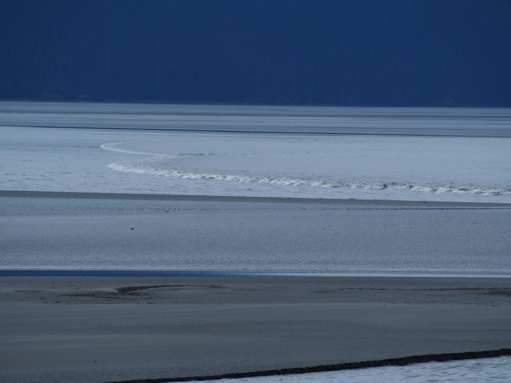
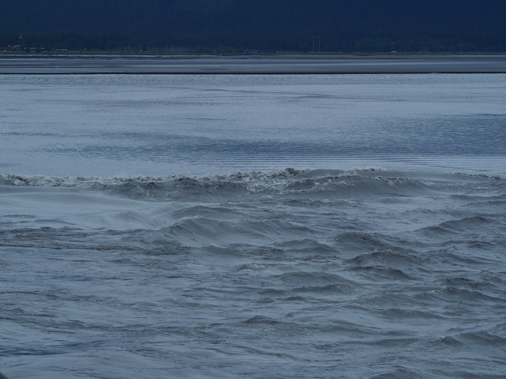
Today we are heading out to Aleyska Resort at the head of Turnagain Arm. One of the phenomena of this area is that at certain times of the month they have what is called a Bore Tide. This is a breaking wave that rushes in twice daily at speeds of 6 to 24 mph and can be up to 6 feet high. The length of the Turnagain Arm bore tide is about 50 miles and takes up to 5 hours to travel from the mouth of Turnagain Arm to the end. We were just driving along not really taking much notice until Philip noticed a couple of surfers out in the waters, surfing the bore tide wave. Pulling over we watched the wave, (this time fairly small probably 2’ (600mm) in height), for a while. It’s quite a sight to see this wave spread across the width of the arm. Pretty hard to take photos of it but gave it a shot.
Bore Tide Wave, Turnagain Arm
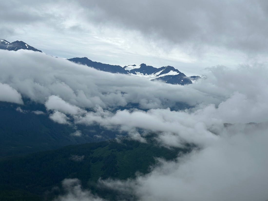
Then it’s on to the Aleyska Resort for Philip to take on the Veilbreaker Skywalk while I enjoyed a lovely hike along the Winner Creek Trail. I would rather keep my feet firmly planted on the ground especially today as the clouds are hanging around the peaks.
(P- On April 1st this year, I saw an advert for an adventure walk across some peak to peak suspension bridges. These were located near Girdwood, Alaska. I thought this is for me and I will book that, but the advert disappeared and I just thought it was an April “Fools “ joke! Phil fooled again! We were in Homer, Alaska and the advert came back announcing the Veilbreaker peak walk at 2500’ elevation had just opened. A mental note was made to make sure I can fit this in our unplanned wander around Alaska. Yesterday was the day! We went up on the Sky Tram to 1500’, had lunch and I met the guides with 6 others. Harnessed in safety gear and helmets off I went without Judith – there is no way she would think this was gunna be fun! We had about 3/4 of a mile hike up to the summit the first peak, the cloud randomly engulfing us then clearing we get to the first “bridge” consisting of a couple of wire ropes supporting some 9” (225mm) wide galvanised steel walkway material plus a safety line to clip to just in case! 2 of the 7 victims never made the first bridge and turned back after seeing the approx 330’ (100m ) long bridge with about the same measurements to the steep valley below. I did it solo as my wife was miles away ( walking without her bear defence pepper spray! ( which was in the pickup)! Every step the bridge would bounce and twist under my weight. The second bridge was up another steep climb and longer with a deeper drop underneath. Because there was only a few of us the guides allowed us to turn back and do bridge number 2 a second time. A fantastic adventure experience with great guides – It was well worth Judith’s effort worrying about me on it (as I certainly wasn’t! )Another top Alaskan Day.)
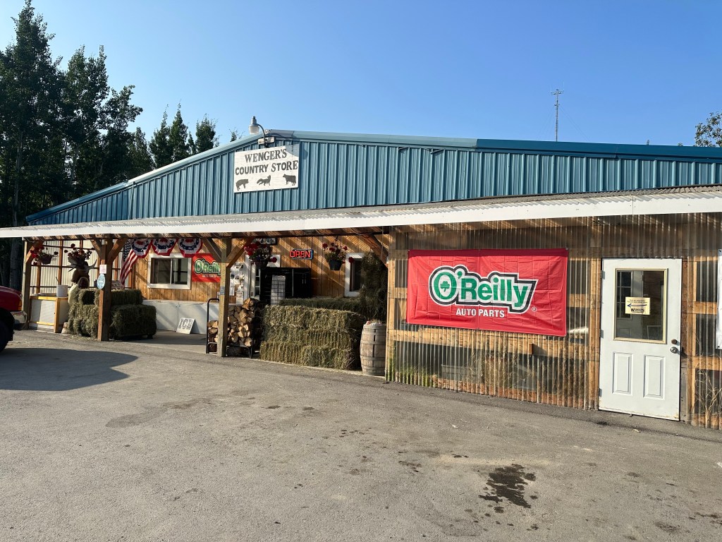
This morning we stopped at Wengers Country Store, more for a look than needing anything. The advert in our brochures says “You’ll find a little bit of everything” groceries, hardware, auto parts, pet care, farm and garden supplies, propane, ice, snacks, souvenirs and dip nets. Just about everything. The front verandah was stacked with hay and firewood. Inside was a surprise. Yes it had everything listed and more. Good supply of groceries, fresh fruit and veg, frozen meats and breads and dry goods of all descriptions. Anything a homesteader in this area could want. (P- Or for a couple of Aussies wandering around in a truck camper with very few pre made plans- Just gotta love the “Country Stores”
Wengers Country Store
We made a stop at a “Fish Camp” at Copper Centre on the Klutina River where Lee and Claudia (who we met fishing in Valdez) were staying in their RV. We spent several hours with them watching the river flow past their campsite. The previous day Claudia had caught a 19.7 pound King Salmon just off the boat launch.
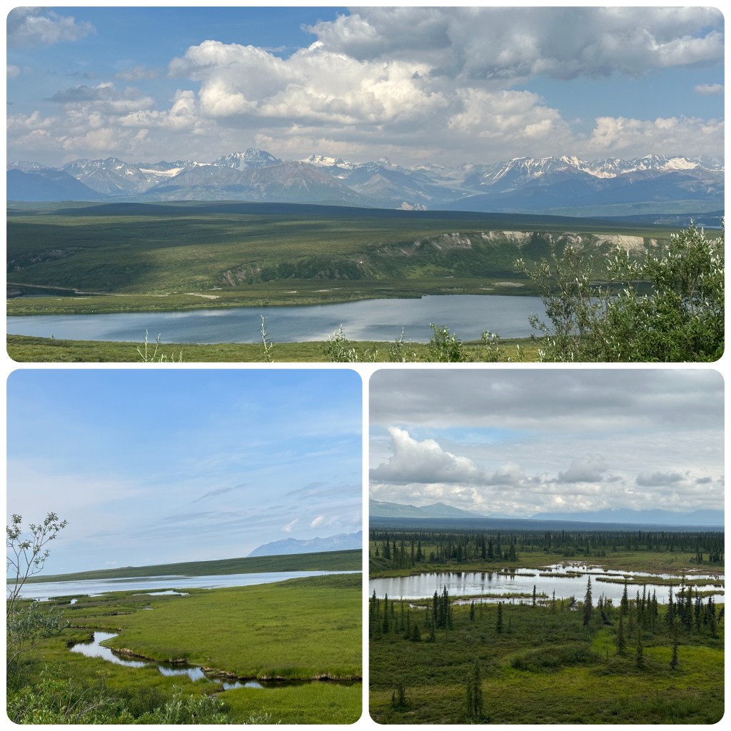
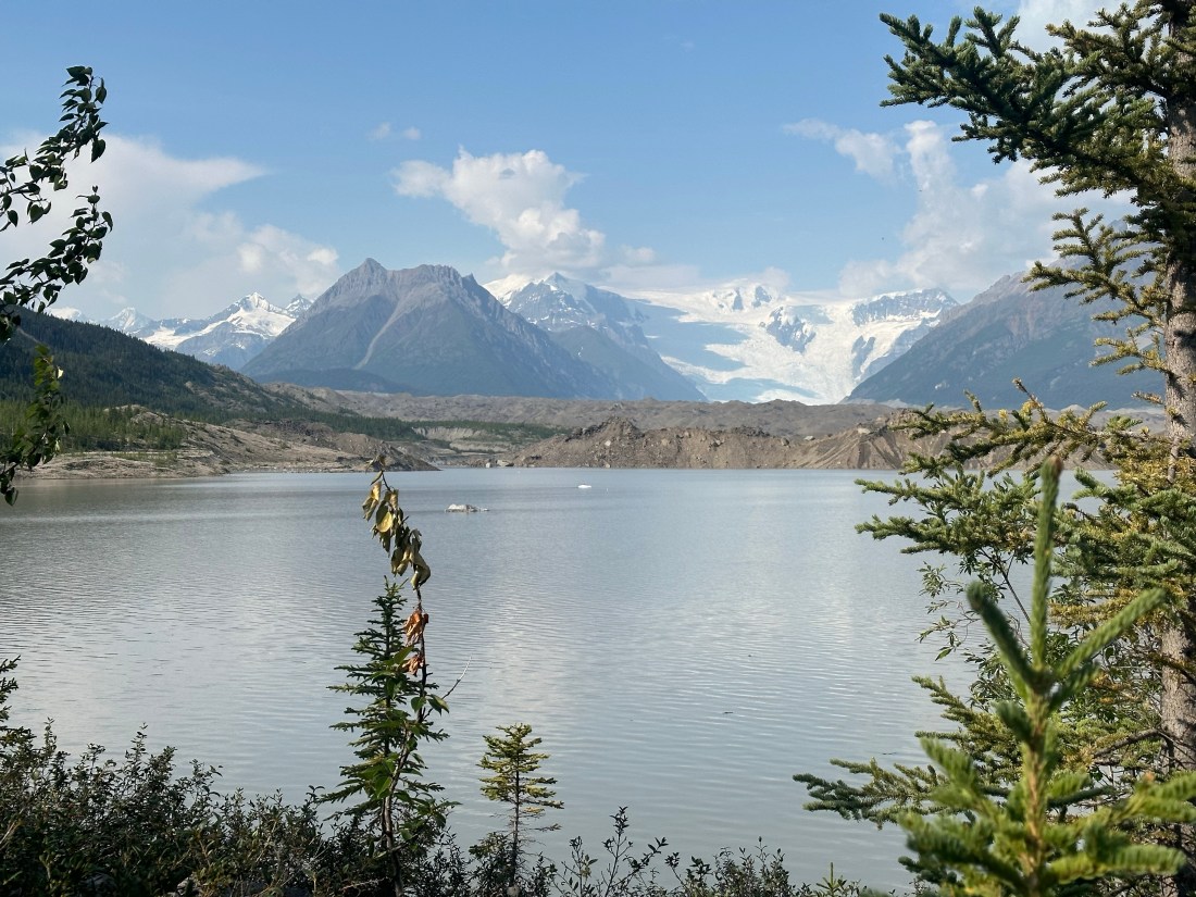
From here we headed up to Paxon where we turned west onto the Denali Highway. This is a summer road and is closed in winter. The scenery is spectacular with the Alaska Range becoming more prominent the further we travel. Mountains soaring to 16-18000 feet. Snow capped summits and glaciers, tundra, multitudes of lakes and ponds, beaver dams and glacial ridges. We stop for the night at Tangle Lakes Campground. The Tangle Lakes are a series of long, narrow lakes connected by the Tangle River that forms the headwaters of the Delta River.
Alaska Range and Some of the Many Lakes
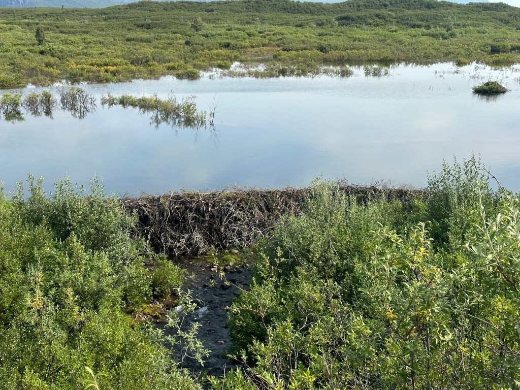
Stopped on the side of the road to check out a beaver dam. An amazing structure. Dam wall was about 5 feet high and held back a huge amount of water. Not often you can get right up to a beaver dam without getting your feet wet.
Beaver Dam
Low cloud stopped us getting any views of Denali but we enjoyed the trip across the Highway. Quite different to what we had expected. It was more open tundra land, big river valleys where the McLaren and Susitna Rivers run and huge mountains in the distance. (P- most of the road was on top of a ridge so we could drive with a vantage point view- Judith tells me they are Eskers ( yep she read it in a book!)
We turn onto the Parks Highway and head south. First stop along here is to check out Hurricane Gulch Bridge. This bridge is 260 feet above Hurricane Creek, not as high as the railroad bridge that spans the gulch. (P- Hurricane gulch holds a special memory for me as it was one of the places we stopped when we toured here with my late sister Eileen and her Husband Ross. We went for a stroll up a forest trail and I am sure Eileen developed 360 degree vision on that walk and others we did in Alaska in the year 2000. That was a fun trip with my bestest sister a trip that always bought back memories and still does).
Hurricane Gulch
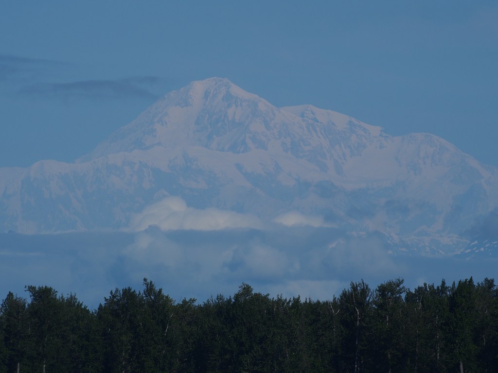
There are places to stop as we head south to view Mt McKinley, Denali, but the cloud is low and no views are visible today. Hopefully we will get another chance later in the trip.
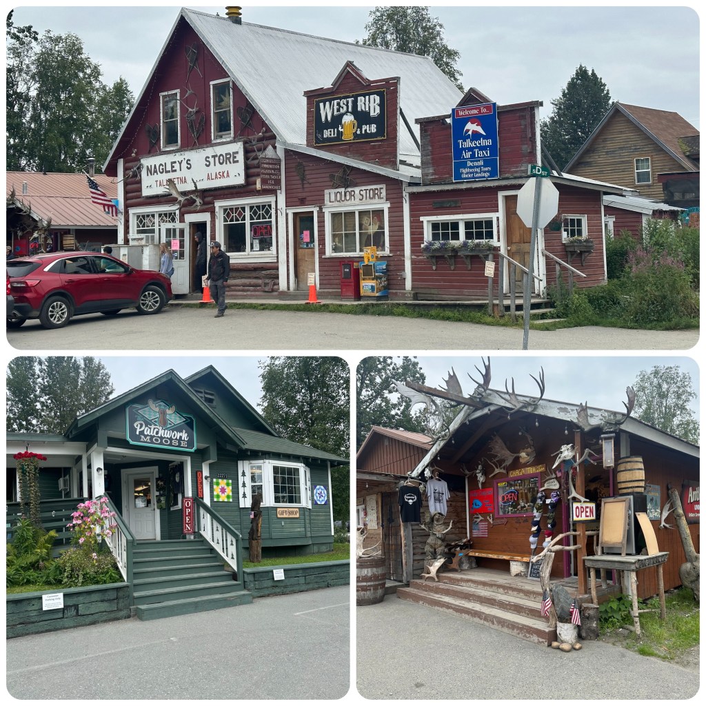
We continue on to Talkeetna where we find a campground for the night. Once we set up we walk into town through a short bush track from the park, across a gravel road and the railway tracks and through the rail yard. It’s a beautiful late afternoon and there are lots of people about. Free music at the sound shell and people are gathering on the grassed area ready to listen. We wander along the street checking out the shops and restaurants and people watching. Walking down to the rivers edge the view of Denali is still covered in cloud. Back up the other side of the street and Philip has spotted “The Patchwork Moose” and even though it’s almost 7pm it’s still open, so we just have to go in. It’s a lovely shop with lots of gorgeous kits and fabrics, souvenirs and quilts. Some of which is coming home with me. (P- NB not that I am counting but that’s #3 quilt shop Phil has found! One good thing about dropping in is I can usually extract some local “what’s to see” gossip from the proprietor ( even if it took almost 90 minutes to extract at the last one). I have often commented quilting is a refined form of an excuse to have a catch up and gossip! )
Talkeetna
We wander back to the RV via the boat launch where families are just heading out for the evenings fishing. They are running jet boats here because the rivers are shallow. In the campground one large group are setting up for a wedding tomorrow and it looks like most of the guests are staying in RV’s or campers. Should be a fun weekend for them.
5th August.
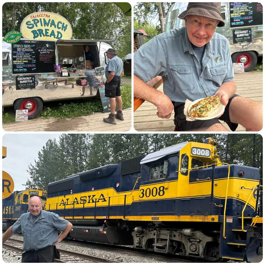
We are up and out for a walk before packing and leaving. We walk back round the road into town and although not as busy as last night, this morning there are quite a few tourist from the train about. A few of the main shops are open which we wander through again before heading to the end of the road and the river to see if Denali is visible yet. Stopping on the way for some Spinach Bread. This is quite a popular spot and is well know around these parts. It’s served out of a quaint Airstream Trailer. Tons of garlic, spinach and cheese on spent grain bread cooked while you wait. It was delicious. (P- and cost me another 10,000 steps that day to walk it off!)
Spinach Bread
Then back to the RV to pack up and head out of town. At the end of the street we are suppose to turn right but the airstrip is to the left so Philip just has to go that way to check out the planes. Then as we head back we get a very brief glimpse of the mountain so decide to drive back down to the river viewing spot. (P- incorrect -Judith spots Mt McKinley looking up the railway line as we return from the airfield and says let go to the view point for Mt McKinley (Denali). – Thanks Phil for going to look at the planes)! We park up and walk to the river and line up along the banks along with many others as Denali slowly emerges from the cloud. 30 minutes or so later the mountain is clear and we become two of the 30% of people that see it with no cloud. This is actually the 3rd time we have seen it since 2000.
Mt McKinley, 100 miles away and just over 20 310 feet
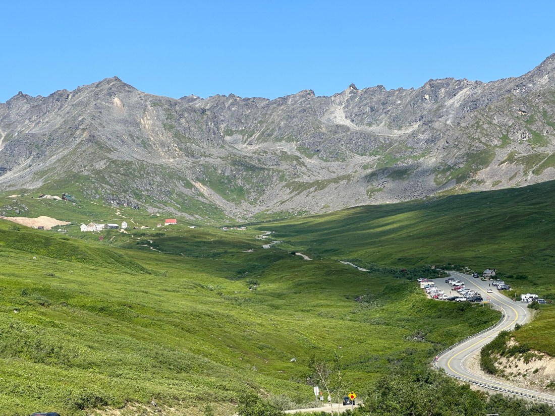
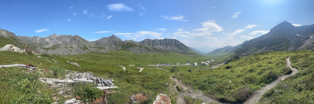
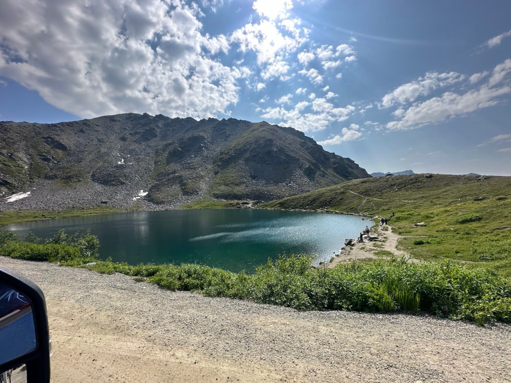
Once we leave Talkeetna we head toward Hatcher Pass. This is a popular recreation area for locals from around Anchorage. The road initially follows the Little Susitna River before climbing up over the Pass. Today there is a 50 mile marathon happening so there are runners (walkers, plodders and persistent participants ) all along the road. The road winds up to 3465 feet with steep drop offs and hairpin bends with spectacular views of the valley and the mountains. Summit Lake is the highlight of the drive to the top but there are so many vehicles parked in every available space that we don’t stop. People are hiking to the peaks and around the lake. There are also paragliders floating around on the thermals.
Independence MineSummit Lake
We continue on down the other side, very steep and narrow road to Independence Mine. This was one of Alaskas largest gold mining operations and is now an abandoned gold mine in a spectacular setting. Many of the buildings have been held in what the National Parks here call “Arrested Decay”. Meaning they repair so that it doesn’t decay any further. We have been here previously so rather than spend time wandering around the buildings we do a hike 5 k round the back of the site. It a great little hike and gets the heart rate up. There are people here everywhere, hiking the many trails around the area. People are making the most of the great weather we are having, the best they have had so far this summer. Let’s hope it continues.
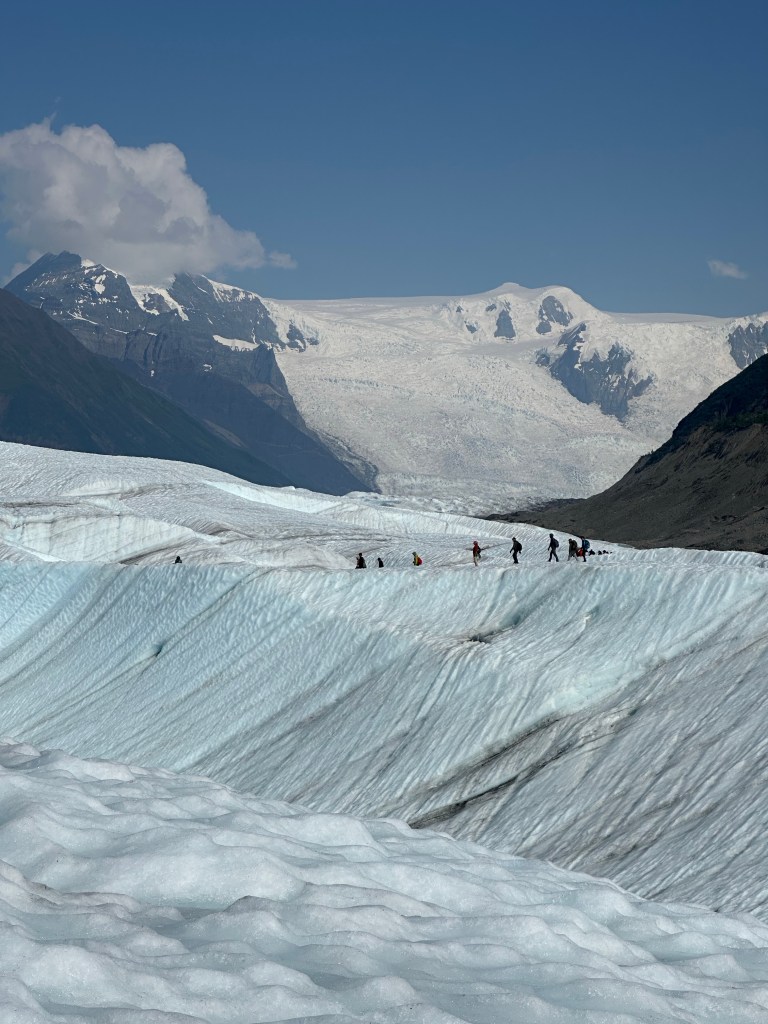
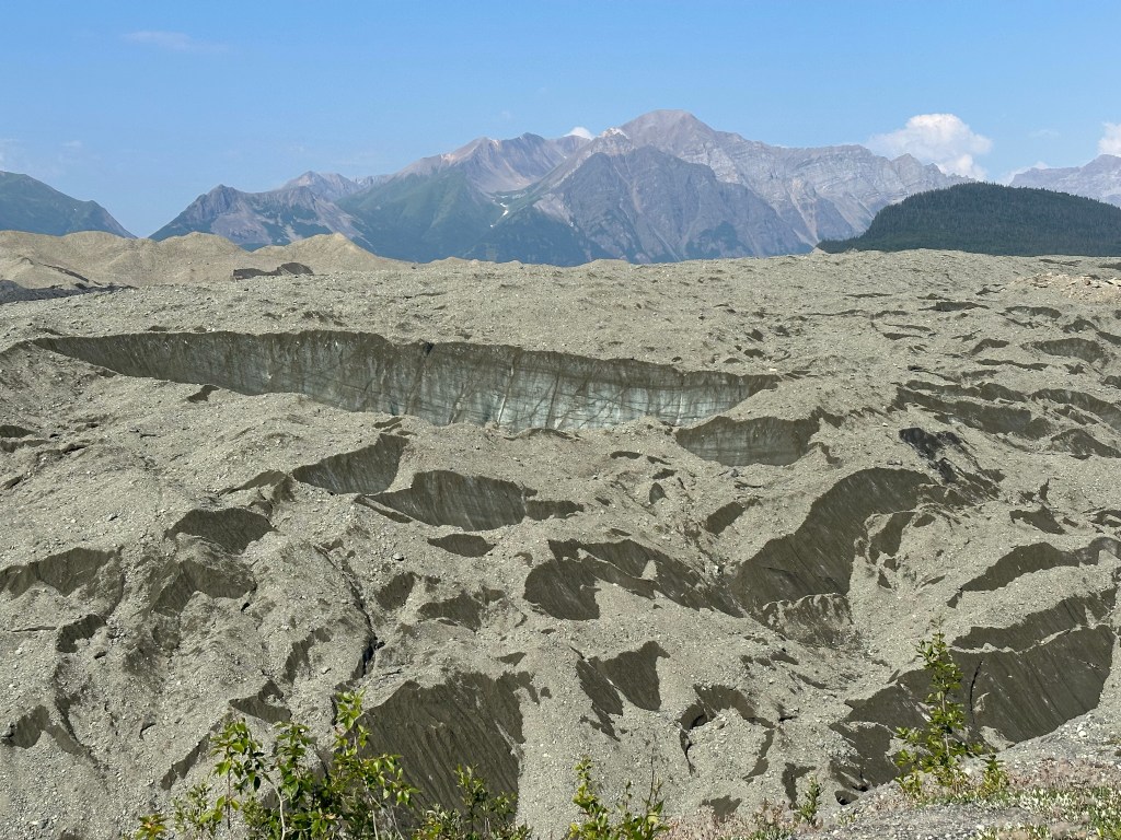
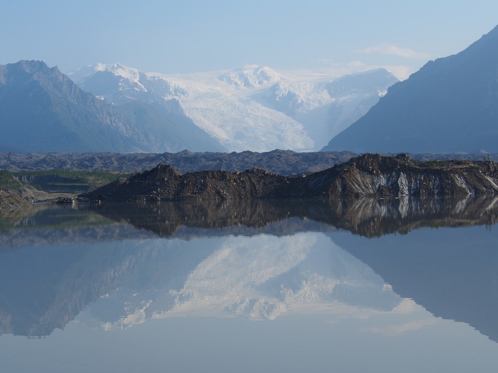
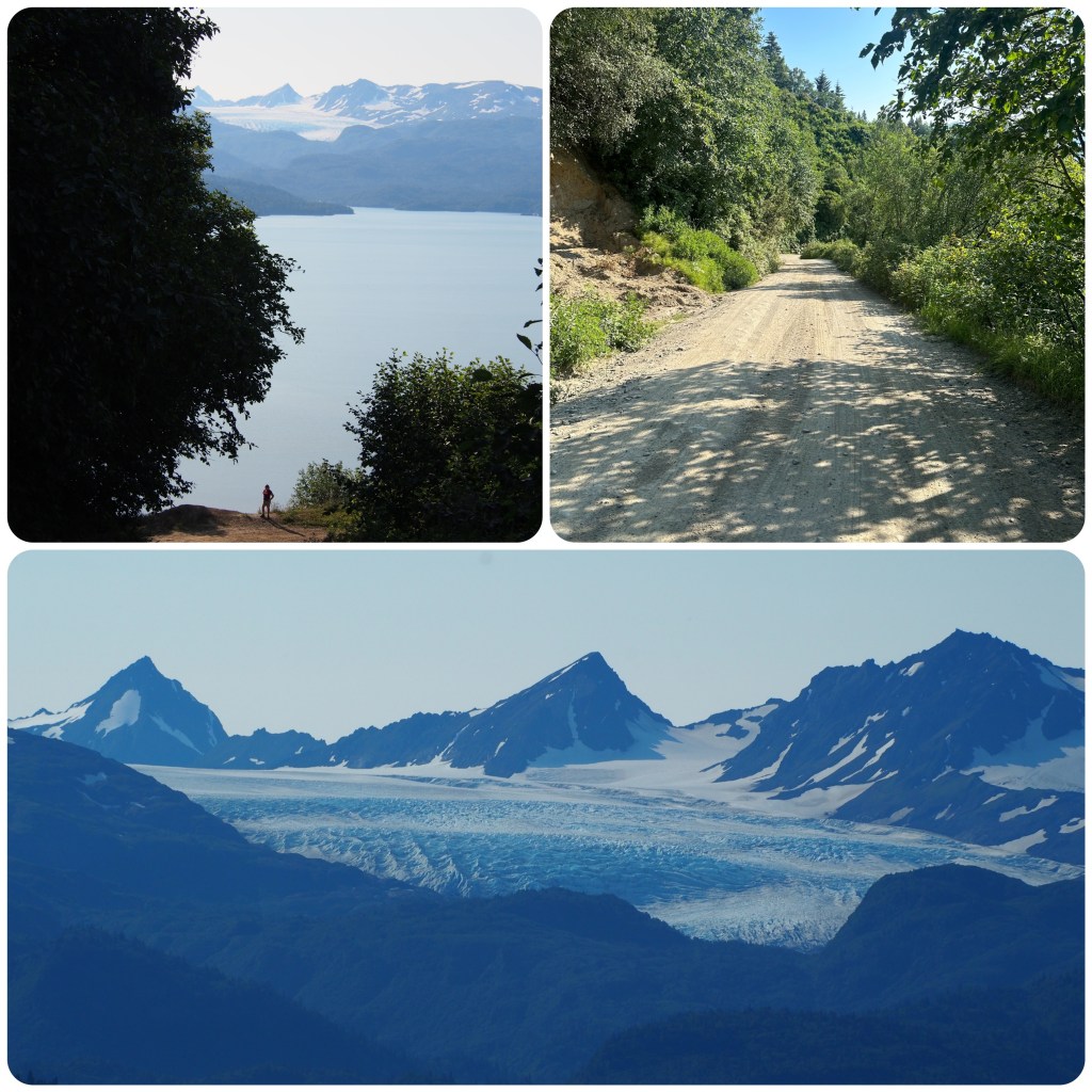
We are at the footbridge for an 8.30am shuttle pick up to get us to Kennecott where we are all fitted with crampons for walking on the Glacier. After being fitted we have a 1 1/2 hour walk along the edge of the glacial moraine to reach the toe of Root Glacier. Morgan, our guide is very informative and keeps us together and interested with lots of glacial facts as we hike along. When we first arrived and looked out over this moraine we thought it was all just silt and stone moved down by the Glacier melting but with some knowledge and closer vision of the moraine we discover that it just has a rocky silty layer over ice. This insulates the ice underneath which can be between 1000 and 3000 feet deep. Also when Kennecott was first operating the glacial moraine was at least 350 feet higher than it is today.
We are walking towards Root Glacier which is about 1 mile wide and 5 miles long but this is dwarfed by Kennecott Glacier that meets Root Glacier and pushes it around a corner. Kennecott Glacier is about 5 mile wide 27 mile long, cascading down from 16,390 foot Mt Blackburn. Root Glacier has the second largest icefall in the world after the Khumbu Icefall on Mt. Everest. The Stairway Icefall is a 7000 ft vertical ice wall which has never been climbed.
Root Glacier and Stairway Icefall
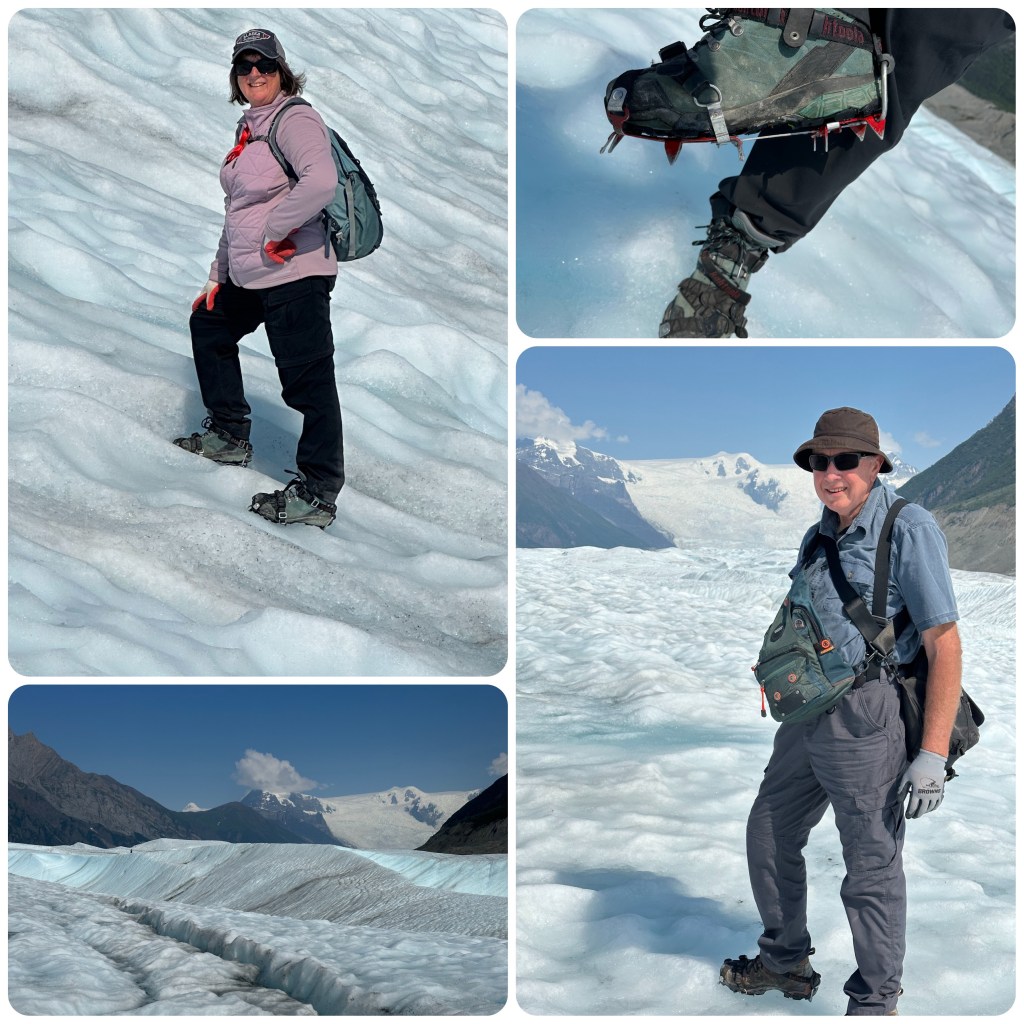
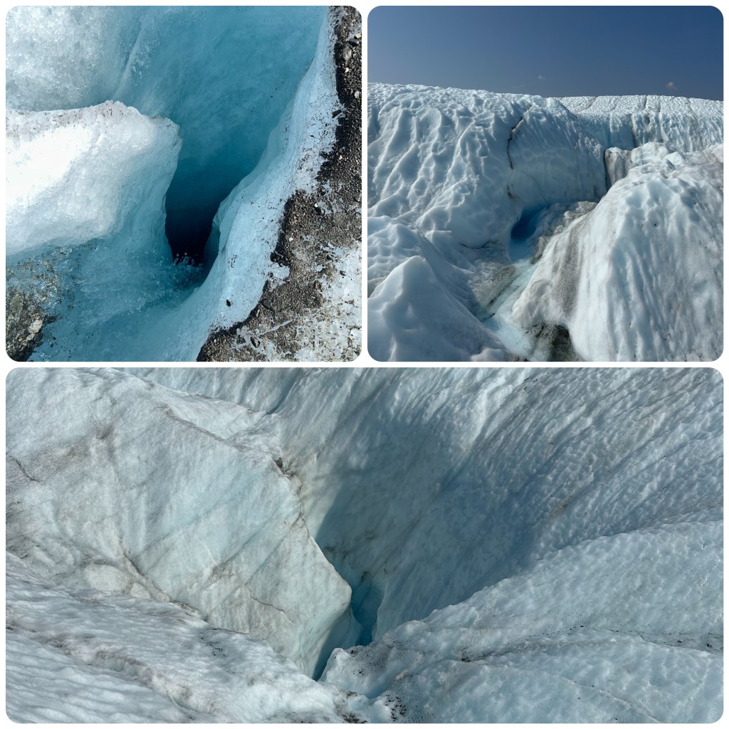
Once we turn off the hiking track we head down to the toe of the Glacier and strap on our crampons and head up onto the ice. The first part slopes up gently and this gives us a chance to get the feel of walking with the crampons. The higher up we go the cleaner and whiter the ice becomes. Morgan gives us lots of information about the formation of the ice, why some ice is bluer than other parts. It’s an awesome experience walking on ice that was formed Millenia ago. We see waterfalls and crevasses (small ones, thankfully) creeks that run and erode the ice out and turn blue as the water accumulates. Stopping for lunch Morgan collects Glacier water and heats for hot drinks. Then we fill our water bottles with fresh, freezing Glacier water that is crystal clear and tastes so refreshing. After spending 2 hours on the Glacier we head back to Kennecott tired but exhilarated from an awesome day out. 6 1/2 hours. We are both tired and have some newly discovered muscles but it was a great day.
Glacier Ice
Back at our vehicle we freshen up, pack up and leave the campground driving for a couple of hours before finding a camp just before the Copper River. Highlight of the drive was spotting a moose in a pond just off the side of the road. What a way to finish the day.
Moose
Kennecott and McCarthy have been a highlight of our trip so far.
A “big day” today as we have 180 mile to drive to reach McCarthy! Leaving the campground we fill up with fuel and propane, then a stop at the supermarket for water and some fruit before stopping at Easy Freeze to pick up our packaged and snap frozen salmon from yesterday. Once all this is done we head out of Valdez to Point Alison and Solomon Gulch Fish Hatchery where we watched the salmon trying to swim up stream.
Solomon Gulch Hatchery, Bridal Veil and Horsetail Falls and Thompson Pass
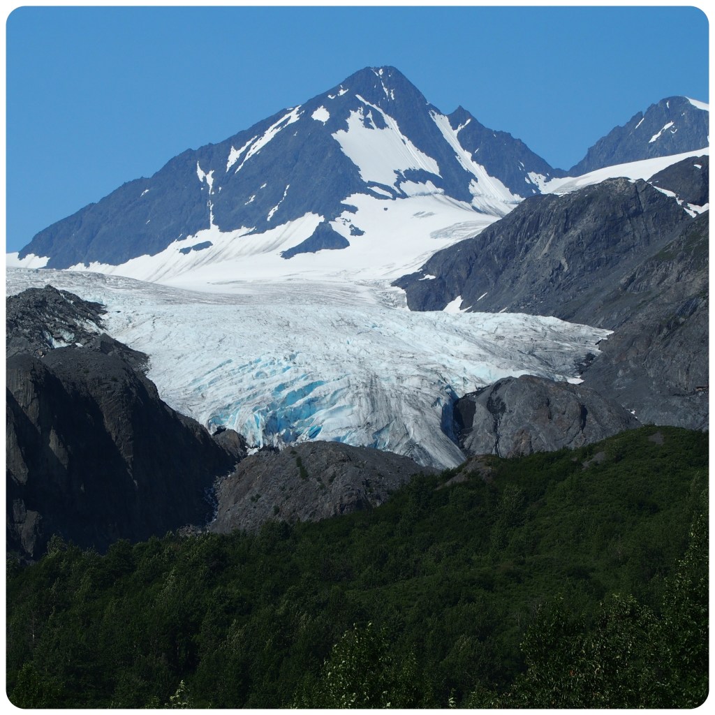
From here we head up the Richardson Highway through Keystone Canyon and passed Horsetail and Bridal Veil Falls then up and over Thompson Pass. The day is clear as we leave but as we climb the pass the mist rolls in and hangs heavy over the mountains. We are told the views are great here but not at the moment. Luckily as we descend the northern side of the pass the mist clears and the views are spectacular. We stop on the roadside to watch an eagle protect it’s prey that is squashed on the middle of the road. Numerous vehicles stop and watch as he sits on the fence and then a snow pole. Just down the road we pull into a stop to view Worthington Glacier. This is one of the most visited glaciers as it is so accessible to the road. We only stop for photos as we will see more glaciers later today.
Worthington Glacier
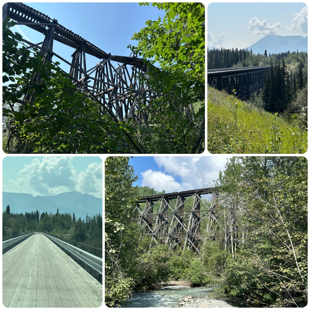
We turn off onto the Edgerton Highway which will take us into McCarthy. We are heading away from the main tourist route and traffic is getting less. Off this road there are spectacular views of Mountains, Mt Drum being the most obvious, and it’s huge, small farms (homesteads) with bales of hay, cattle and even some Tibetan Yaks. We pass tiny communities consisting of a church, a store and maybe some fuel and a few homes. Then it’s onto gravel for the last 58 mile of the road up along the Copper River and Chitina river until we reach “Base Camp” at the Kennicott River. This road was built along the old Copper River and North Western railway bed. Old rail ties and rails are still embedded in the road surface. The road ends a little over half a mile from McCarthy. There is so much to see as we travel this area. First up is crossing the Copper River bridge where we could see people dip netting on the banks of the river and fish wheels operating. From here we enter the Wrangell–St St Elias National Park and Preserve. There are lots of marshy areas, lakes, moose and duck ponds but unfortunately no animal sightings today.
We cross the Kushkulana Bridge. This former railroad bridge was built in 1910 and is 525 feet long and 238 feet above the river. It is only 14 feet wide and until a few years ago had no guard railings along its sides. I’m glad it has them now. Next stop was to view the Gilahina River Trestle. This is where the railroad was built up and around a curve to cross the river. This timber structure was an awesome feat of engineering. The 13 mile section from Kushkulana to Gilahina was built in just 17 days. Wooden trestles like this were common along this railroad with a total of 273 over a span of 30 miles. In January 1911 when this trestle was built the temperature dropped to -67 F. It was so cold timbers cracked from being frozen, the ground had to be blasted to set the piles but workers rose to the challenge and had this trestle built in just 8 days. A very impressive feat.
Kushkulana Bridge and Gilahina Trestle
Reaching “Base Camp” just near the Kennicott River we book in and then drive round to find the perfect site. On advice we stay away from the rivers edge where the river is roaring over small rapids, (would be very noisey at night) and head away from the river to a spot with views of the Kennecott and Root Glacier.
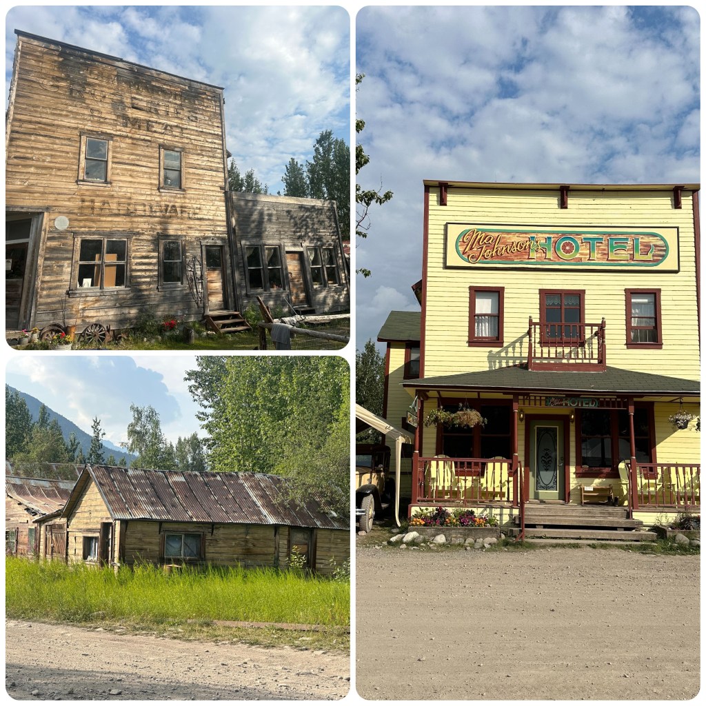
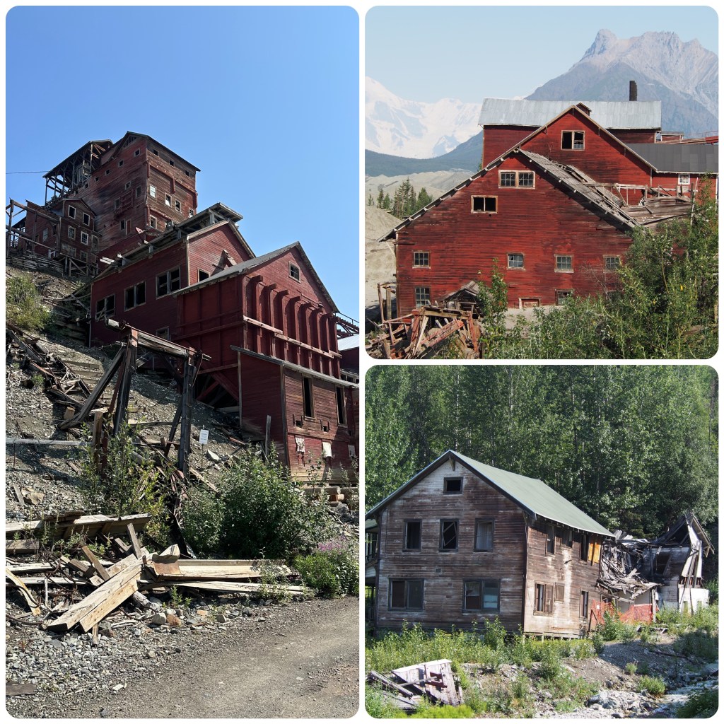
McCarthy is now only 1/2 a mile away but is only accessible for tourists by a pedestrian bridge over the river and a short pleasant walk. (P- the term “pleasant” wasn’t what I heard Judith exclaim as we went to cross the narrow pedestrian bridge which had a grated base that she could clearly see the water cascading underneath her as she outpaced an Olympic walker to get back to Terrafirma on the other side). We wander around McCarthy, a very small rustic community, pub, grocery store cafe and museum and a few homes before heading back to the River to organise some dinner.
Relics of McKarthy
1st August
Today is Kennicott Mill Tour and as this is what Philip enjoys he can write about it…..
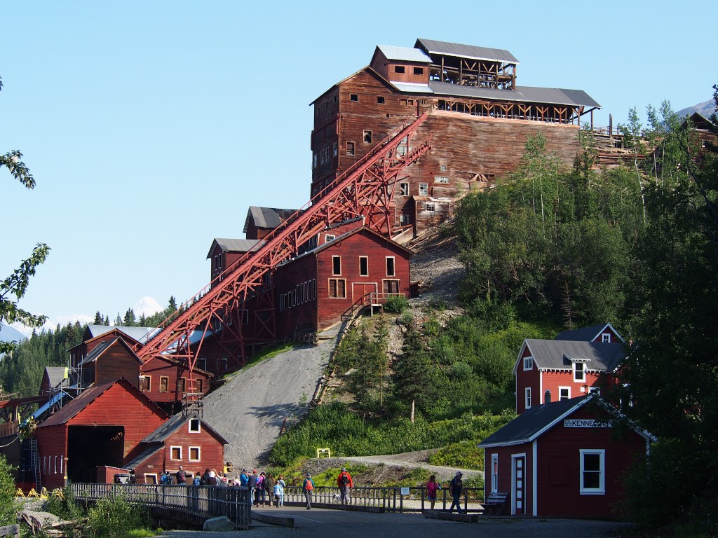
(P-McCarthy as historians tell us was established as a locomotive turn around area and also served as a “Wet” town for the neighbouring company mining town of Kennicott ( which was alcohol free). It also became well known as a town of ill repute. Kennicott’s purpose was as a mill town to process copper ore from 4 underground mines in the mountains some 3-4000 feet above the processing mill. This all happened around 1912 – 1938. The majority of the 14 story hills side building and some of the town still exists and is maintained in a state of “arrested decay” by the National Parks Service. We have seen this often in the USA and it is so wonderful to see history maintained for us to view. The tour thru the 14 stories, treatment rooms, power house etc was fascinating and the structural and mechanical engineering amazing for being over 100 years old. Although this was a series of mines and mill for copper there was enough silver recovered as a by product to pay the cost of operation of the mill. That’s enough, use Dr Google if you wish to find out more!)
Kennecott MillKennecott Mill
While waiting to do the mill tour we check out and book the Glacier Tour for tomorrow morning. Nothing like trying something new.
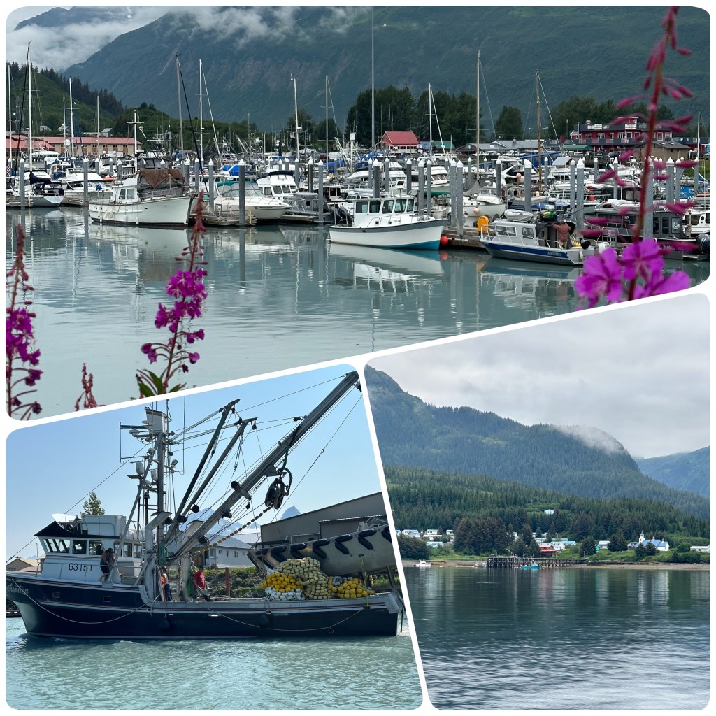
After a good nights sleep we are off to explore the town of Valdez. Again it is a port town with a large marina, State Ferry and Cruise Ship dock. (P- purely coincidentally that we seem to have quite the nautical theme at the beginning of this trip!) It was established as a port of entry in 1897-98 for gold seekers bound for the Klondike goldfields. Thousands of stampeders arrived in Valdez to follow the route to the Eagle mining district in Alaska’s interior and from there up the Yukon River to Dawson City and the Klondike. After the gold rush, copper discoveries north of Valdez brought conflict and development to the area. A railway from Valdez to the rich Kennecott copper mines near McCarthy, 150 miles away began a bitter rivalry between Valdez and Cordova. The Copper River and Northwestern Railway eventually went to Cordova, but not before Valdez had started its own railroad north. The Valdez railroad did not get far and the only trace of its existence is an old hand drilled tunnel 15 miles from Valdez.
Nowadays Valdez is a Salmon fishing area and tourists hotspot. It is also the terminus for the Alaskan Oil Pipeline as Valdez is the northernmost ice free deep water port. (P- I am sure some of us can remember the disastrous oil spill from the Exon Valdez in March 1989).
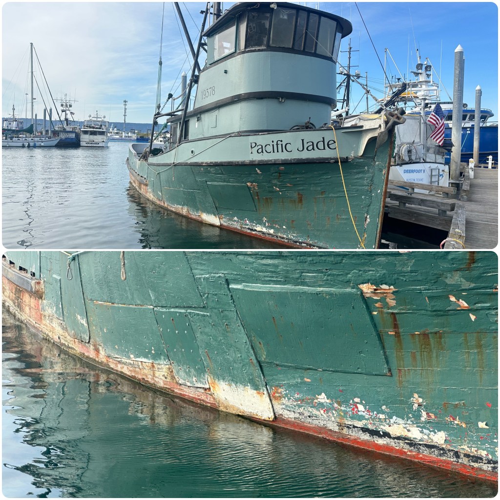
We once again wander around the marina with Philip inspecting all styles and sizes of boats. We take the boardwalk out to the south Marina and seafood processing factories. Peter Pan Seafoods has a big complex out here with processing factories, accommodation dormitories and mess hall facilities. Most workers are international from South America or the Philippines.
The supermarket is our next stop to stock up for the next couple of days. Only have a small fridge so always seem to be at the supermarket. Later in the day we find a great outdoor store, The Prospector. They had some great clothing, camping gear, hiking gear and of course fishing gear.
Sunday 30th.
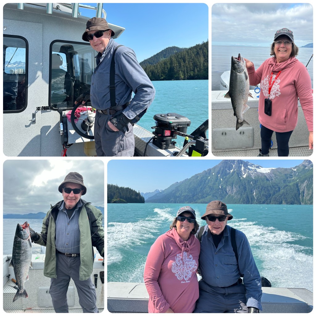
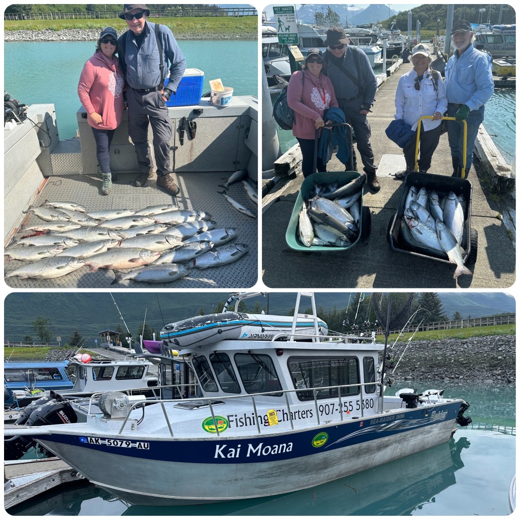
We are up early this morning ready for a 6.30 start on K Dock, berth 20, where we meet Josh our Captain for the day. We are heading out Salmon fishing. Another couple is also on the boat, the Kai Moana, (NZ for Seafood). (Josh is a New Zealander by birth but has lived here for over 40 years). Philip can give the fishing report…..
(P- it’s a well known fact that Judith is about as keen on fishing as I am quilting! I wasn’t coming to Alaska without at least one fishing trip. After research I decided on Valdez – sheltered waters, a salmon run that coincided with our visit and beautiful scenery. Over the last few months after some serious searching for a boat operator that didn’t have half the tourists from Valdez onboard, I found Josh, he ended up being a great guy and excellent guide and fisherman. A 06.30am start ( with another wonderful couple from Arizona) and we are cruising down the bay to one of Josh’s favourite spots, well out of the way of other commercial and charter vessels ( we were the only ones there!) Josh had taken us to a wild fishery (no hatchery fish here), gave us instructions and left us to fish ( not just hold the rod as most charters do) . The fish came aboard in a steady stream all day. Coho Salmon ( rich red flesh) was the main variety. We all caught our limit and returned to port around 14.30. Being in a camper we didn’t want a lot of fish – just 2 or 4 for a feed so we gave most of ours away. Part of the charter was filleting and freezing, next morning we picked up our frozen harvest before we departed Valdez. Judith really enjoyed the day but I doubt she will be any more eager to come boating with me when we return home!
Salmon FishingOur Catch, Claudia and Lee and our Charter Boat
It truely was an excellent day both fishing and scenery.)
We are back to the dock and then it’s busy in the Laundry to get our fishy clothes washed and dried. I guess we will just have to have fresh Silver Salmon for dinner tonight. Can’t get it much fresher. After dinner we wander along the waterfront again before enjoying an icecream.
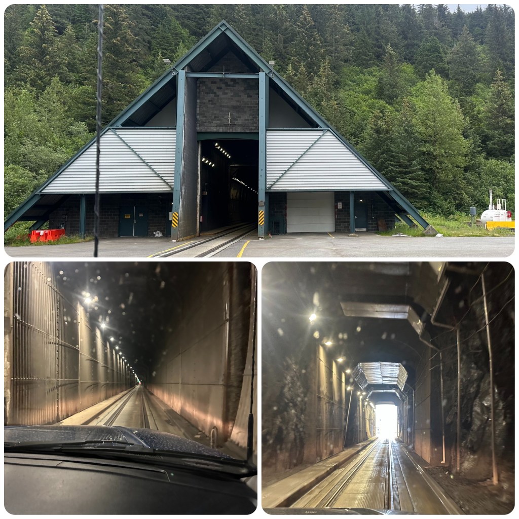
This morning we drive from Tern Lake into Whittier where we are booked to catch the Alaska Marine Highway Ferry to Valdez. We are currently sitting on the ferry as I write this enjoying some spectacular views as we cruise past mountains, glaciers and many, many islands. But back to Whittier. This is an amazing little town. Access to Whittier is via a train/vehicle tunnel 2.5 mile long. It is the longest tunnel in North America and the first designed for -40 degrees and 150 mph winds. The tunnel was originally built for the train and it wasn’t until 2000 that the road was constructed so that both trains and vehicles could use it. The tunnel is only a train width wide. Trains have priority and traffic lights control this one way at a time tunnel.
Anton Anderson Memorial Tunnel, Whittier
Wandering along the boardwalk we spot a whale right in close to the shoreline. We stopped to watch it for a while. They are such graceful animals for being so large.
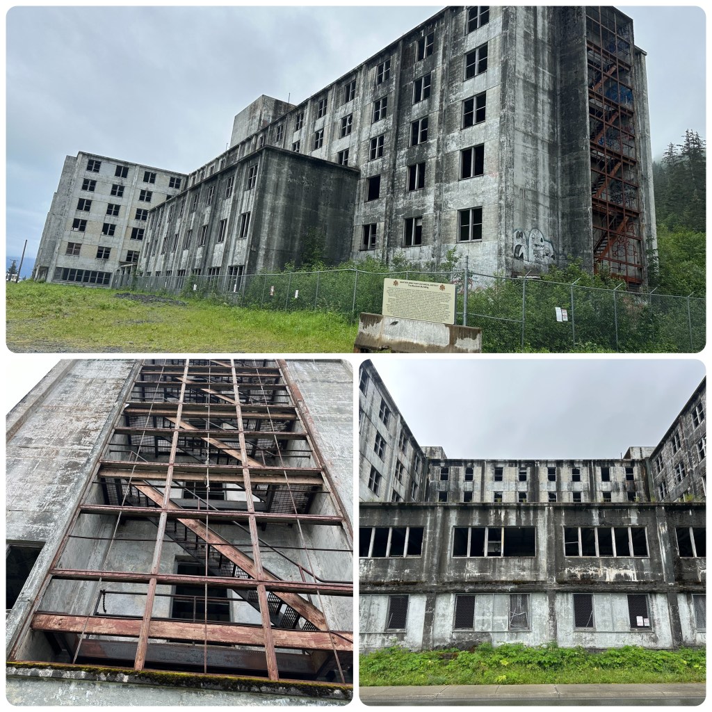
Whittier was an Army Garrison and at the end of WW11 people were still wintering in small wood framed buildings. With the advent of the Cold War it was deemed necessary to build a more substantial building that would house 1000 troops under one roof. The building was designated the Buckner Building and was destined to become the largest building in Alaska. Construction began in 1949 and was ready for occupancy in 1954. The building was a city under one roof. In addition to housing the troops it also had a 350 seat theatre, hospital, 4 lane bowling alley, bakery, church, barber shop, library, radio and tv station and a huge cafeteria. It was all connected with wide stairwells and elevators. This massive building was in 7 sections, each separated by 8 inch gaps. This design gave the building flexibility and when the 1964, 9.2 Alaskan Earthquake hit the building survived when most of the other structures around the town crumpled. The military mothballed the building in 1960 when the Whittier Army Port was closed.
Buckner Building
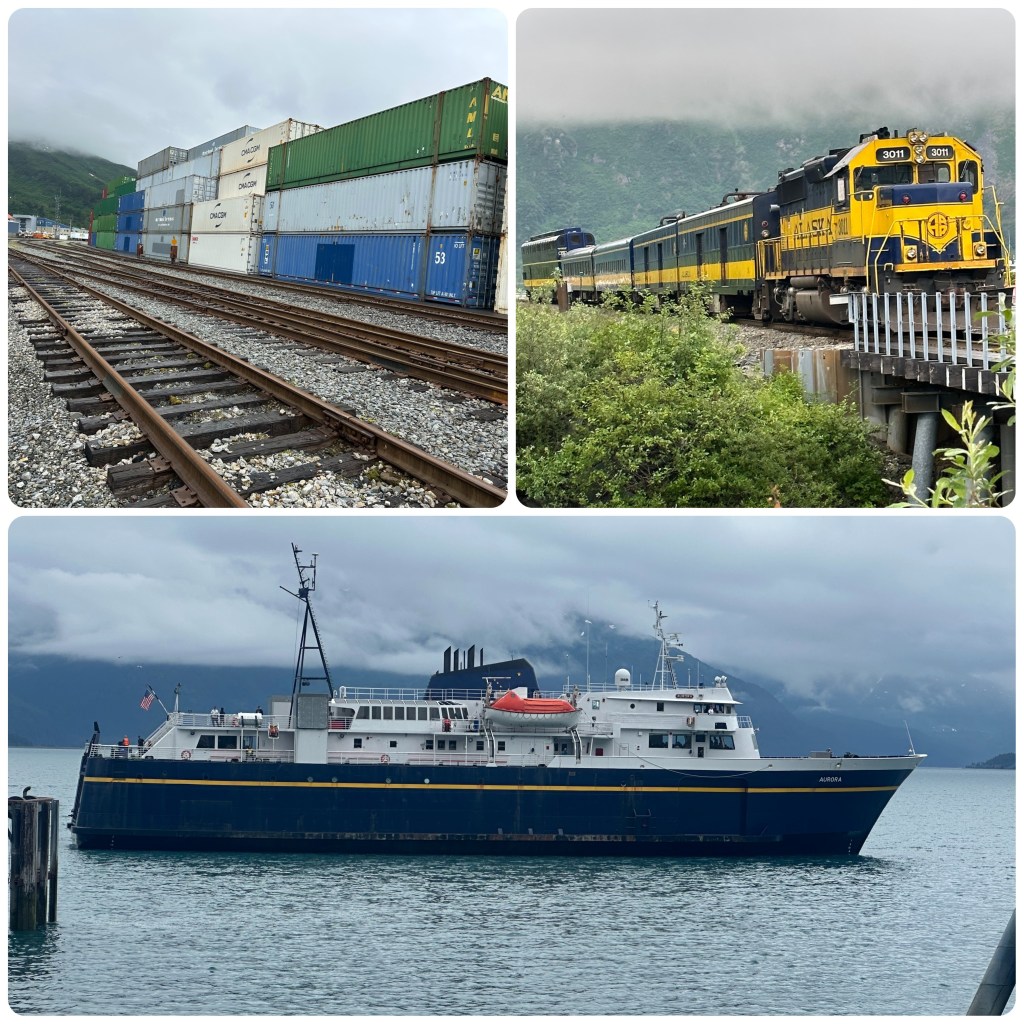
Whittier is now predominantly an all weather freight destination which supplies Alaska from an ice free port and almost all weather rail system, the tourist and fishing industries are also significant. From the Alaska Marine Highway to local kayakers and fishing boats to cruise ships. The town population fluctuates as the seasons dictate. Even though this is a deep water port and open all year Whittier still receives huge dumps of snow. The average snowfall per year is 50 inches and it’s also the wettest town in Alaska having an average rainfall per year of 197 inches (5metres).
We board the Aurora, Alaska Marine Highway Ferry from the rear, park and head upstairs to find a couple of seats for the 6 hour ride through to Valdez. The route takes us out into Prince William Sound and through Valdez Arm before docking in Valdez just after 8.30pm. It’s been a spectacular trip, skirting islands, spruce covered mountains, past numerous waterfalls and past icebergs floating out from Columbia Glacier. Fishing boats pass us continually as does the cruise ship Majestic Princess as it sails towards Whittier. The water is calm and it’s not too cold to go out on deck to get the odd photo or two.
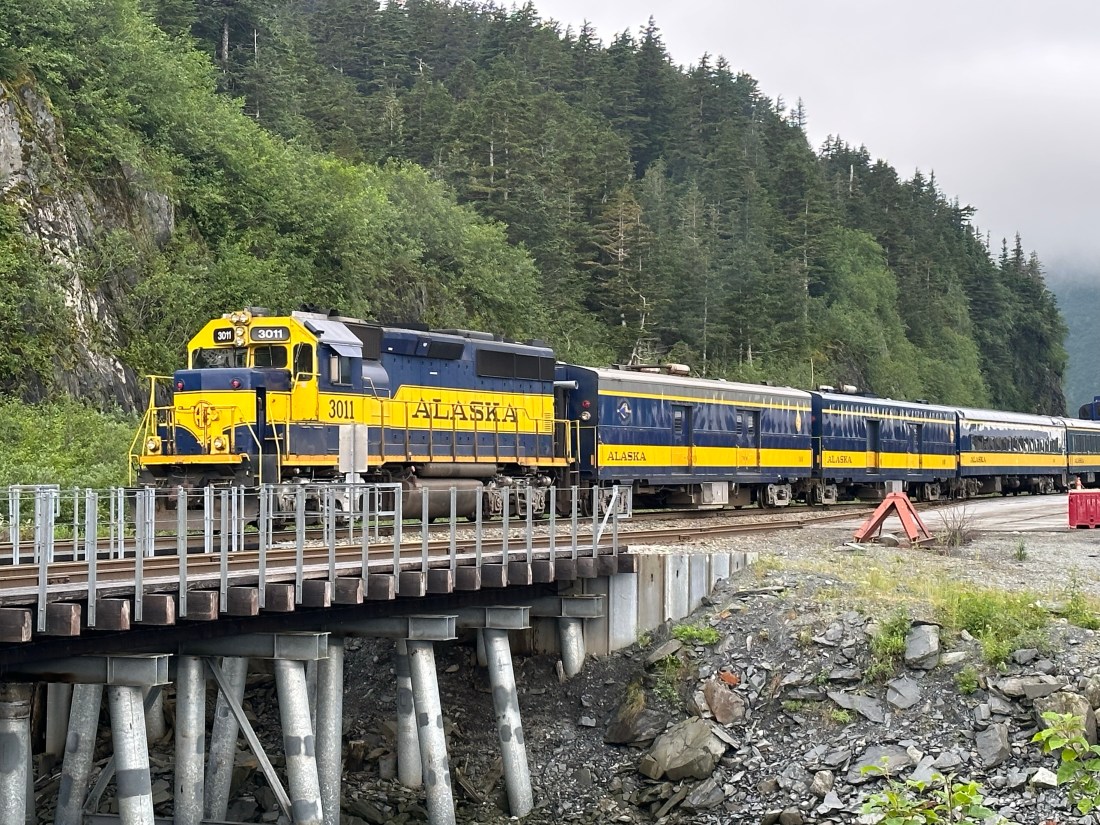
Freight, Tourist Train and Alaska Marine Highway Ferry
Docking at Valdez we unload from the Starboard side of the Vessel and head just down the road to Bear Paw Campground, our destination for the next 3 days.
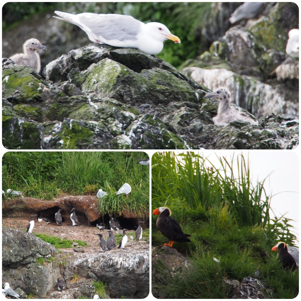
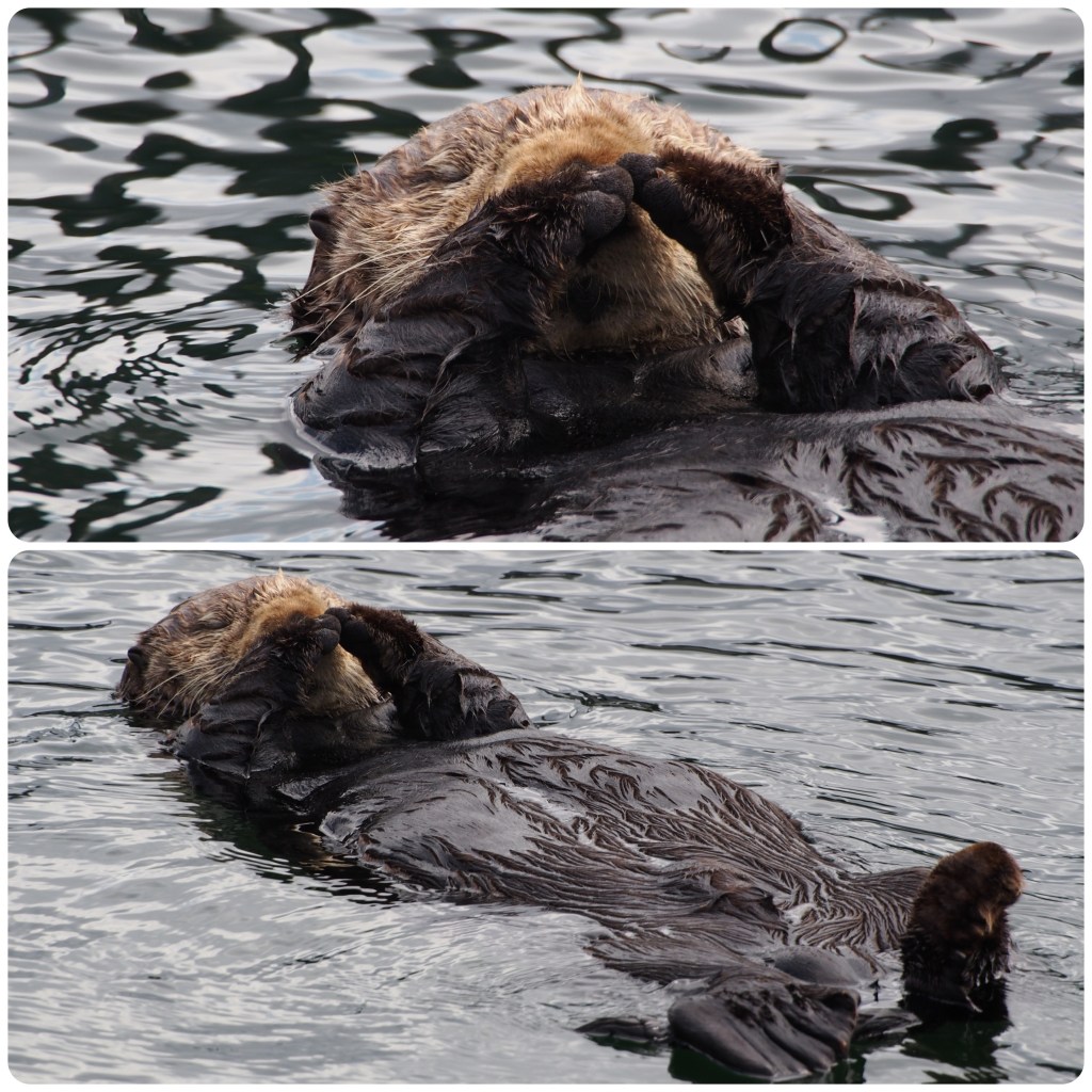
Seldovia is only accessible by boat or plane. We board the Rainbow Connection for the 90 minute cruise, along the way we pass a bird rookery spotting nesting gulls, cormorants and puffins. Then pass through an area where sea otters are gathered. These floating Otter groups are called rafts. The sea otters have extremely thick fur, approximately 1 million hairs per square inch, which keeps them warm and waterproof as they have very minimal fat. They are very cute and several have babies resting on their stomachs as they float around. Extremely hard to get photos of as they dip underwater if we get too close. We arrive in Seldovia just on lunch time so first up find a cafe for some lunch (P- wasn’t hard to find a cafe – there was only 2 and one was closed!) after which we head off walking around the small town to visit the tourist hotspots. First stop is the St Nicholas Russian Orthodox Church built in 1891 under the leadership of Russian Orthodox Travelling Priests. The bell tower was added in 1906. The church is still used today for weddings and special events.
Tour Boat and scenerySt Nicholas Russian Orthodox Church
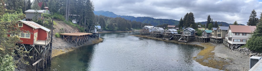
Only a small part of the historic boardwalk is left but it is certainly a pretty spot, even at low tide. Originally most of Seldovia was built up on stilts like these homes but when the 1964 earthquake occurred it dropped this area of the coast 10 feet and destroyed most of the original buildings. Before reboarding we find an ice cream shop and as Philip has been deprived of ice cream we decide to have one each. Limited choice of flavours but they we very nice.
Historic Boardwalk
(P- Deprived! I hadn’t had an ice cream in 6 or 8 weeks. When Ice-cream o’clock used to come every day. I wasn’t sure if I had relapsed to my old ways or would have enough inner strength to continue my (more ) healthy eating habits of late! Judith’s “ very nice ice cream ” was an understatement it was bloody delicious!)
(P- I wonder where CAPTAIN COOK didn’t sail to and explore? Evidently he was splashing around up here too at one stage. Cook Inlet and a few other names alerted me to research a little and yes he was here! He has also been a lot of other destinations we have visited over the years. Well done Captain Cook!)
Bird RookerySea Otters
On the return journey from Seldovia we were on the lookout for Orca. Some had been sighted back toward Homer so we were keeping our fingers crossed. Luckily we spotted some and spent the next half hour following them, watching as they surfaced and dove again. The male orca have huge dorsal fins reaching up to 6 feet. The first you see is this fin slicing through the water before they spout water then their arching back gliding smoothly back to disappear underwater again. An awesome way to finish the cruise.
Orcas
Back in our RV and we are heading out of town and back toward Soldotna. We drove for a couple of hours before finding a spot to Boondock (freecamp) at Tern Lake. Had a spectacular view out our door over the lake towards the mountains.
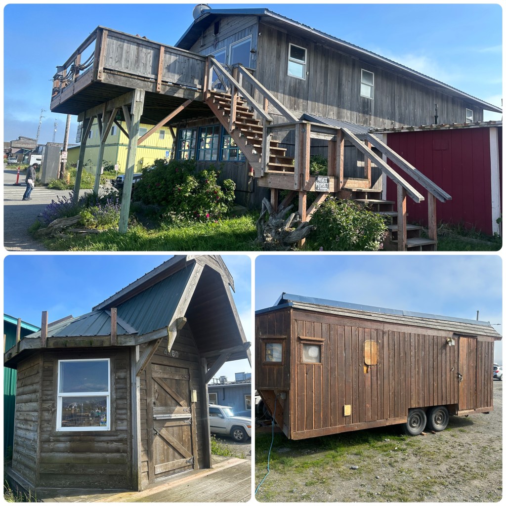
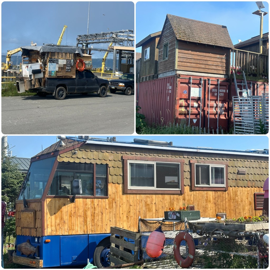
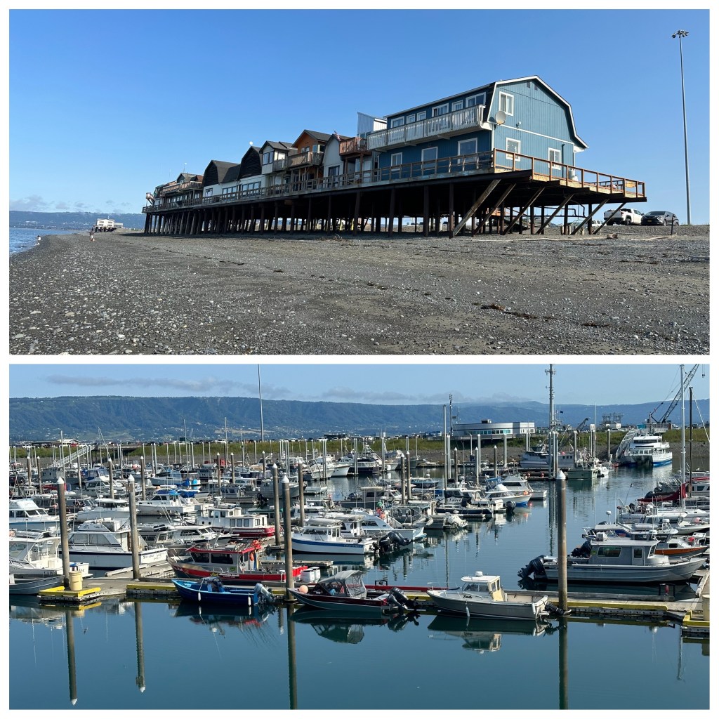
Three days to explore Homer, Homer Spit and Seldovia. We are staying at Homer Spit Campground, at the tip of the Spit. The spit is 5 miles long and is the tourist hub of Homer. Tours, fishing charters, ferries, tourist traps, restaurants and cafes nestle along the shores of the spit, along with a huge 920 berth marina. There are the fish cleaning stations, large boat ramps, coast guard dock, boat mechanics and much more. A great place to wander and explore. Board walks meander along the shoreline and edge of the marina and we find it easy to clock up steps as we walk from one end to the other numerous times checking out the movement of boats and people. The first day here is just checking out places and soaking in the quirkiness of this area!
Homer Spit Campground and Marina
(P- Judith is correct about the quirkiness and rustic charm of the Homer Spit. It’s a feast of visual overload of a nautical theme).
Quirky Homer
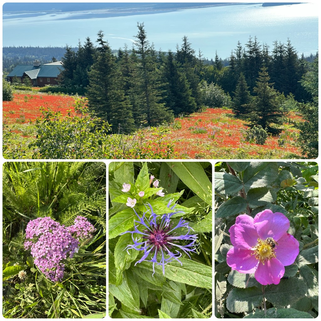
The morning of the 26th we pack up the camper and head into Homer for a drive around the area. We turned right as we came off the spit and drove towards the head of the bay. It’s a beautiful drive, following the edge of the bay, looking out over the water and back towards the spit. Homesteaders here are cutting and baling hay. Only small crops and some very lopsided round bales.
At home we have watched TV series “Alaska, The Last Frontier”. Mainly for the scenery. This is actually filmed near here and we keep an eye out for the property.
(P-Well I am feeling bit cheated! “Alaska- The last Frontier” to me that conjures up thoughts of remote, isolated, homesteaders, no neighbours within a “Bulls Roar” etc. etc. The Kilcher family which the documentary is based around is 12 miles out of Homer, 3/4 of a mile from a blacktop road, has electricity to the property, A fully developed blacktop and then gravel road to their “Remote” cattle run at he “Head Of the Bay” – so the moral of this story is NEVER believe what you see on TV! Their homestead is as remote as our house is from Ulverstone!)
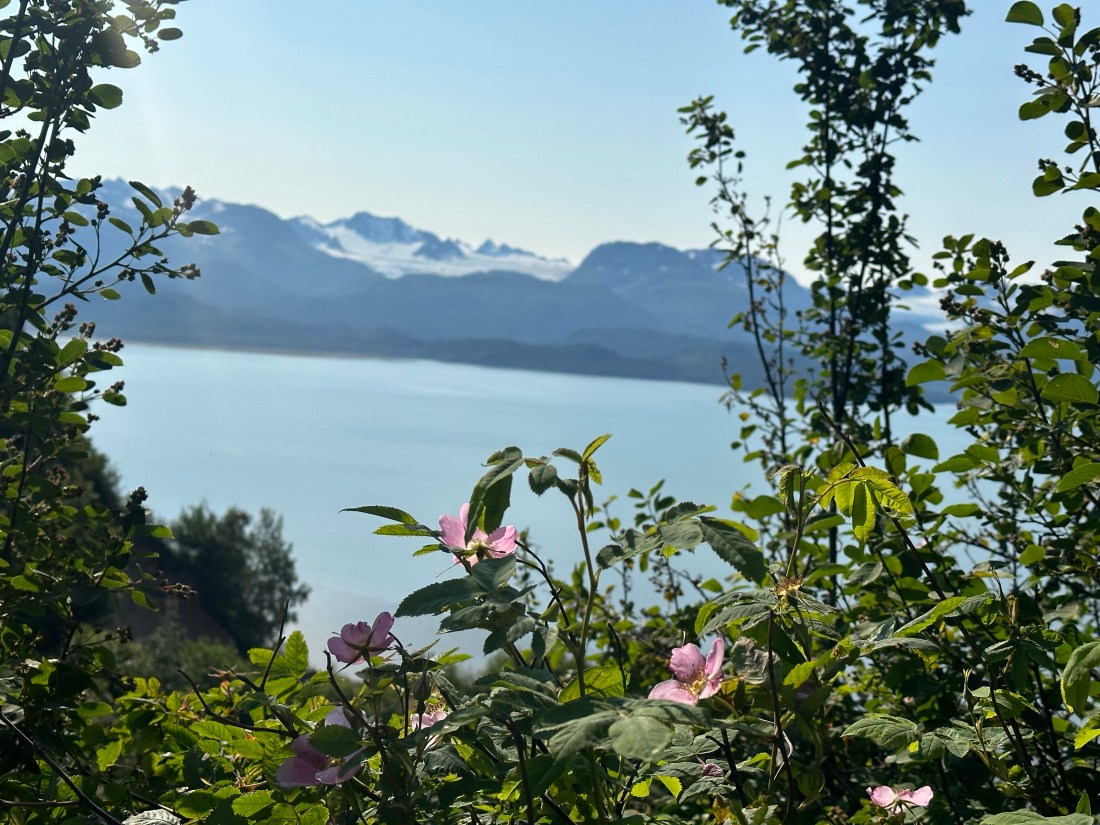
Wild Flowers at Head of the BayHead of The Bay
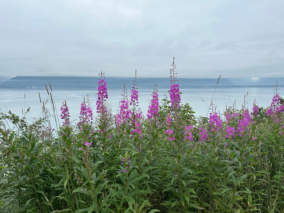
We walk down a track to get some views over the Head of the Bay and back along the cliffs towards Homer. Some wildflowers are about but the season is about 3 weeks late so the fireweed is not in bloom yet.
Once back at the park we wander and have a poke around some of the tourist shops and down to look at some of the many boats moored at the marina. All manner of shape, style and size. We decide that we will do a day trip cruise to Seldovia tomorrow so head up to book tickets.
More Patches than on Judith’s QuiltsHomer Spit and Marina
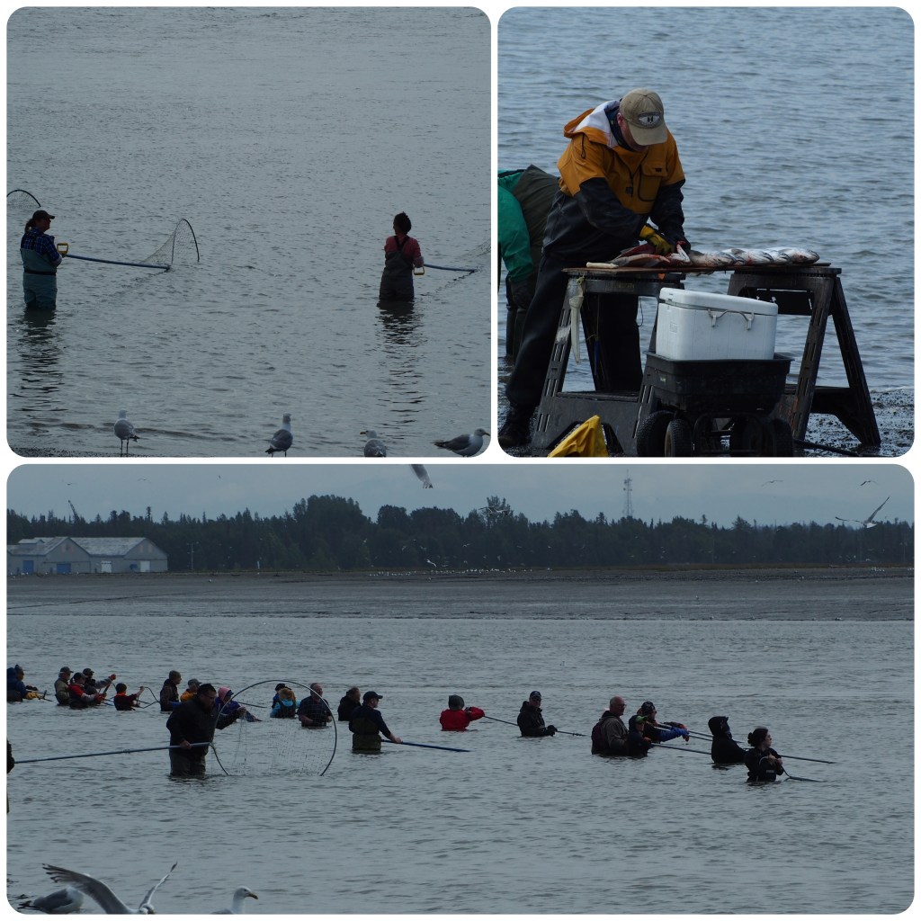
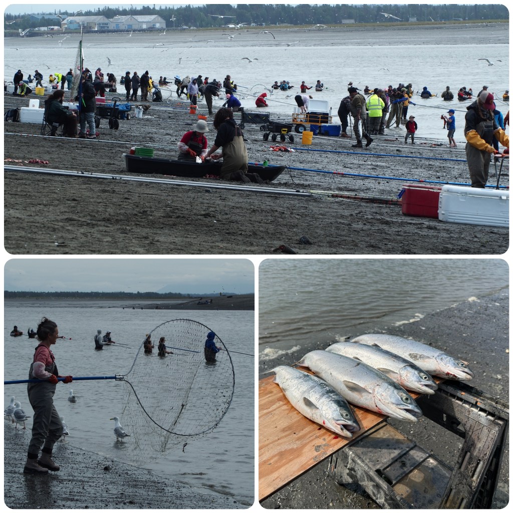
Driving through from Seward to Homer today we stopped at a Beachside park for lunch. Parking was at a premium with people in waders, gum boots, trailing esky/coolers behind them with piles of stuff in small trailers all heading to the beach. The mind boggles as to what is going on. We eat a quick lunch first then head over to the beach and mouth of the Kenai River. There are hundreds of people on the beach, vehicles parked to one side, tents, shelters, chairs, tables coolers in all manner of shape and size and people everywhere. Seemed to be a real family affair!
People are standing up to chest deep in the cold water holding huge dip nets just waiting for the salmon to swim into the nets. Poor fish don’t have much chance with the number of people hoping to catch some. Once they get a fish or two in the net they drag it up onto the beach and spread the fish out on the sand or table. Once they have a stockpile of fish they clean and gut them leaving fish carcasses and guts and fish eggs littering the sand. There are seagulls everywhere and the noise is ear splitting. The gulls are so full they are not eating the scraps just pecking the eyes out. It is a truly amazing sight.
Dip Netting at the Mouth of the Kenai River
We spoke to one guy who told us that as the first member of the household could catch 25 salmon and each other member could catch 10. That meant as a family of 5 they could catch 65 fish for the year from this river, the Kenai. There was also another river he could get the same from. That’s a lot of salmon. He was also saying that there are approximately 120,000 fish per day swim the Kenai upriver to spawn.
(P- A fish in Alaska (fresh or salt water) would have to have the odds stacked against them! No matter (so far) where we go the fish are targeted by, pleasure boat, charter boat, float boat, commercial fishing boat. Add to that there are anglers river bank fishing, shore fishing (salt water), standing in freezing water chest high ( to beat the law in places there is no fishing within 10’ of the river bank) and expensive fishing equipment everywhere- Very few anglers go home empty handed and they are having fun. There is a salmon restocking program and limits on size and number of fish caught to ensure the sustainability of the industry. Me? Well so far my enjoyment has been cooking and eating fresh Halibut and Salmon both different but delicious on the plate. With a bit of luck I might get to catch a Salmon later in the trip).