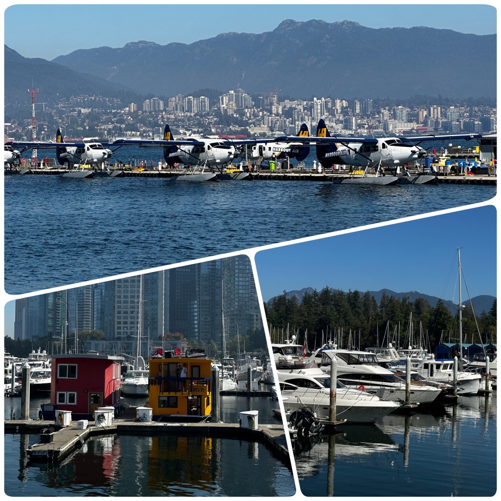
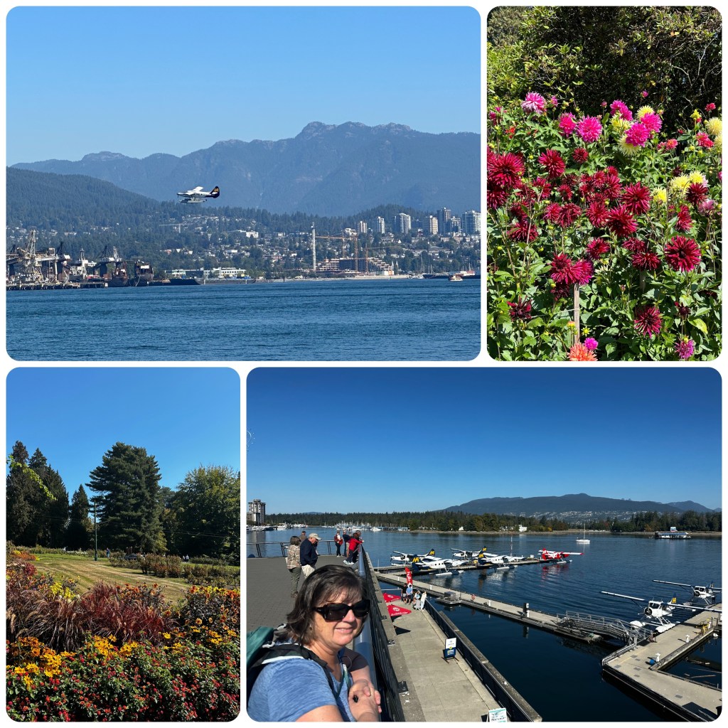
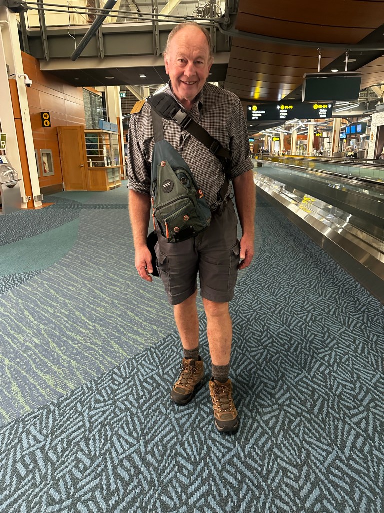
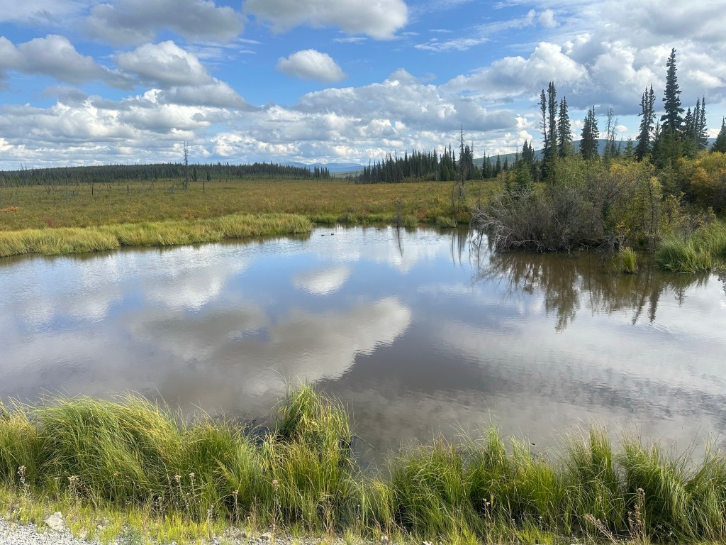
8 weeks of fun, adventure, new experiences and amazing views. What an amazing time we have had, finishing off with a couple of days in Anchorage, cleaning our RV and packing our bags. Finalising some shopping and spending some time walking through some lovely parklands around Anchorage. Flying to Vancouver where we filled the day in around Stanley Park, watching float planes and cruise boats. And finally boarding our flight to Sydney, Australia.
Vancouver Waterfront
We have:-
Walked on Glaciers
Flown over mountain tops
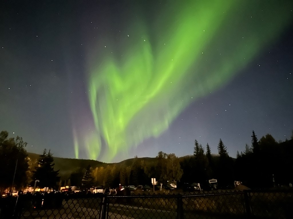
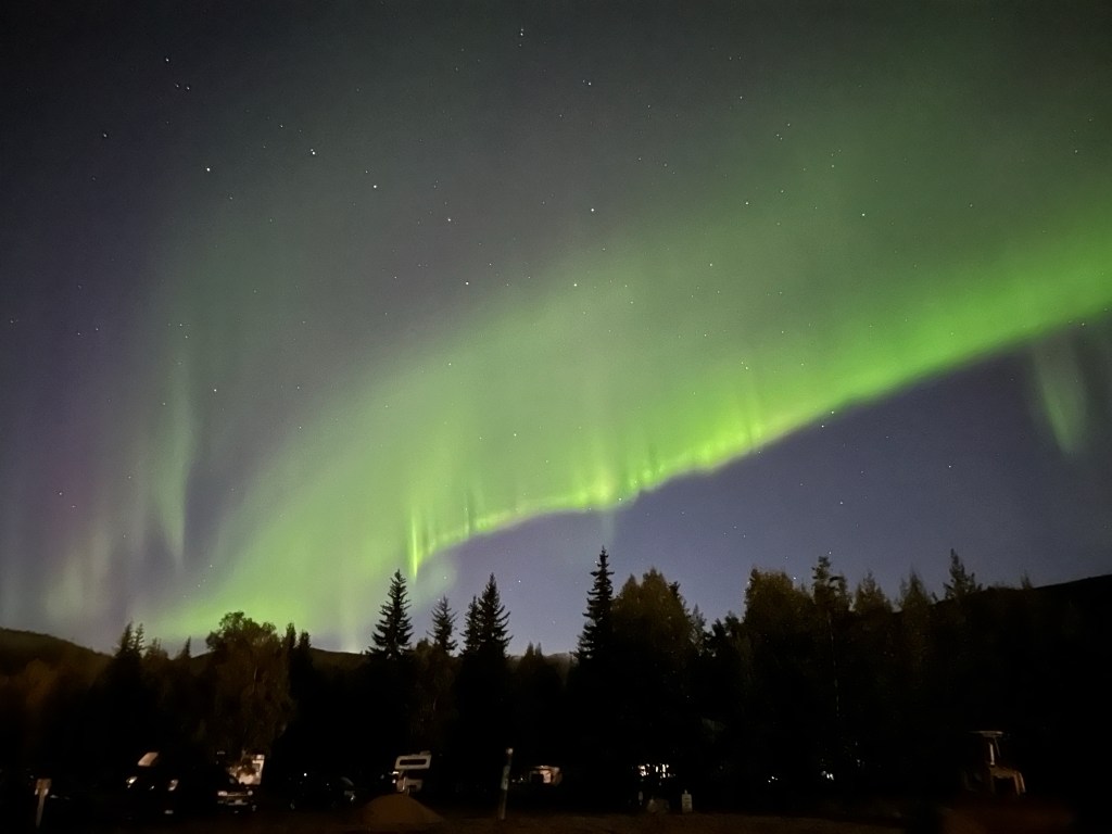
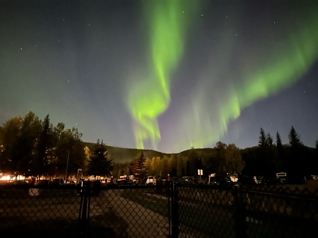
Watched the night sky glow with an Aurora
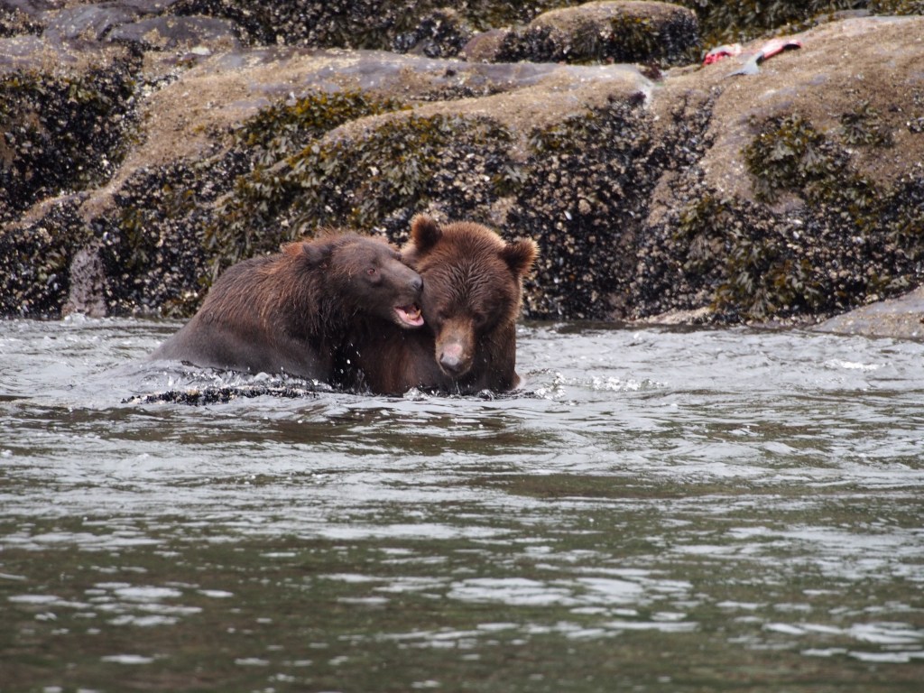
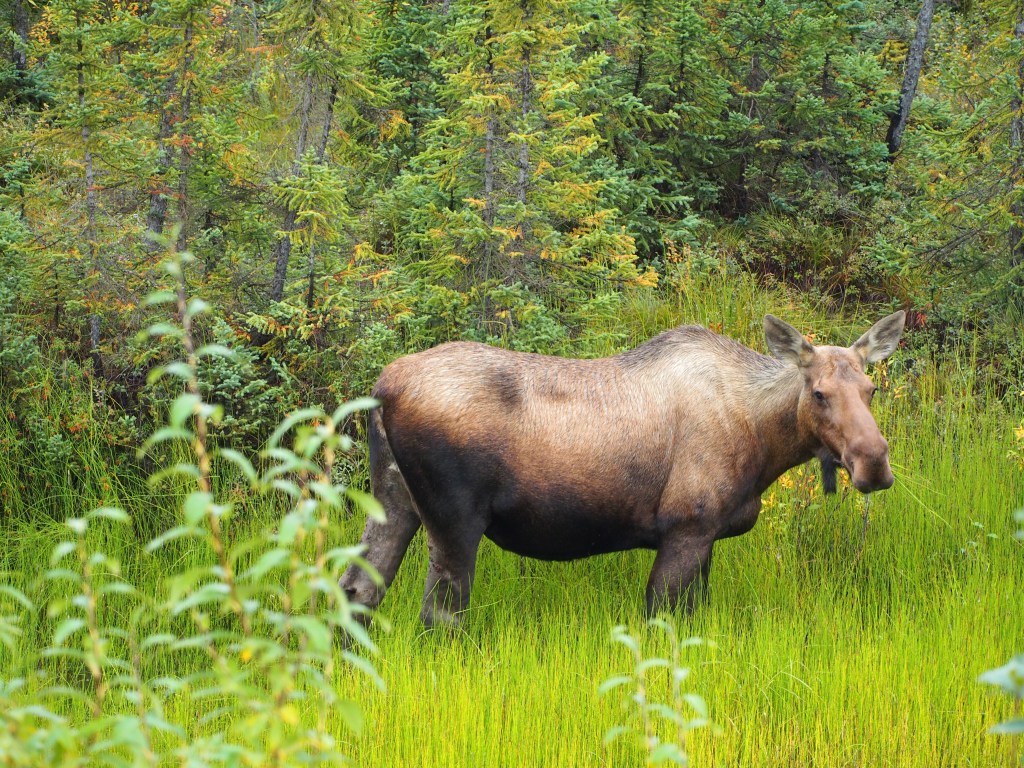
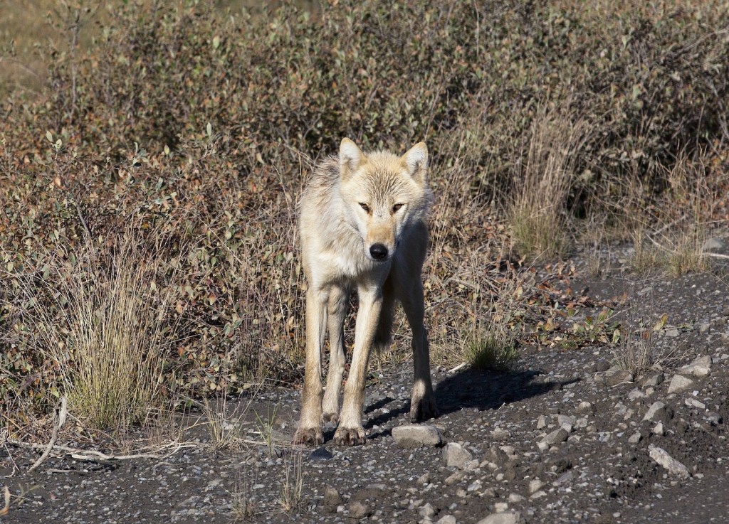
Seen bears and moose, wolves and a Lynx
Cruised passed Glaciers
And kayaked below their ice cliffs
We have hiked and walked and kayaked and cruised
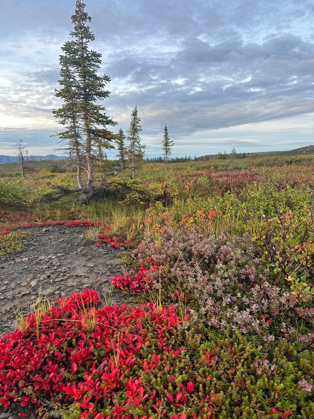
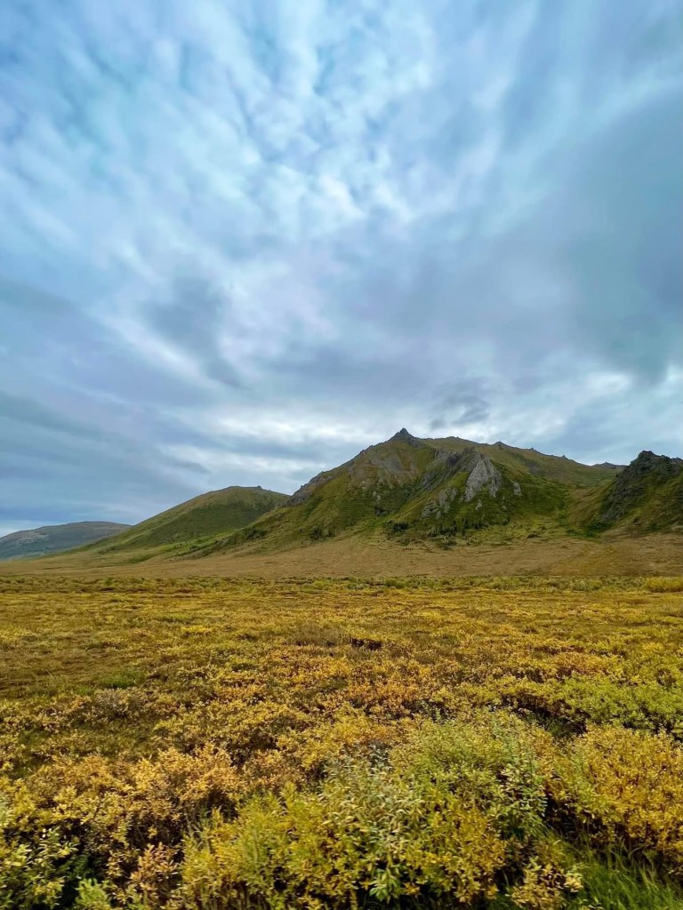
Seen amazing sights and beautiful fall colours
We have driven on paved roads, gravel roads, muddy and slippery roads
We have seen majestic vistas spread for miles ahead of us
Driven in fog where we can barely see 20 feet ahead of ourselves
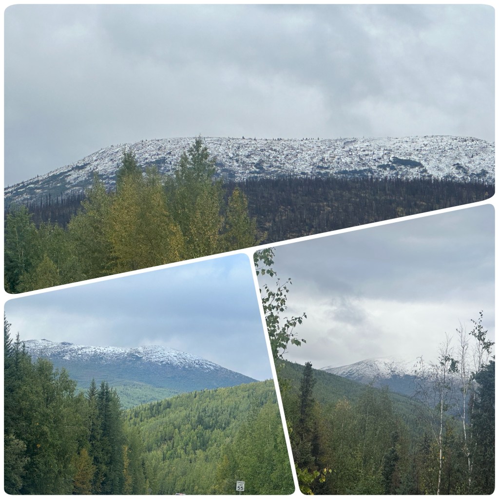
We have had sun and rain and termination dust (First new season snow indicating the end of the summer season) on the mountains
Dipped our toes into the Arctic Ocean
(P- We have tasted Whale meat, held gold nuggets, been Salmon fishing, we have eaten local foods, experienced days of continuous sunlight, shared stories with locals, Boondocked (bush camped 75-80% of our nights)
I walked mountain top suspension bridges.
Plus I achieved my goal of Tasmania to the Arctic and return wearing shorts every day!
Whilst Judith visited many Quilt shops! Excelled in her roll as chief navigator and worried about the cliff edged roads we often drove).
We have driven 5000 mile (8000km)
Every day has been an adventure.
Oh what a wonderful adventure.
(P- now to plan our next adventure to – – – somewhere else on our amazing planet).
Aurora BorealisFall ColoursShorts worn to the Arctic and Back
Oh no! This means we are nearing the end of our trip. But a few days to fill in before we reach Anchorage so we are on the road again.
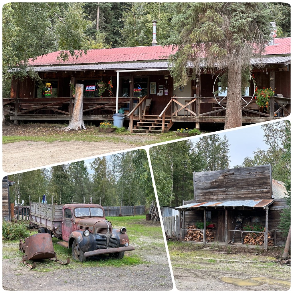
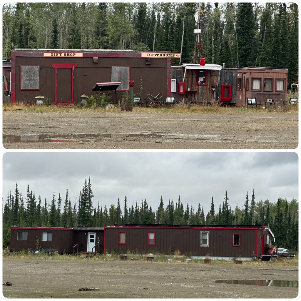
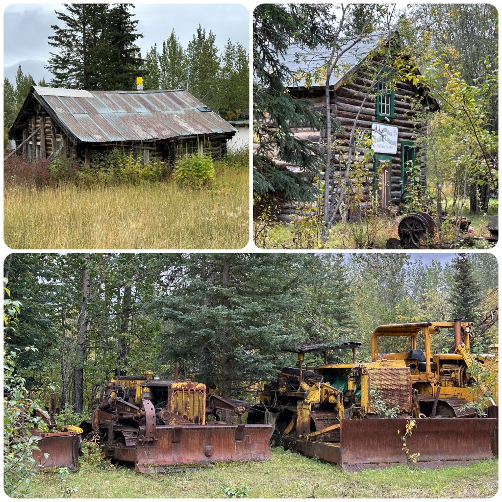
After the thrill of seeing the Northern Lights at Chena we had a later start to the day, leaving the hot springs mid morning and returning back to Fairbanks. The day is overcast and gloomy with just a faint dusting of snow left on the hilltops. Back in Fairbanks we visit a couple of stores we wanted to see, spent some time in the old city centre and drove up around the University of Alaska and checked out some of their farm research area. Before stopping for lunch overlooking the very impressive University grounds. After lunch we pointed our noses south and slowly wandered along, enjoying the road trip, some of which was on the old Highway. We stopped for a look at the old mining town of Ester, which was founded around 1900. All it is today is a collection of dirt streets, old log homes and massive tailing piles from dredging for gold.
Ester
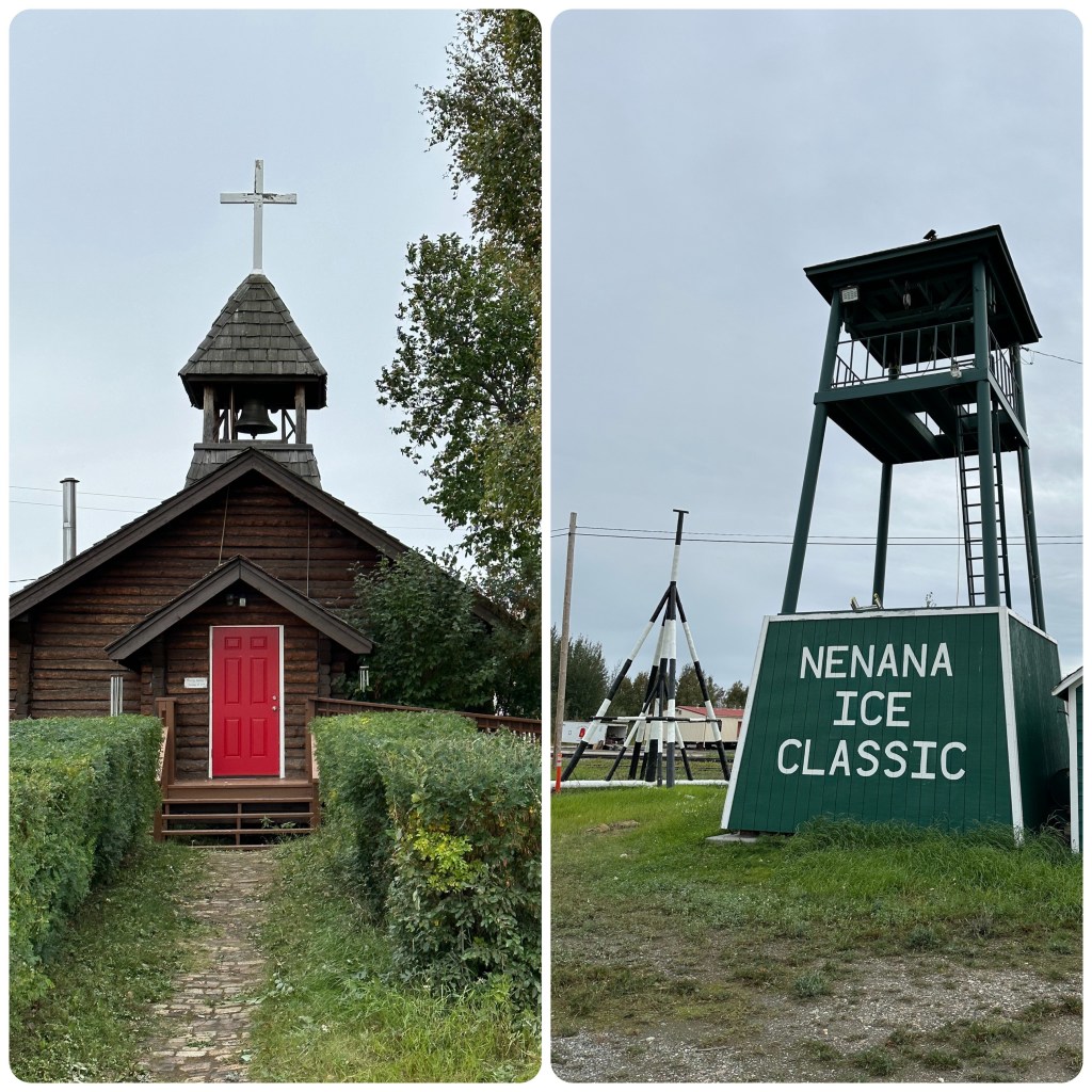
Continuing down the road we reach Nenana, where we plan to stay for the night. Parking up we rug up and take off for a walk around the town. This town sits at the confluence of the Nenana and Tanana Rivers. It’s claim to fame is the Nenana Ice Classic. This is a lottery based on guessing when the river ice will break up in April or May. This has been run since 1917. Guesses are made to the day, hour and minute that the ice breaks and the tripod stops the timer. The tripod must move 100 feet downstream for the timer to stop. Last year there were two winners guessing the exact time. Prize money of over $300,000 to be split between the winners!
St Marks Church and Ice Classic Tripod. Nenana
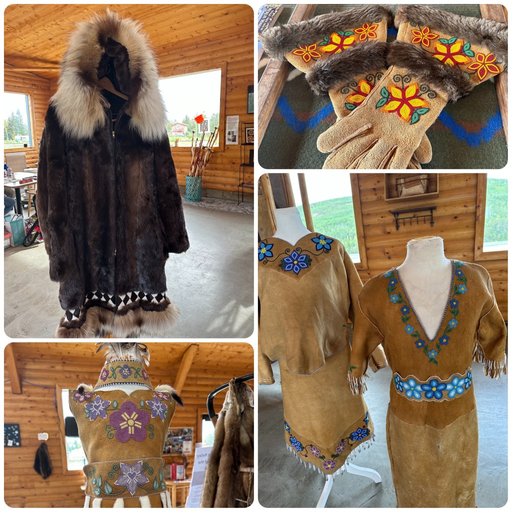
We visited the small native craft/information centre where we chatted to a lady there doing some beadwork on moose hide. The hide was so soft and looked just like felt. Her needle just slipped through it. The hide she was using had been tanned the traditional way with the brains of the animal. She showed us some hide that was tanned using modern methods and she couldn’t push the needle through it. A full tanned moose hide is over $2000 to purchase. They also had some fur skin samples there from a Beaver, lynx, wolverine and wolf. It was interesting to feel the difference between the furs.
Beading on Moose Hide and Beaver and Wolf Parka
Later in the evening we watched several trains pass us and cross the river. To do that the trains have to do a big loop before crossing the bridge.
Next morning we continue south towards Denali National Park. The weather is miserable again but as we are driving it doesn’t matter much. We head into the visitors centre and check out some of the displays and watch a couple of short movies about the park. We had thought we might go further into the park but with the weather miserable it’s not worth it.
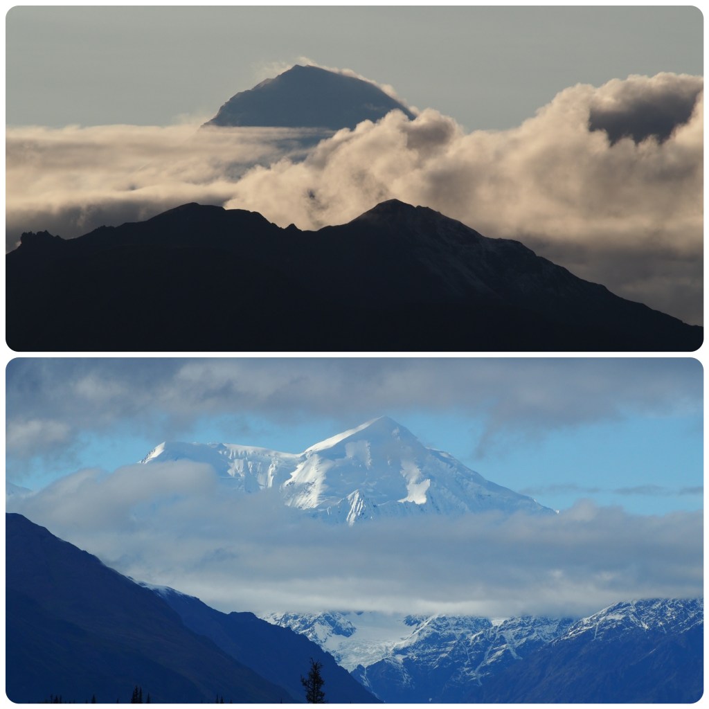
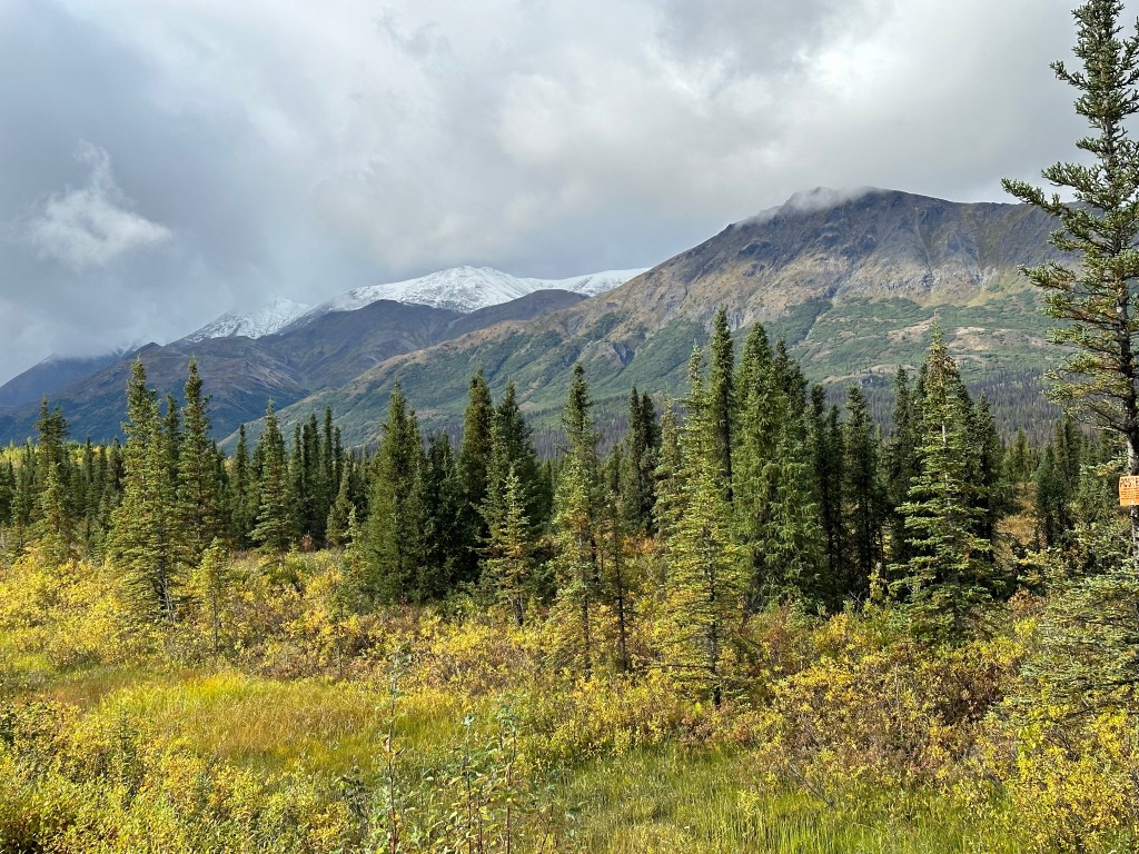
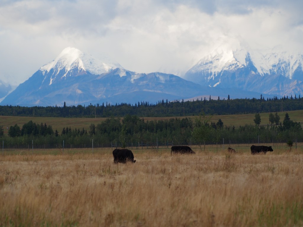
(P- as we were wandering outside the visitors centre an old guy comes up and says “Dang it’s freezing boy and you are wearing shorts” I wore them into Alaska, wore them in freezing weather at the Arctic Ocean and plan to be still wearing them as we leave Alaska – just a personal challenge). So we continue driving south. The weather starts to clear as we get further south and more of the mountains are becoming visible. The fall colours are again showing their beautiful colours. By the time we reach Denali View North Campground the sky is turning blue and the Alaska Range is becoming visible. We decide to camp here for the night in the hopes that Mt McKinley will be visible at some stage.
Lots of people pull up here and take photos but there is no sign to point to exactly which mountain is McKinley. Philip thinks it’s still behind the clouds but everyone is taking pics of the picturesque mountain in view. Later in the evening Mt McKinley eventually reveals itself but it’s no where near as impressive to look at as what we now know is Mt Deception. We have had a lovely evening though sitting by the fire and cooking our dinner while watching the ever changing view.
(P- My trusty gps maps and compass was telling me the beautiful fully clear mountain wasn’t Mt.McKinley, but with everyone taking photos of it I started to disbelieve my judgement. Well into the evening the “real” Mt. McKinley (Denali) unveils itself from the cloud. This viewing is our third this vacation, all from different areas. How lucky are we! Statistics tell us less than 30% of visitors see USA’s highest mountain as it is usually covered by cloud. Only one other vehicle in the normally crowded campground tonight. Over the last 3 weeks there have been less and less fellow travellers – it’s getting cold and they appear to have all gone home! When we wake this majestic mountain is again hidden deep in cloud. I wonder how many people have a photo of aptly named Mt Deception thinking it is Mt McKinley?)
Mt . McKinley and Mt Deception (bottom)Peak Finder App
Tuesday 5th
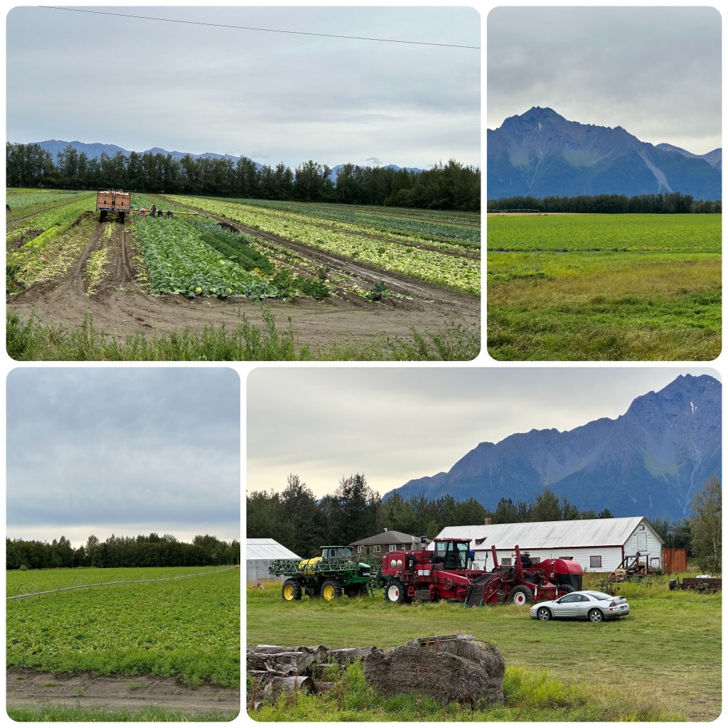
Today we continue our way south towards Palmer where Philip wants to check out some farming areas and then we want to visit the Musk Ox Farm. We noticed this small area of farming when we visited the State Fair. Also happened to take a wrong turn and drove around a beautiful subdivision. Some very impressive homes and gardens.
(P-Palmer is a valley north of Anchorage, and has a milder climate, (only frozen for 7 or 8 months of the year!) For many years there has been a thriving vegetable industry here through the summer months, Temperate crops similar to what we grow in Tasmania except short growing season varieties. The crops looked good and to me very interesting. Harvest of potatoes was about to commence.)
Farming Area in Palmer
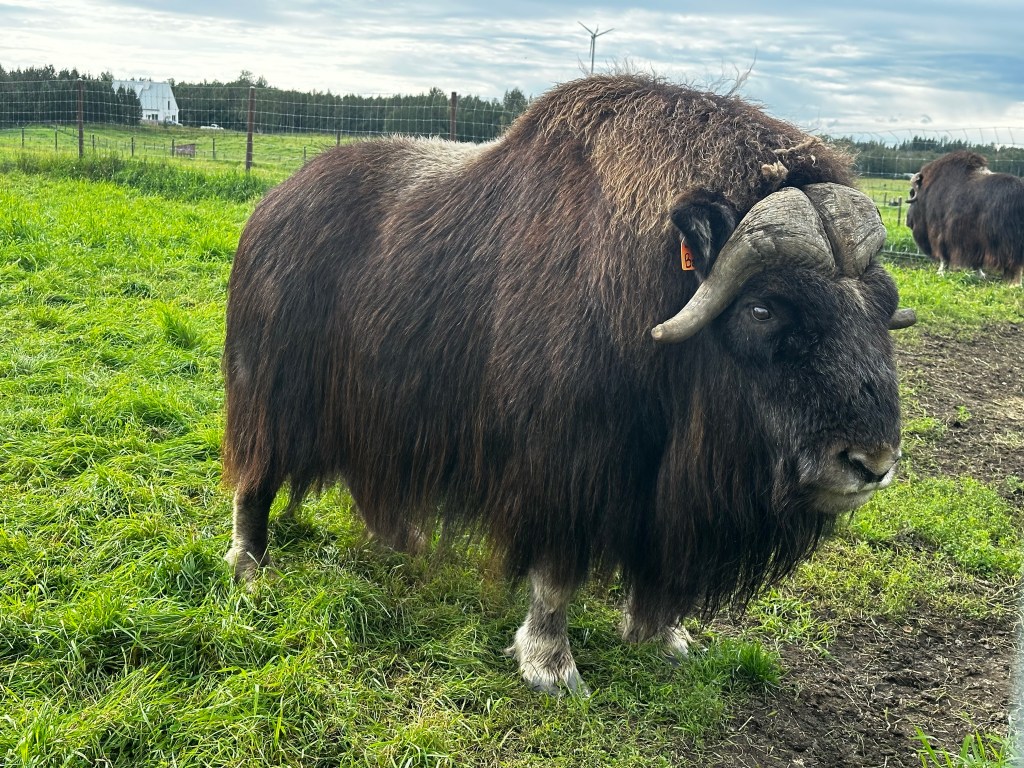
The Musk Ox Farm was very interesting. It is a non profit farm and provides a look at the musk ox which were reintroduced to Alaska in the 1930’s. The musk ox under coat, or Qiviut is gently hand combed from the animals and sent to South America where it is cleaned, spun and dyed before being returned to be sold. Qiviut lacks the lanolin that sheeps wool has and is free of barbs and scales, making it tremendously soft and easy to wear. It is one of the warmest and softest fibres on earth.
Musk Ox
(P- more craft materials purchased (Qiviut) – I could have nearly bought another piece of farm machinery with the cost of it! Judith is going to be busy crafting so I am hoping I won’t be noticed missing (in my workshop) when we return home!)
We continue onto Anchorage and settle into the Ship Creek RV Park for the next 3 nights. Then it’s off for a walk before dinner.
After a catch-up and cleanup morning in Fairbanks it’s time for some retail therapy. It’s wet today so a good day to checkout Fairbanks stores. New shoes for us both, before wandering around “The Prospector” an outfitters store, Rays Outdoors, Costco, and the Bentley Mall (almost empty). We stop at the Food Factory for lunch not knowing what it will be like but there are lots of people inside so must be good. Both our meals turned out to be excellent along with our root beer floats. (P- my 4th icecream in 7.5 weeks! I am almost unaddicted!)
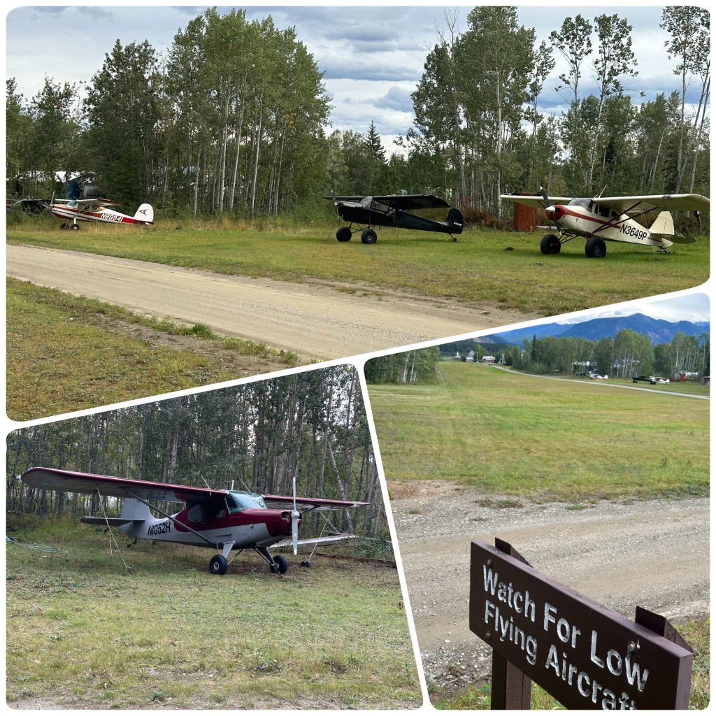
After lunch we drove out to the float plane area and drove around the planes checking them all out. Not many flying today as its pretty windy and miserable. Later, back at the RV we do some planning for our last week in Alaska.
2nd
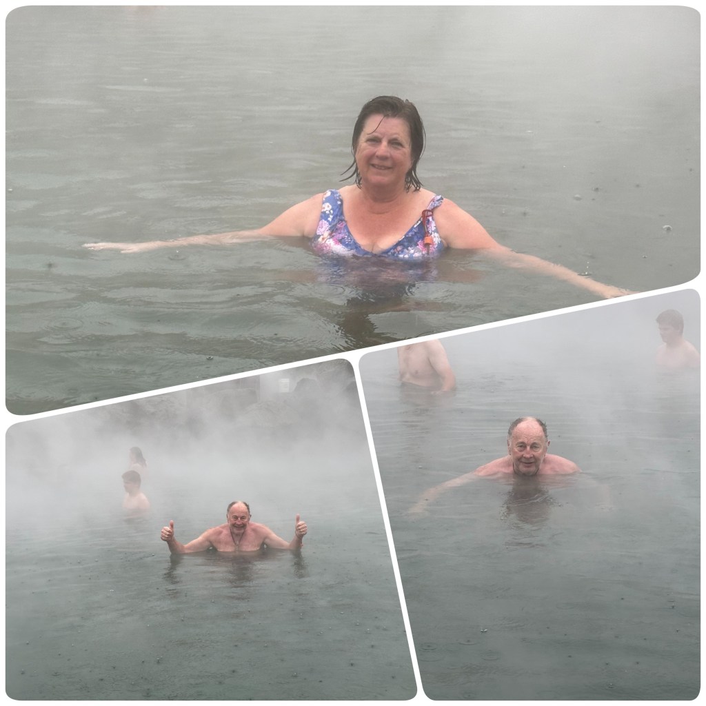
We are on the road by 9 driving the 56 mile out to Chena Hot Springs Resort. This has Camping on the grounds on a first in basis so plan to get there early, nab a site and then spend the rest of the day enjoying time in the hot pools. The hot pools are constantly fed by a mineral spring at 165 degrees (74 degrees C) and cooled before filling the pools which are surrounded by large rocks. The water temperature varies depending on where you stand in the pool.
Bathing Beauties, Chena Hot Springs
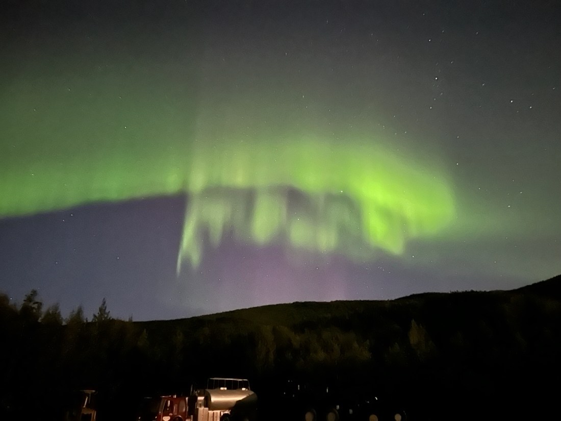
The other reason for coming to Chena is that it is an Aurora hot spot and tonight is suppose to be clear after all the rain. The Aurora is one of the things I particularly wanted to see while here in Alaska. Philip has consulted the weather App and tells me the skies will clear for 3 to 4 hours at the correct time and we will have a very good chance to see it.
Three sessions in the hot pool, the first hour in rain. An interesting experience, beautiful hot water from the neck down, freezing cold rain on our heads and upper body when we need to stand to cool down a bit. The weather clears later in the afternoon and the pools are still very relaxing.
We enjoy a walk around the resort in the late afternoon and note that when the clouds and rain have gone there is a slight cover of snow on the higher peaks surrounding us. Winter is coming.
Winter is Coming
A late dinner, some reading and a documentary later, its now just after midnight and the sky is clear so we don our warm clothes, hats, gloves, coats, thermals and head torch. Then head outside and across to an open area, the end of the runway of Chena Airstrip and look skyward. We are rewarded with the Aurora, just becoming visible with the naked eye. With the camera it becomes more visible and the colours richer. It dances across the skies above us while we ignore the cold to get some photos and enjoy this phenomena.
Aurora Borealis Chena Hot Springs
(P- while we are on PH words Judith should add “and potentially get Phneumonia! ). The Aurora fades and we head back inside and to bed in the small hours of the morning. The only thing spoiling the night was the guy camped next to us left his generator running until well after 2am. (P- so Judith says, I couldn’t hear it! – Pretty sure the Aurora viewing has added even more “Brownie points” to my well overflowing bucket)!
Well not quite a dash but a spur of the moment decision while doing our groceries in Fairbanks (P- the advantages of not having fixed plans for our road trip!) sees us driving up the Dalton Highway towards Prudhoe Bay. Although we have little intention of getting all the way, the Brooks Range at the half way point is our main goal. We have a couple of spare days before heading back towards Anchorage so Philip could not possibly have some time relaxing, instead we do some more serious driving. (P- research advised me there are no Quilt shops on the Dalton Hwy. so that’s a sound reason to tour the road)
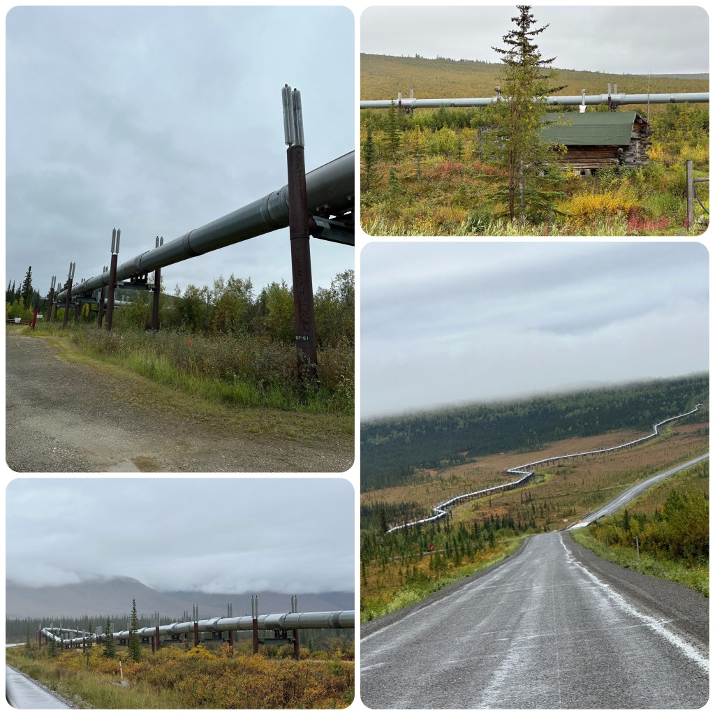
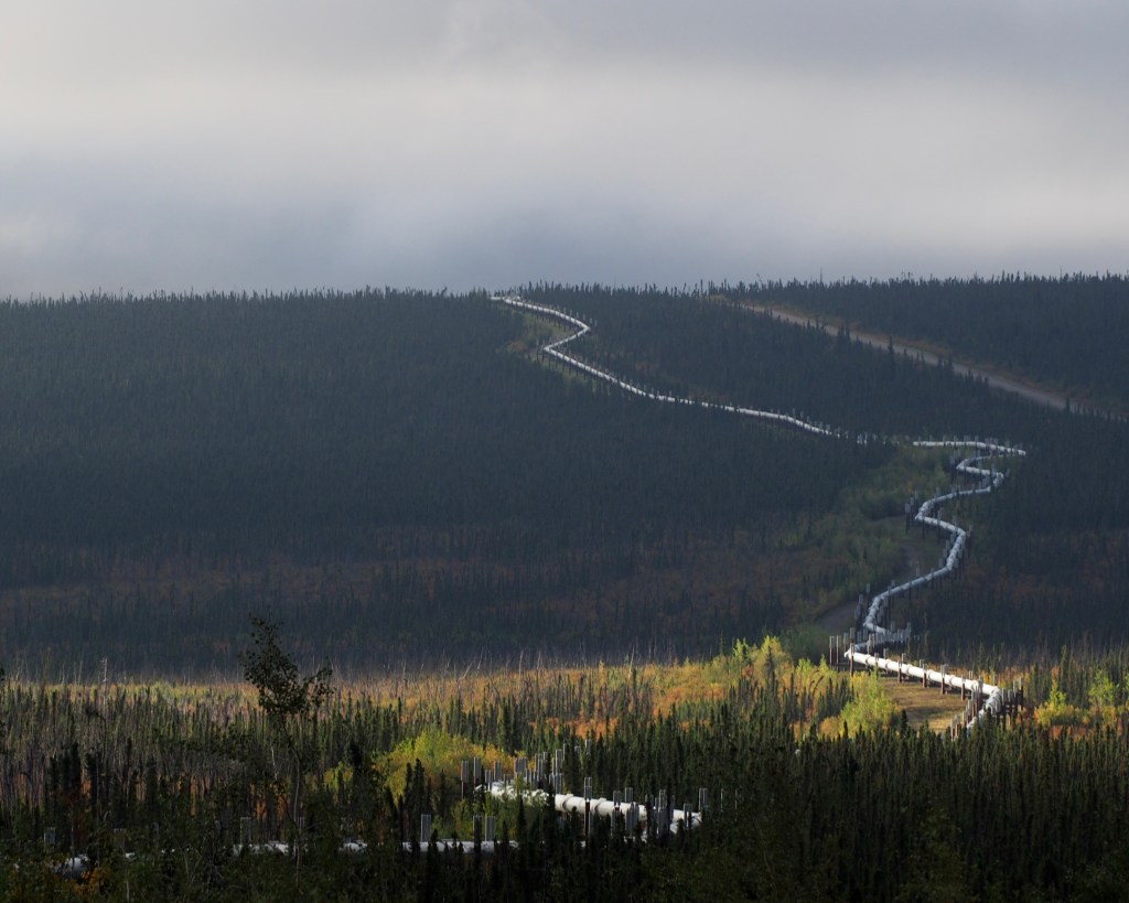
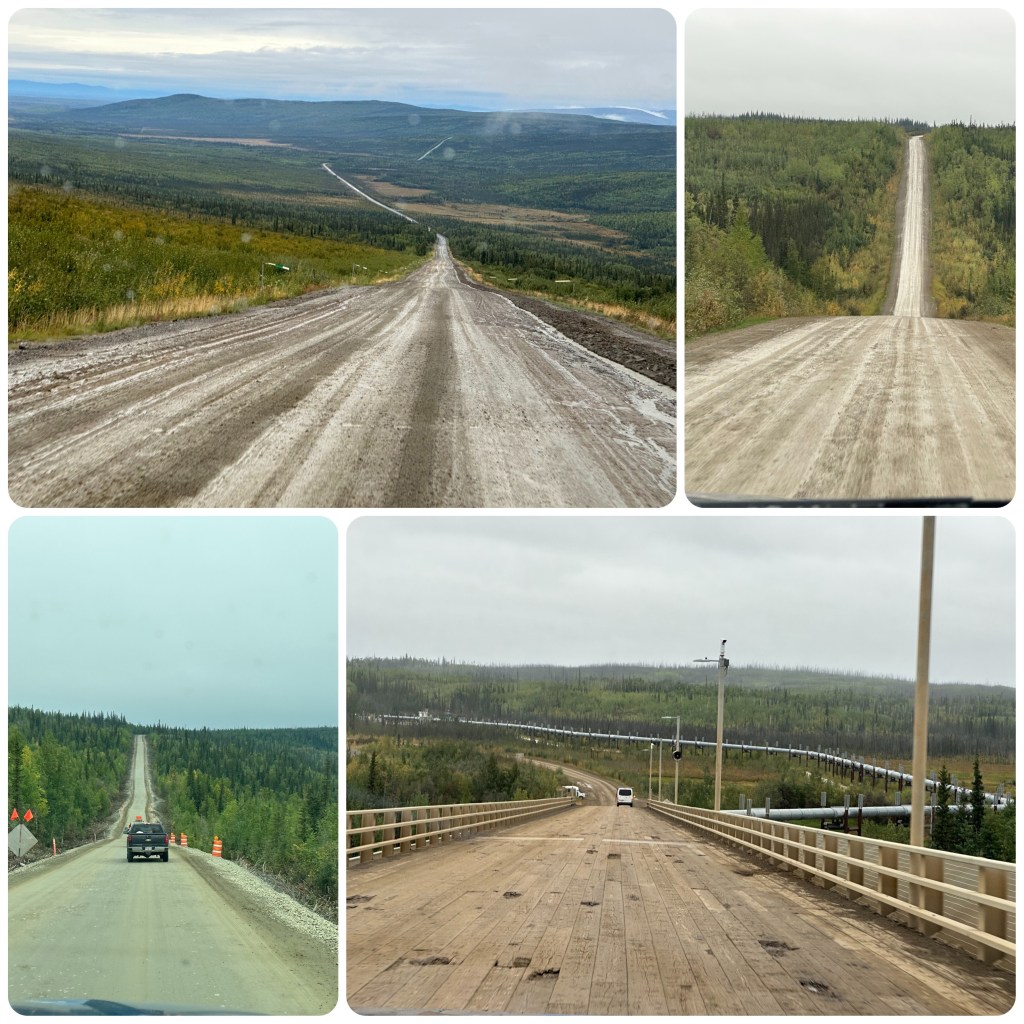
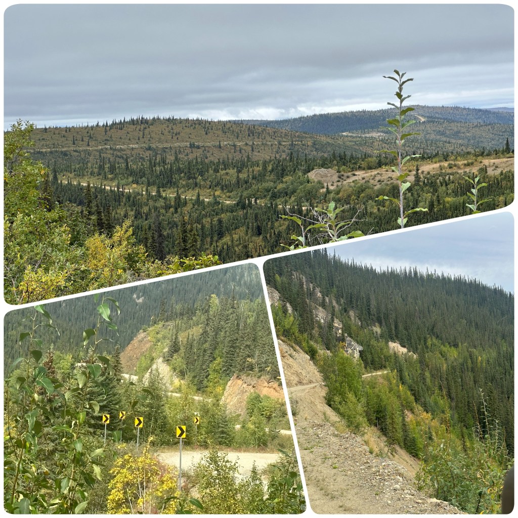
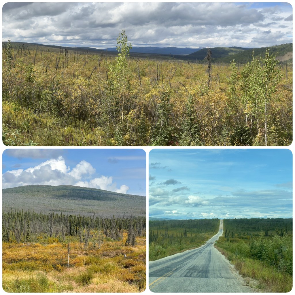
The Dalton Highway is 415 mile (668 k) long, from Fairbanks to Prudhoe Bay on the Arctic Ocean. The Highway follows the Trans Alaska pipeline, up and down hills, through forested valleys and over the Brooks Range at Atigun Pass and then across the treeless north slope. It is one of Alaskas most remote, dangerous and challenging roads. It is still considered a haul road and is continued to be used by all types of vehicles from motor bikes to cars to freight haulers.
The Trans Alaska PipelineMany twists and Turns of the Pipeline
After filling up with fuel in Fox we turn onto the Dalton and onto the gravel. Before too long we are waiting at a stop for a pilot car to guide us through 20+ mile of roadworks. Apparently (according to social media “arm chair” experts) this is due to a large washout or landslide. (Later learning that is not correct and it is for realignment of the road).
The Yukon River Crossing, a bridge this time, is 2290 feet long (698m)and has a 6% grade. It was completed in 1975 and upgraded in 1999. There is a short track to a viewing platform under the pipeline and bridge. This is the only bridge that crosses the 1980 mile (3190 k) river. The Bridge also Carries the Aleyska oil pipe line across the Yukon river. A short way up the road is our campground for the night. Again no one but us. The season is coming to an end very quickly.
The Road and the Yukon River Bridge
The campground is just near the Hot Spot Cafe, a now defunct facility. We wander around the remains of the buildings, finding nothing much of interest apart from the accommodation that looks as though someone walked out yesterday and just left everything behind. Linen still on the bed, guitar against the wall and shoes inside the doorway. Pretty sad really. During Highway construction mammoth bones were found near here.
The Hot Spot Cafe
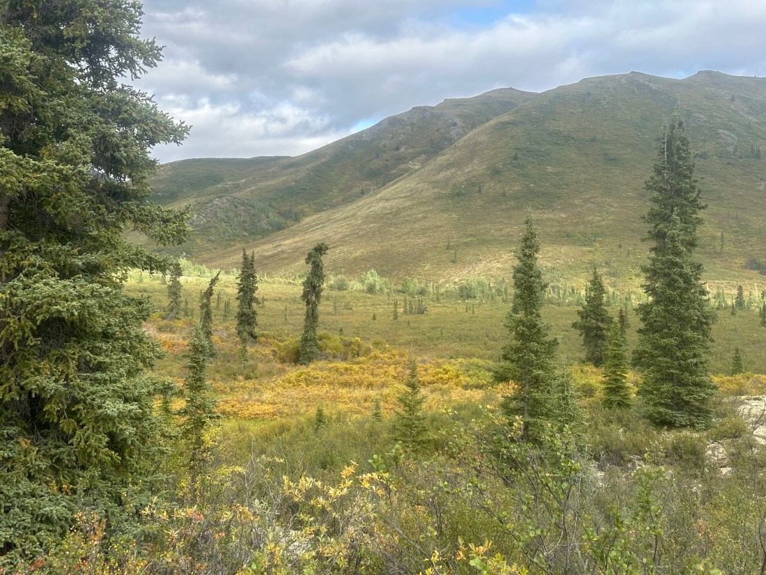
The road is a series of frost heaves, pot holes, corrugations and mud, interspersed with cloud, rain and fog. We continue to drive up to Coldfoot enjoying the scenery, when visible and refuel. Stopping by the Visitors centre we chat to the staff there about the road further north. We would really have liked to go over the Atigun Pass but the road apparently deteriorates more after Sukakpak Mountain. On their advice we continue on to Sukakpak as it’s very picturesque there and stop for lunch while enjoying the view of the mountain. The pressures on the limestone have changed much of the mountain into marble, with veins of copper, quartz, crystalline and cinnabar in the mountain. While lunching, the fog/cloud ahead of us lowers even more and as the Atigun Pass is twice as high as any we have already been over we make the decision to turn back. We will have to save the rest of this trip for another day.
Sukakpak Mountain
On our return we divert a few miles to the Rustic town of Wiseman, Alaska, first settled in 1909 as (and still is) a gold mining town. (P- If I was looking for a place to be a Hermit and go into recluse it would be the perfect community!) We drive and wander around this quaint place and are welcomed to visit the local “Chapel” well local worship place. Wiseman is a well worthwhile diversion. To make our return trip special we spotted a moose right by the roadside. Stopping to get some great photos. We stop at the Arctic Circle Campground for the night with only a couple of other campers there. Alas no Northern Lights here either too much cloud.
The very quaint Wiseman ChapelAround Wiseman
31st
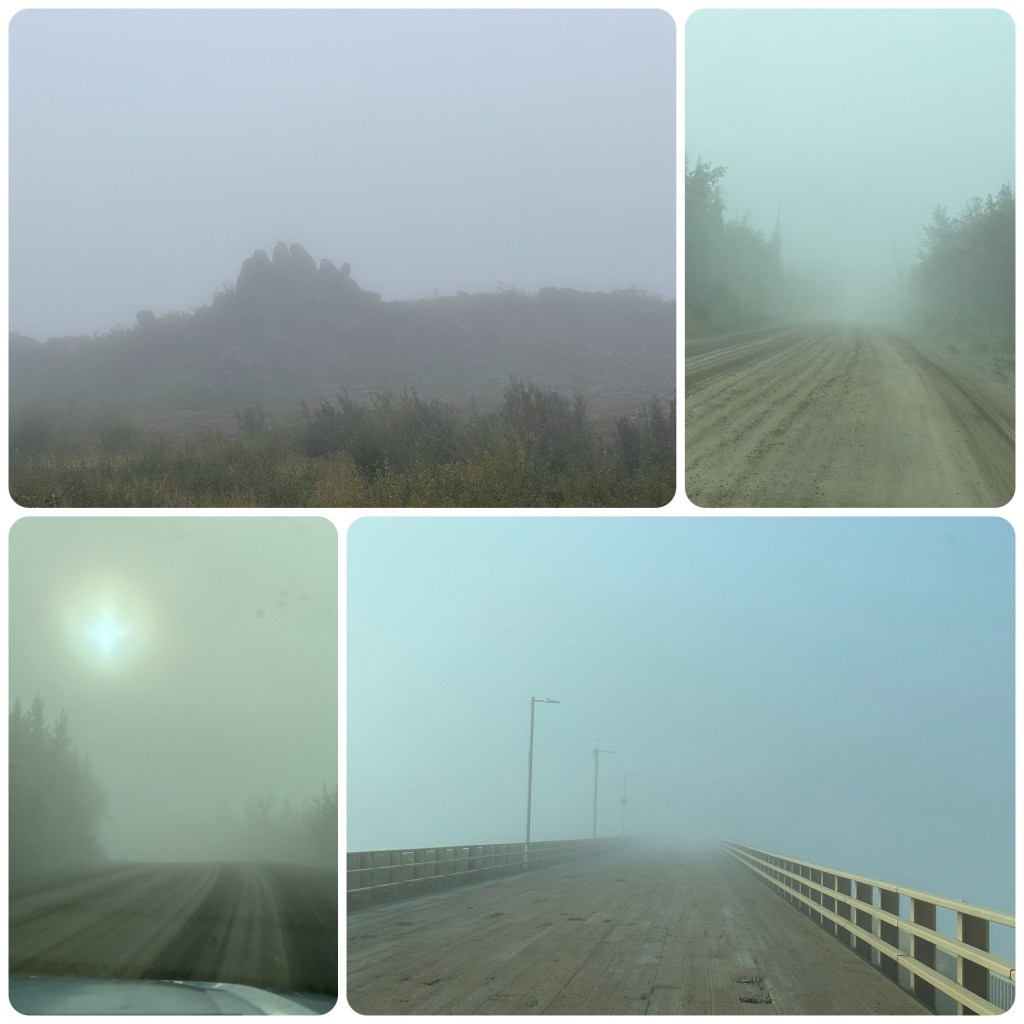
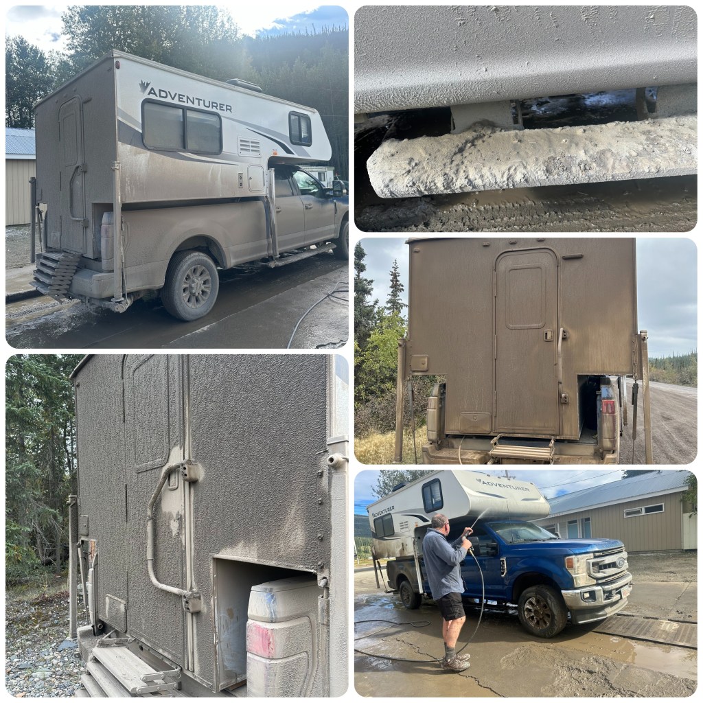
From the Arctic Circle we continue south heading for Fairbanks. This morning around 50 miles of fog with 100 -200 feet of visibility and it’s slow going. As we crest one hill 5 wolves cross ahead of us. How awesome to see them. Back in Fairbanks we book into the Rivers Edge RV Park and have lunch before using their car wash to once again discover our vehicle is blue not dirty brown. 1 1/2 hours to get the gluey mud off. No more dirt roads for us this trip.
Foggy Road
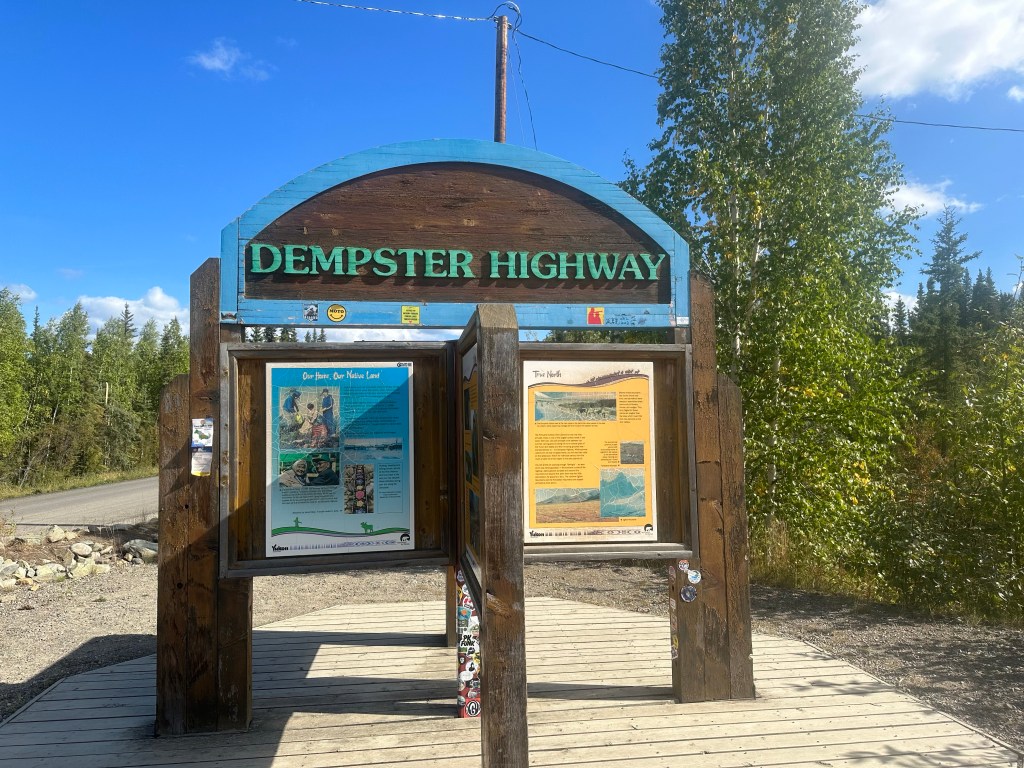
The Dalton Highway is interesting in that it follows the Alaska Pipeline but it is not as scenic as the Dempster Highway.
(P- We knew we wouldn’t get to Prudhoe Bay the location of Alaska’s North Slope Oil Wells.
Always another day and another reason to visit Alaska again!
-The North Slope is home to America’s National Petroleum Reserve Alaska, area over 1/4 million acres.
-Over 1000 wells are connected by a network of pipes and pumps to the Trans Alaska Pipeine which snakes its way approx 800 miles (1287 klm) to the port of Valdez where there is deep water, ice free port facilities and a refinery.
– 11 pump stations assist the flow of the crude oil to Valdez in the 48” (1.2m ) diameter insulated pipe
– The pipe is a continual series of bends to allow for expansion and contraction, the above ground section (over half the pipes total length)
– The pipe runs above ground in the permafrost areas so that the hot oil does not melt the permafrost environment. Over 78,000 refrigerant filled legs support the pipe.
In my opinion this pipeline is a fascinating engineering achievement!)
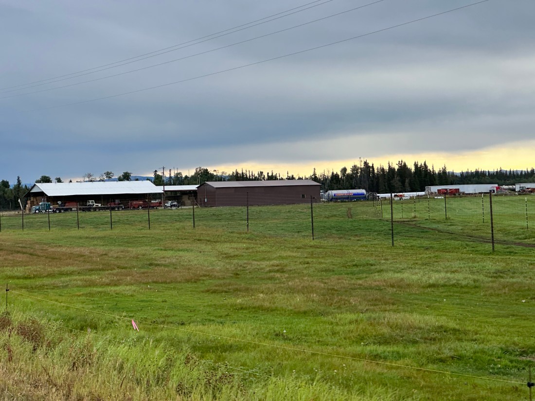
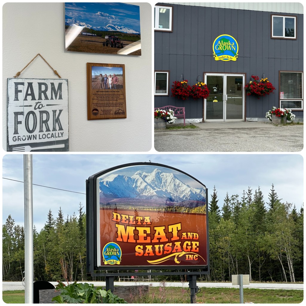
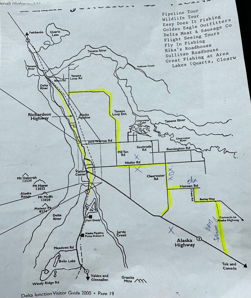
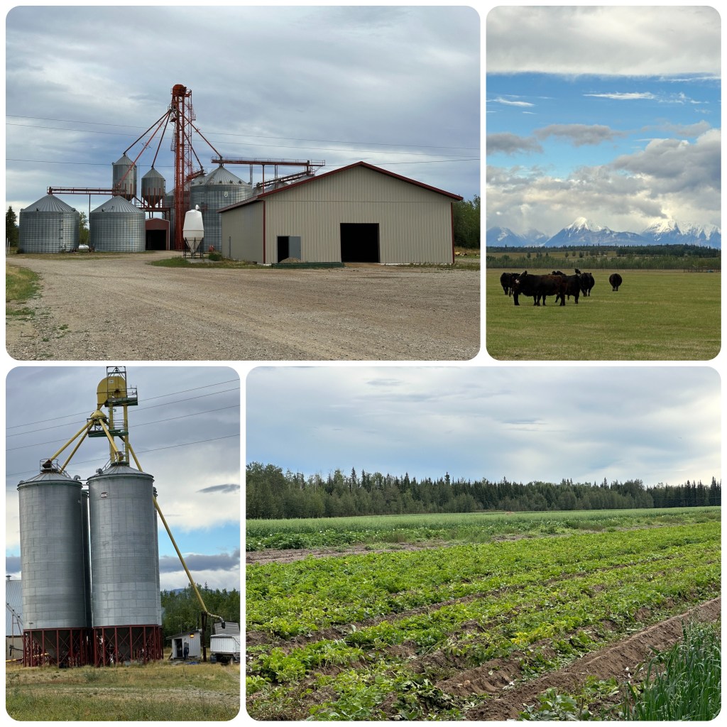
(P- As we drove towards Delta Junction we noticed a road called Agricultural Road and a grain silo or two. After my Google Earth of the area I was amazed to see how much Agricultural land was in the area! Next morning we retrace our steps to investigate. We discover, Yak, Bison, Beef Cattle and a Dairy Farm. Along with Barley, Oats, Canola and a few Potato fields. To me the crops all look stunted and very short on straw or foliage. There were also large fields of round or square bales that had just been made. We came across a Slaughterhouse and Butchers shop (Delta Meat and Sausage inc.) so time for a visit. The lady who served us was one of the owners of this family business. Time for 20 questions I thought!
Delta Meat and Sausage Inc.
-How long is the season? A max of 3 months (hence the short straw and foliage)
-what crops- See above
-How many Farmers? Not many now as the younger generation move away to more lucrative lifestyles
-Where are the equipment dealers? There aren’t any good ones and we all run old non computerised Farm Machinery as there are no technicians to service modern High tech equipment (looking around I could see she was correct)
-How did the farming start here? Politicians deciding Alaska must feed their own.
– Is it viable? Very hard to make viable and getting less and less of the land used
A few more questions and she gave us a map of where their farms were and sent us on a self tour. Before we left we stocked upon on locally grown and butchered, Bison, Yak, Angus Steak and Buffalo. We like to support local and the quality of the produce has been great.)
Personalised mapLocal Co-op, Cattle and Potatoes
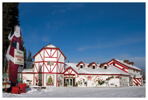
We then drive on thru the town of North Pole. Guess what they have a “Santa Claus” shop (as tacky as) with a big old Santa Statue out front and some penned up reindeer’s!
Santa’s House, North Pole, Alaska
This reminded me of a Reindeer story!
I was reliably informed by the Lady who owned one of the quilt shops (so it must be true!) that whilst Santa’s Reindeers ( having male names) are all female! Why? Because Only Female Reindeer have antlers in winter! We have been misled with the Rudolf song evidently! Oh and Reindeer are tamed and farmed Caribou) – After that story perhaps we should stop calling at quilt shops!
J. Well I think Philip called ahead because the Quilt Shop, The Quilted Cow, in Delta Junction was closed.
Retracing our travels along the Top of the World Highway we are surprised at how the Fall colours have dulled off, changing from golds to dark/orange brown. The mountains today have been in full view with clear skies and no fog or smoke haze. We passed through the border checks quickly and turned off at the Jack Wade Junction to drive down to Eagle. This 65 mile gravel road is located at the end of the Taylor Highway on the Yukon River. The Milepost (our Alaskan travelling bible) states “the road is narrow, winding, gravel, no shoulder or soft shoulders and steep drop offs. Be alert for oncoming traffic on blind hills and curves”, and they weren’t kidding. It was not my favourite road, especially the steep drop offs. In places the road clung to the side of the mountain as we descended the many hairpin bends and steep curves. But the views were great and as long as I didn’t look down and Philip drove in the middle of the road all was good.
The Road to Eagle
(P- The sedation of Judith I mentioned on a previous day of challenging driving conditions should have happened today! It was rather a quiet drive with little conversation especially on the 7 mile downhill with a 5-800 foot almost vertical drop off on Judith’s side!)
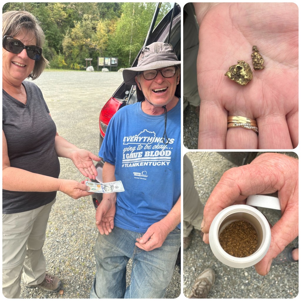
About a third of the way down we came to the Forty Mile River and stopped for lunch. Walking over the bridge we could see gold dredges skiffs and small hovercrafts tied up along the bank. This is one of the very few areas where you can still own a claim that has river frontage and extends into the river to mine for gold. After lunch we met a guy who has been gold mining here.
(P- I wander over and say hi- not knowing what the response would be! The response consumed the next hour of our day. Asking him how he mined and did he get any gold at all? He dredges for gold, suited up in a hot water heated dry suit and breathing apparatus. It’s heads down and feet up in the cold sometimes murky, fast flowing Alaskan River ( Forty Mile River) and does he get gold? Out comes the clean up dirt he will take home and pan out, small nuggets of gold clearly visible, then a container of gold particles ( evidently the money maker) and then a Jar of nuggets! He then hands some of them over to Judith to hold while we listen to his mining stories (we thought about as stretched as fisherman stories until he produces the photos as evidence). I suggested a bit of cash for a nugget at a mutually agreeable price would be a great Alaskan Souvenir! Kent was out with the gold scales quicker than I could say CASH – Judith chose her nugget and the deal was done! What a fun hour or so in backwoods Alaska! And never let it be said I never buy Judith Jewellery! )
Purchasing Gold from Kent
Continuing on round more corners and over bridges along valleys we drive past the American Summit Liquor Store and Snack Bar. It’s no longer open but you have to wonder why anyone would open a liquor store and snack bar out here in the middle of nowhere on a barren hill where it gets snow for 9 months of the year and the road is closed for six-eight months. Someone must have had a dream I guess.
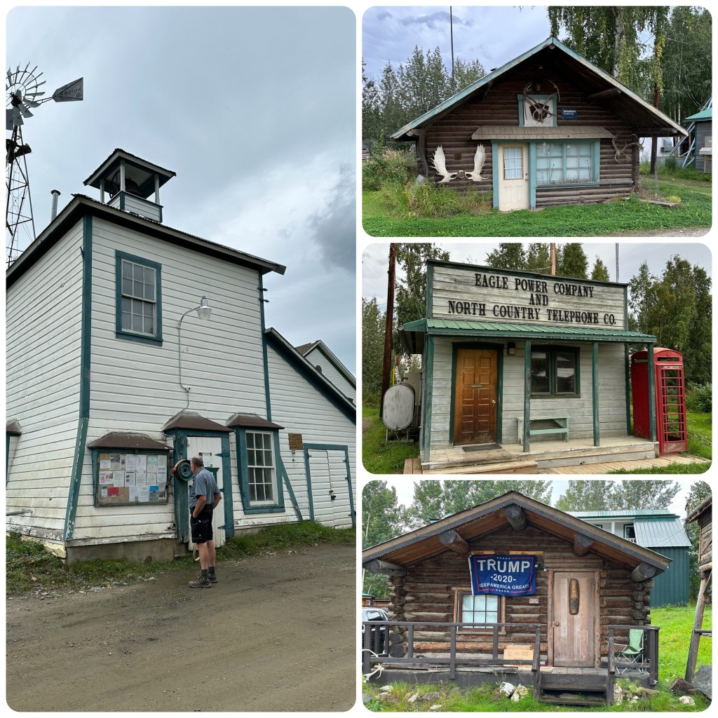
Continuing on we reach Eagle and drive around town before heading up to the campground. We set up camp, we have a choice of 16 sites as no one else is here, and pay our $12 camp fee.
Then with bear spray in our pockets we walk back into town and around the few remaining buildings of Fort Egbert.
(P- on the way we meet an older gent walking our way, we stop and exchange greetings, and he shares some of his 50 years he has spent in the Isolated town of Eagle. Most interesting to hear how they survive the winter, ensuring they drive their pickup to Tok ( the nearest major service town 180 miles on a slow road away) and fly in and out in a Bush Plane as there are no Roads from end of September till March or April. He asked Judith did she know how to use the Bear Spray she had on her belt, lifted his jacket showing us his and saying never be without it. He shared his close encounter Bear story (probably same exaggeration as Fishing stories) the story ended that he won and the Bear tasted great! – another 45 minutes gone in discussing Alaskan life.)
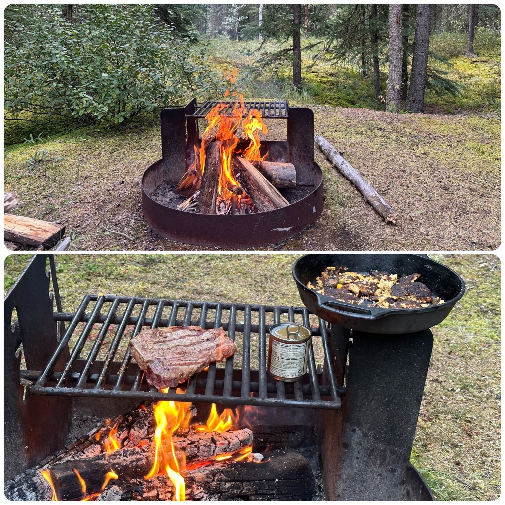
Then stroll down the grass runway towards the old town of Eagle and the Yukon River. Several Bush airplanes are parked along the strip. Quite a few quirky local buildings that we wander around before making our way back to the RV, collecting some small brush to start our fire with on the way. Philip gets the fire going and it’s the best one we have had here in Alaska. Finally dry wood and sticks that burn with some heat.
Buildings in Eagle
While we are cooking dinner we are amazed when a tour coach drives into the campground followed by a truck. Then after 10 minutes they both leave. Later while having dinner a guy walks passed and starts chatting with us. He is a Professor of History at an Anchorage College and has just arrived with the bus load of 17-18 year old school kids who tomorrow morning will be starting a rafting trip down the Yukon for 10 days, leaving the river in Circle about 150 km away. What an experience for these kids and a great way to start their school year.
Great Fire and DinnerAir Strip at Eagle
28th
Departing Eagle this morning and we have to retrace our route 65 mile back up the range, round the steep winding narrow roads. I can hardly wait. Luckily we only meet one vehicle as we were coming out. I was very glad to get back on the main road.
(P- It was also a very quiet last 7 miles as we drove along the cliff side. The co-pilot was operating in nervous quiet mode again. To me it was another great road to drive!)
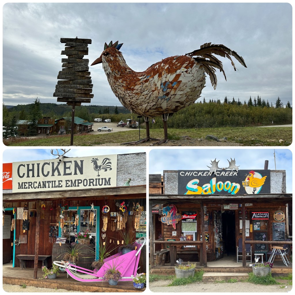
Chicken was our next stop (we stopped at the Chicken Roadhouse when we passed previously) where we checked out the mining dredge, souvenir shop and the mercantile and cafe. We had been told the cafe had great chicken pot pie but alas none today. They had run out of chicken and as the season ends next week didn’t restock. Got some nice blueberry and cherry pie slices for dinner tonight.
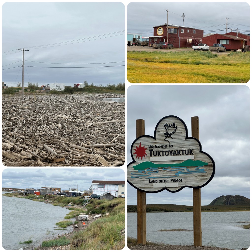
Tuktoyaktuk -Last town before the Arctic OceanEngineers Creek
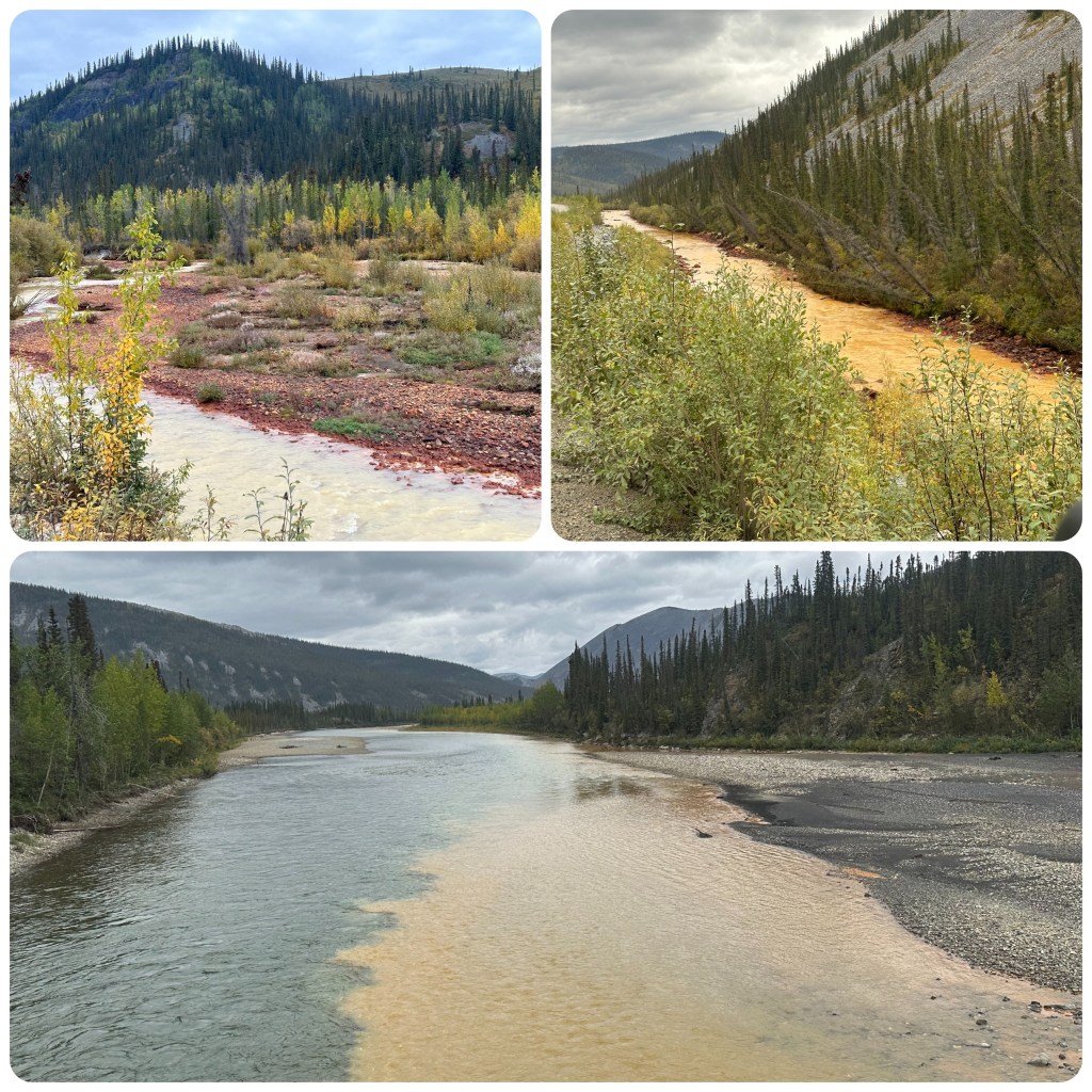
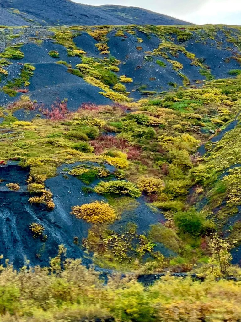
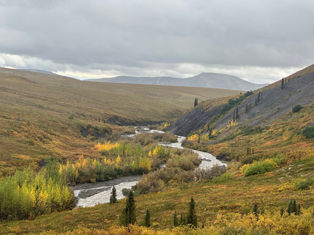
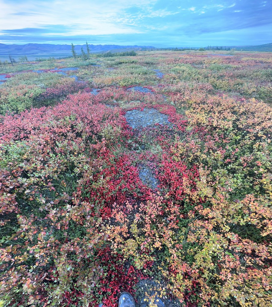
Engineers Creek is a tributary of the Ogilvie River. Iron Oxide, limestone, gypsum, salt and sulphide bearing sediments dissolve in the rain water and colour the creek and earth reds and orange-brown hues. There is a distinctive sulphur smell from the nearby sulphur springs.
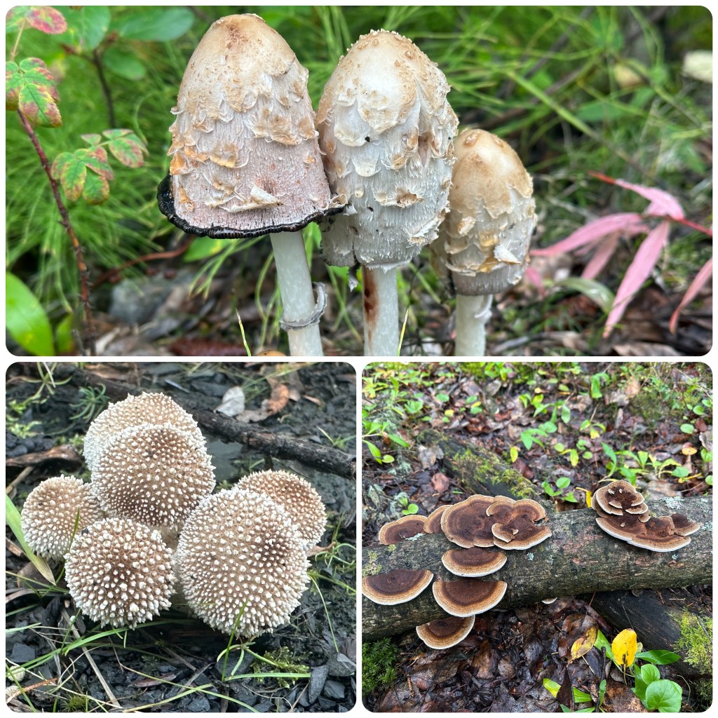
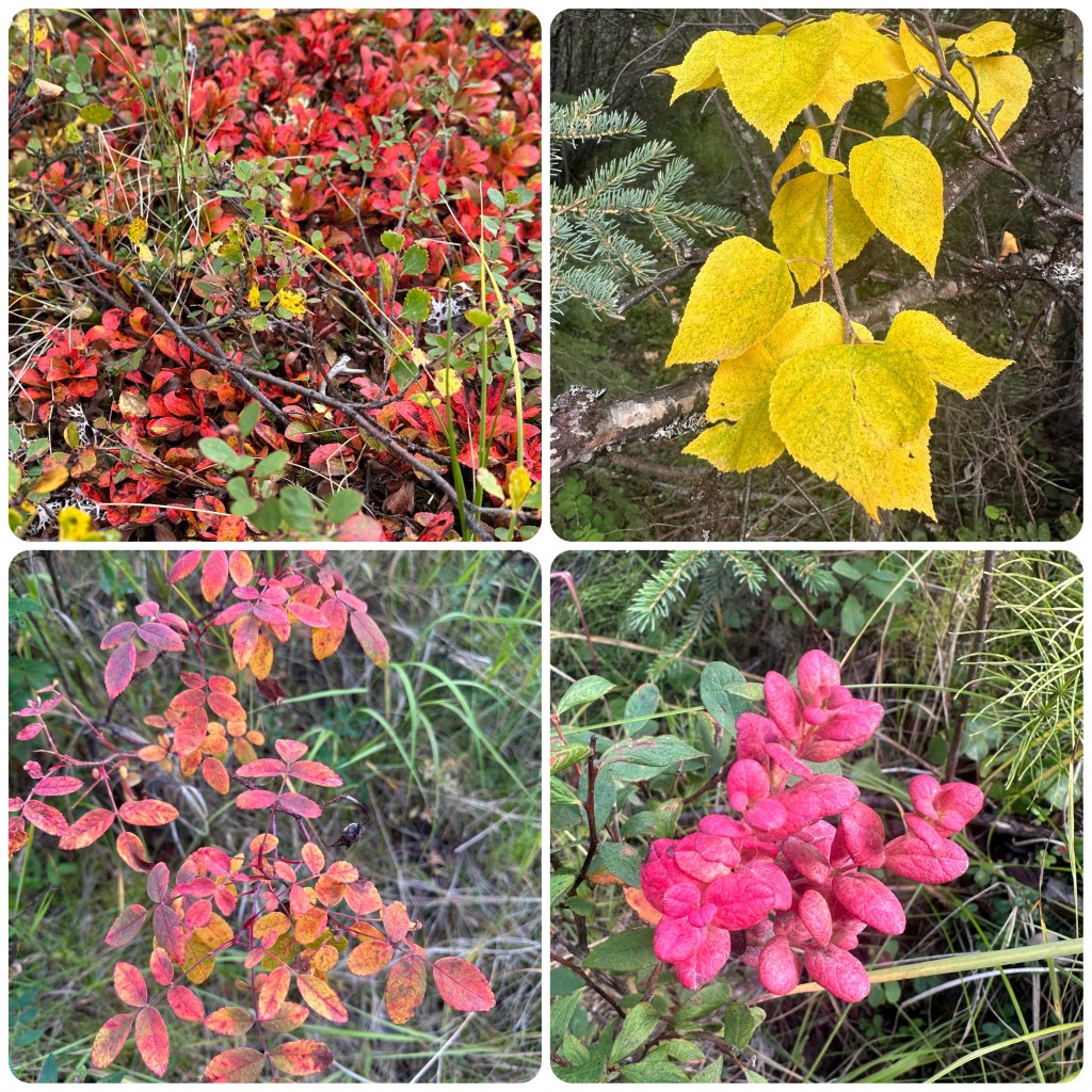
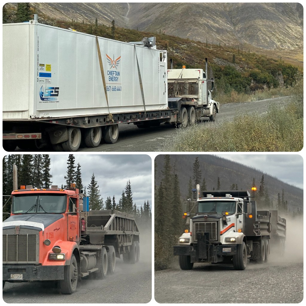
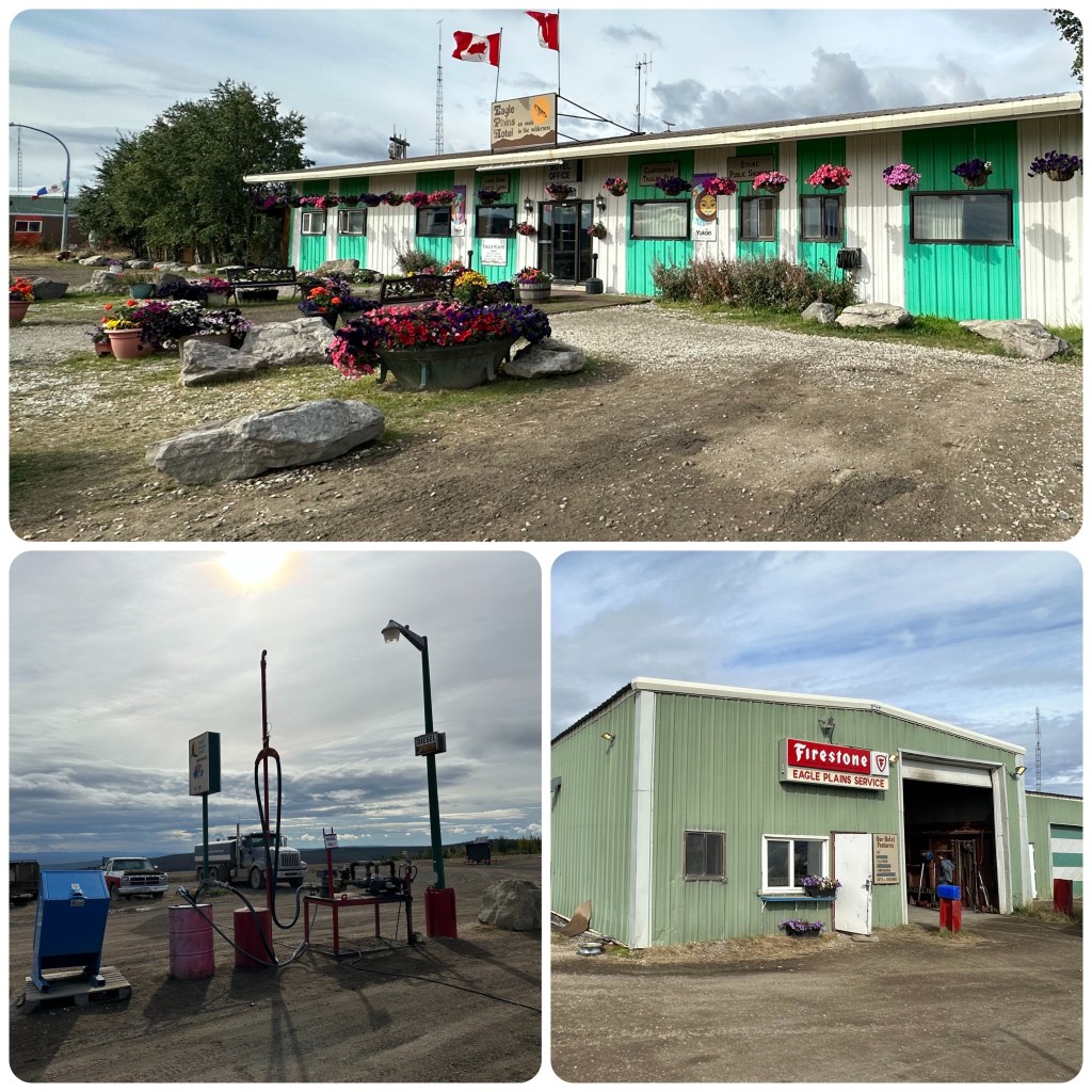
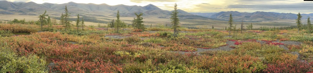
Some of the many fungi Beautiful colour changing leavesTrucks along the DempsterEagle Plains Hotel and Service StationAll these colours are leaves, not flowers.Getting the truck clean. It’s blue again.
This has been an amazing part of our trip. So much to see and experience. 1112mile (1800 km) of dirt and mud, mountains and tundra, bears, moose, the Arctic Circle and the Arctic Ocean.
(P- our original thoughts were to travel the Dalton Highway to Prudo Bay in Alaska, watching a documentary on Canada’s North West Territories changed our plans. The main reasons to Drive the Dempster was, A) it is a winter Ice road crossing rivers on natural ice bridges ( ferries in summer) B) the Dempster went all the way to the Artic Ocean, C) the Dempster travels through several Inuit villages and towns, D) Tuktoyaktuk the most northern town. 67 degrees north would possibly be a chance to sample Artic seafood. Last but not least E) the road in the thaw season is known to be a bit of a driving challenge – so down with the tyre pressures, fuel up, sedate Judith and off we go!) (joking on Sedating Judith she is a great co Pilot)
Here are a few photos for you to enjoy.
Fall ColoursArctic Circle ColoursThe Road
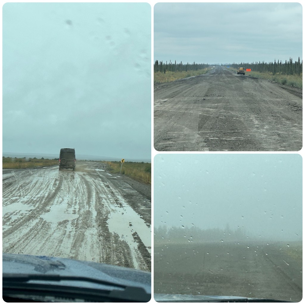
We struck all road types, from dry dusty gravel to slick mud, fog and smoke haze. Philip commented it was like driving in oatmeal porridge.
(P- one “stretch” of road approx 550 kilometres was 4WD as the road surface was that greasy the Truck couldn’t get traction in 2wd and besides the Co-pilot prefers the driving Experience going straight ahead not sideways!)
Spotted 6 or 7 bears along the roadside, none that were interested in us. They were busy feeding. Amazing watching them in their natural habitat.
(P- The “mother” bear in the top left photo armed with her bear spray – just in case! Well that’s if it was remembered prior to a walk! Judith always walks out front when we walk- for some reason she has been walking behind me when we stop on the side of the road and walk a local trail to a lake etc. I wonder why a change and walking behind me??)
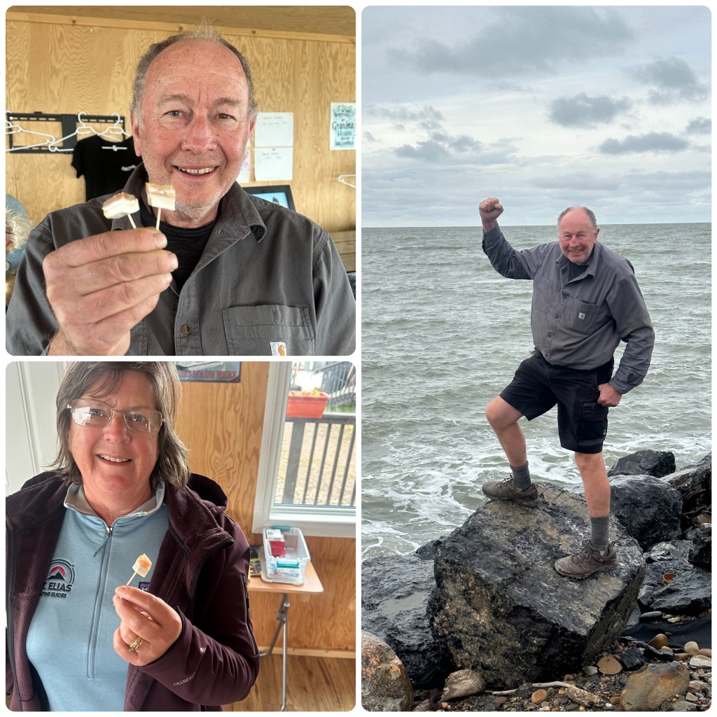
Tasting Whale Meat and Philip in Shorts at the Arctic Ocean
( The Local Inuits can harvest Whale ( Beluga) as a community harvest and the harvest is shared. A little research and getting to know “Grandma” as she is called and we were privileged to be offered a taste. Both of us commented after it was way better than we thought, Pork texture with a seafood taste. Thanks to “Grandma” for giving us the privilege of tasting what is a legal harvest in the Arctic. The communities were friendly and it was great to tour and wander around)
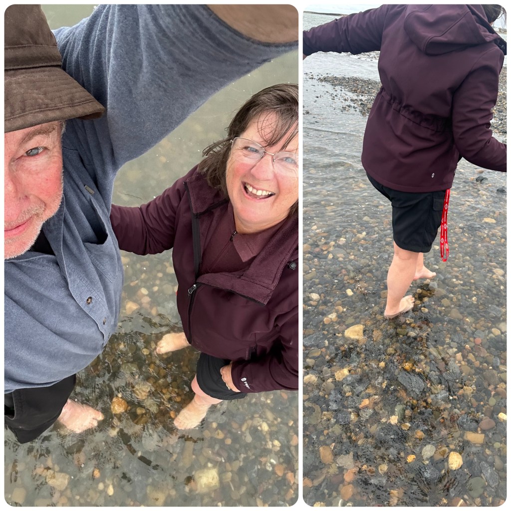
Paddling in the Arctic Ocean
A bucket list item, to Paddle in the Arctic Ocean. We made it here so off with the shoes and socks and into the water. It’s 0.5 degrees C so we take a very quick photo before our toes freeze off and race back out again. My feet we cold for hours after and my toes felt like they were going to snap off.
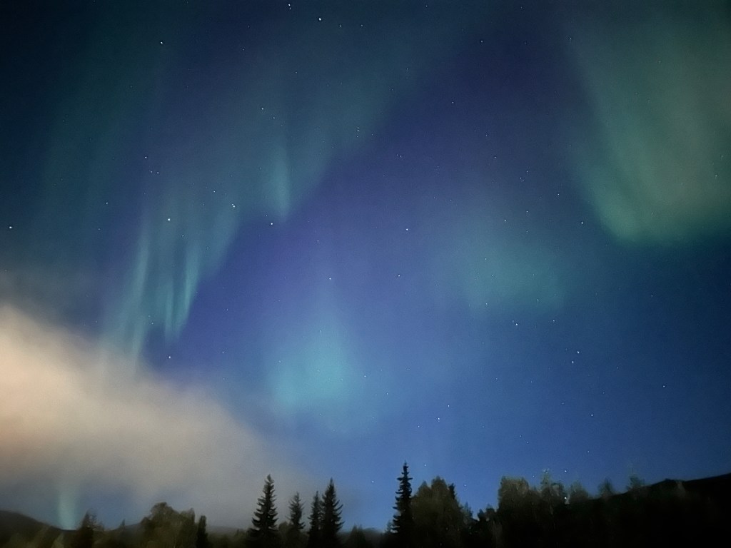
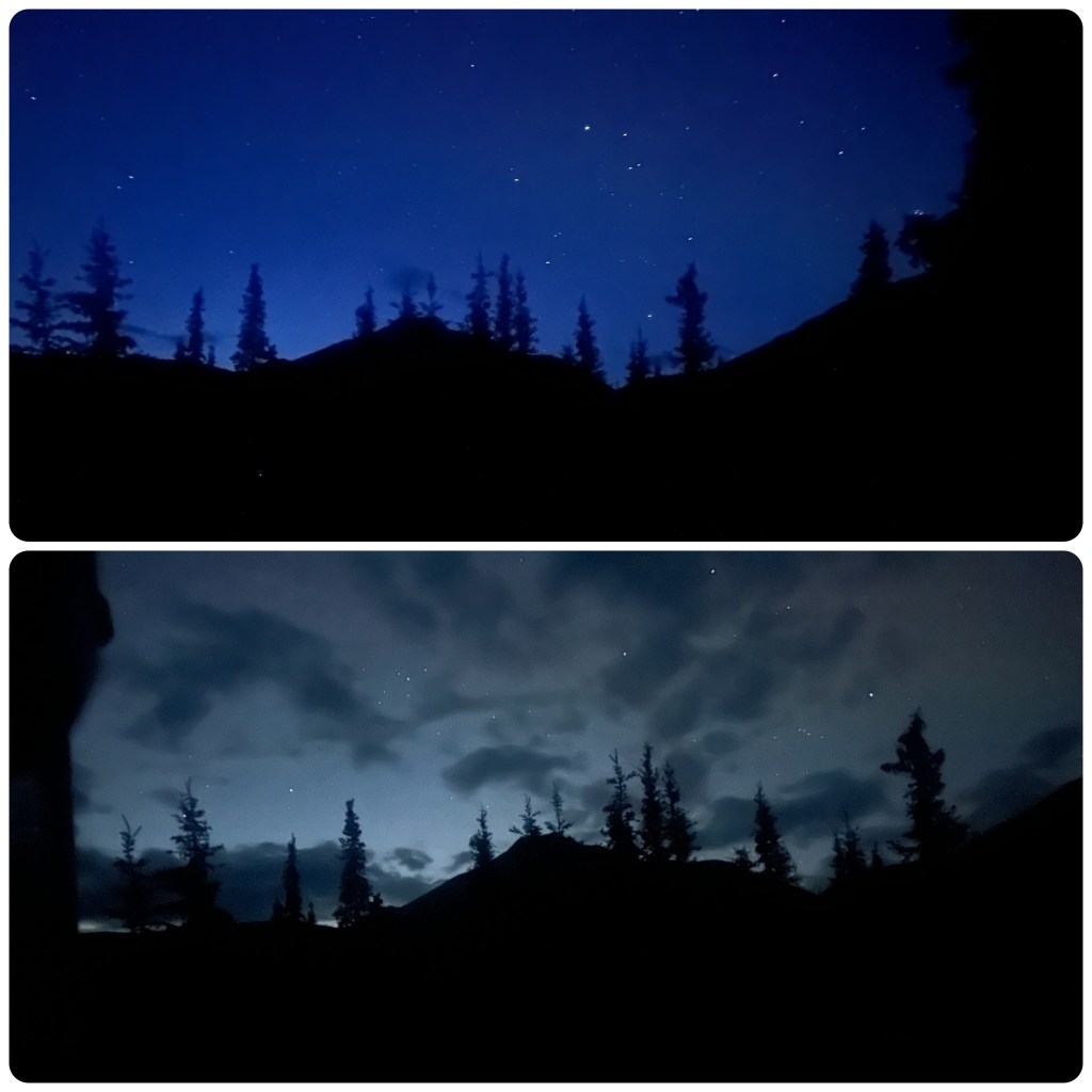
The Night Sky
(P. – According to the Aurora Borealis Observatory the blue sky phenomenon is when the Aurora catches the moonlight and changes it to hues of blue. Seeing they know more than I do, I will take that as true and if it’s not then it’s still pretty.
(P- photos of the Autumn colours don’t do them justice. They were outstanding! Prior to departing we were warned the Autumn colour change lasts approximately 1 week and then it’s all over! We estimated that doing the Dempster at the end of our trip we might get lucky. The colour change in the 4 day period of travelling up and back was very noticeable with some trees already bare. A bit of planning but we really hit the Jackpot here! – I am thinking for the first time in decades my “Brownie point jar must be overflowing“ ! )
Destination Glenallen and the Tok Cutoff road today. We have heard that the Tok Cutoff is a rough road so we will see how we go.
2 1/2 hours to do the road. It was great with very few frost heaves and even less pot holes. In 2000 it was a narrow bouncy goat track of a road, not any more.
One should never believe what is said on social media when travelling. It’s almost never correct
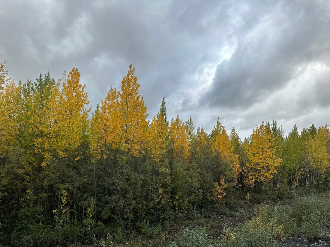
From the Tok Cutoff we turned south and then East as we head towards Chicken. One of the things we wanted to see on this part of the trip was the fall colours. The leaves are just starting to turn yellow in areas and the further we travel the more yellow and gold the hillsides are becoming.
Top of the World Highway
Chicken is just a fuel stop, Rv park and gold dredging area. It sounds good in brochures but in reality is just tacky. We stop for a break but then continue on until we find a gorgeous campground at Walker Fork on the Forty-mile River. There are only a few RVs here and it’s such a beautiful campground.
22nd
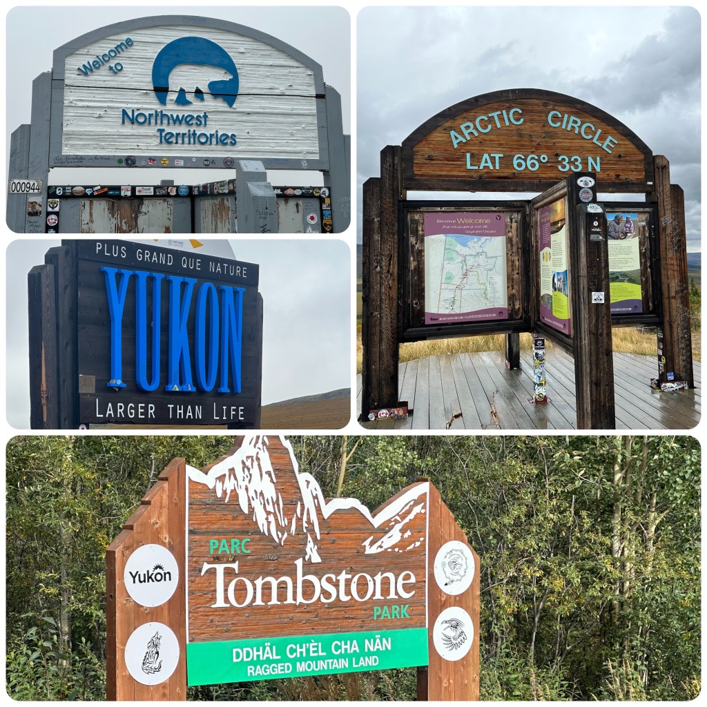
USA/Canada Border
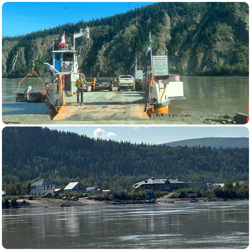
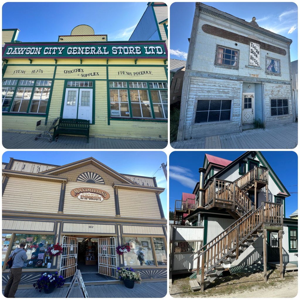
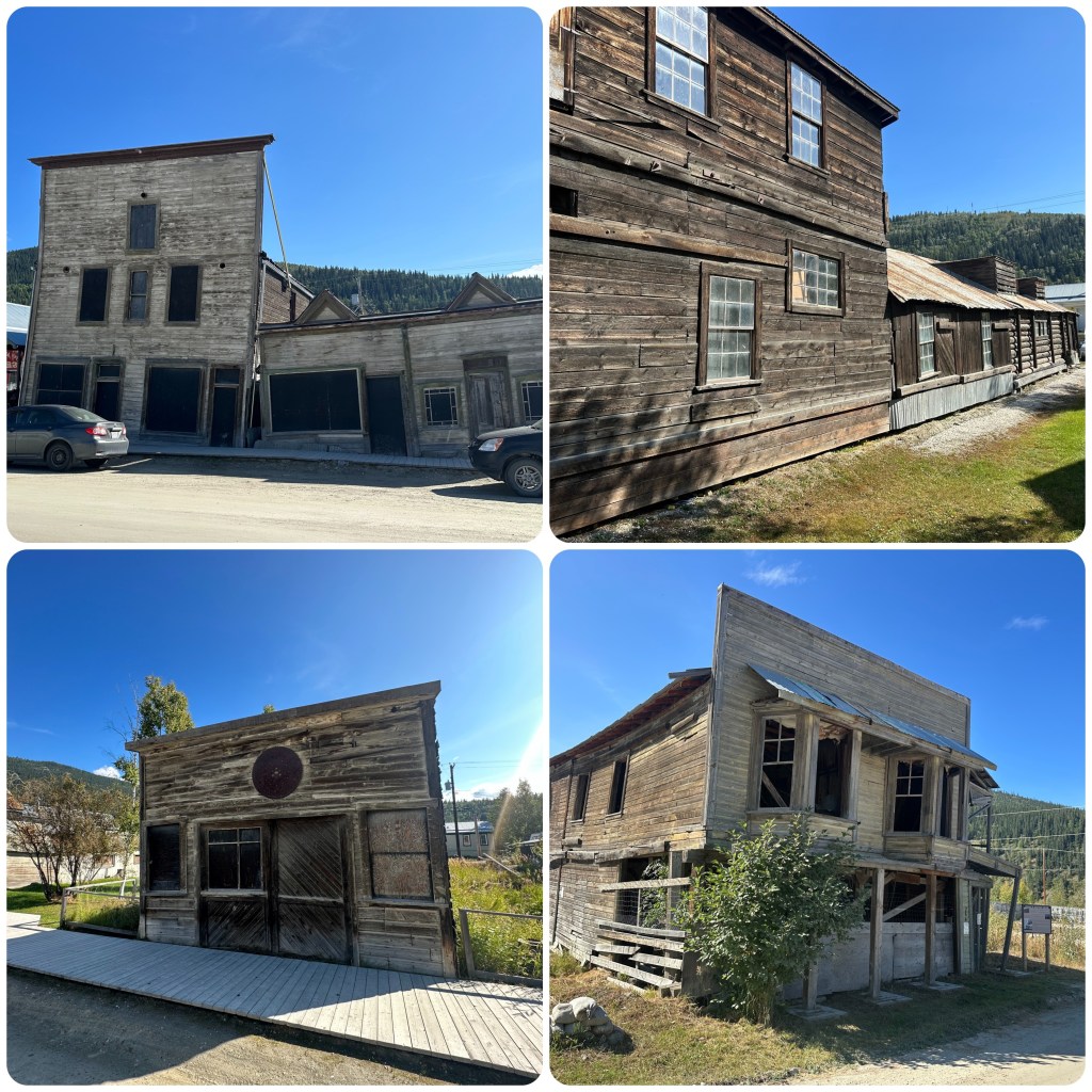
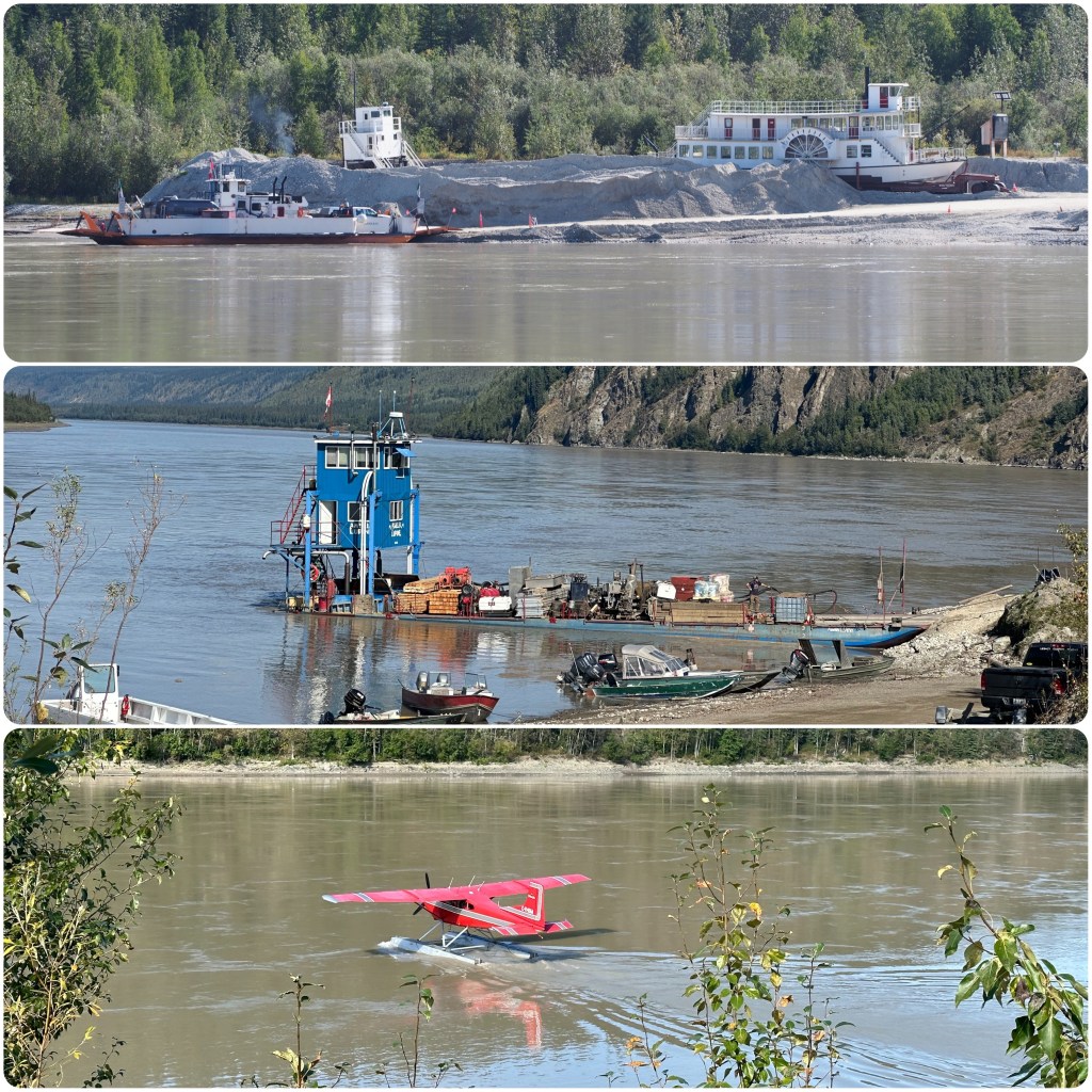
Today we pass through the USA Border into Canada and the Yukon. Travelling along the Top of the World Highway. It’s beautiful with the hillsides dropping away and starting to have a golden tinge. The further north we go the more variety of colours are popping up. There are some great spots of red. The Alaska Range is in the far distance with bare hills and spruce covered hills and steep winding valleys in between. By lunch time we reach the Dawson City ferry over the mighty Yukon River and wait for our turn to load and cross. It’s a glorious day, 72 degrees, and as the weather is suppose to deteriorate later in the week we spend the next couple of hours wandering around the town checking out the old buildings and visiting the NWT Visitors centre to gather some information on the Dempster Highway which we will be taking this afternoon.
Yukon River Ferry , Dawson CityDawson CityOld Dawson City BuildingsYukon River
Around 2.30 we head 30 mile out of town and turn onto the Dempster. We now have approximately 900 kilometres (we are now in Canada and using Kilometres again) to reach Tuktoyaktuk and the Arctic Ocean. What adventures will await us as we travel this road.
(P- one would class this road as Canada’s equivalent to our Cape York Adventure, except no crocodiles, no Tropical Heat and so far no crazy drivers on the road. Judith omitted to say the 900 klms are all Dirt road and once she swims in the almost freezing waters of the Arctic Ocean and camps a night or two it is a 900 klm return drive to Dawson City, oh then another 200 klm of Dirt to Tok. In all about 2200 klm of dirt and gravel road! My type of adventure. And it’s one of the few roads in Canada that go above the Arctic Circle.
I asked again still no Pastry Chef with me again tonight!!- something to be said about cruising!,)
Left Juneau early this morning and had a spectacular flight through to Anchorage. Flying over some massive glaciers and mountains. We have now seen glaciers from the air, from the water and walking on them, giving us much more appreciation of their size.
(P- whilst flying Along the coast and viewing the Glaciers and checking co-ordinates I have added Bering Glacier to my to do list! The Icebergs floating out into the bay from there were huge- even from 30,000 feet up! Nearest town is Cordova (a land locked town near the mouth of the Copper River) might have to come back again sometime- will add it to my travel to do list!)
Glaciers from flight Juneau to Anchorage
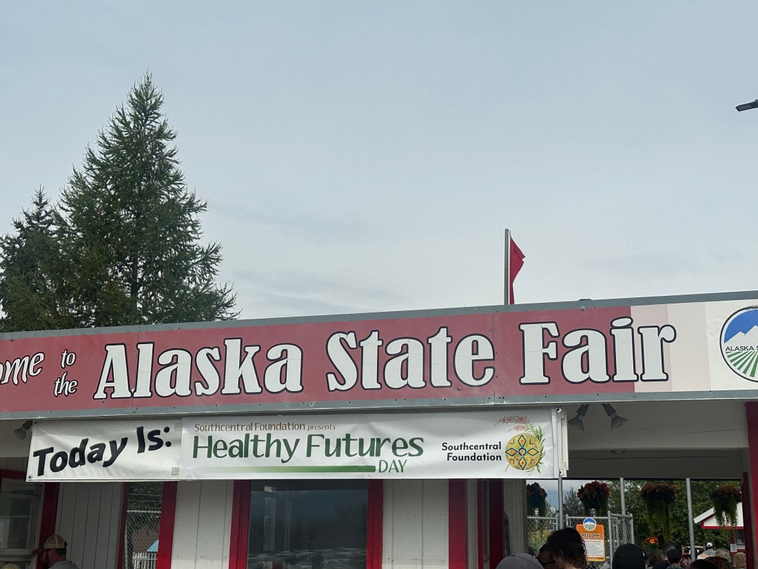
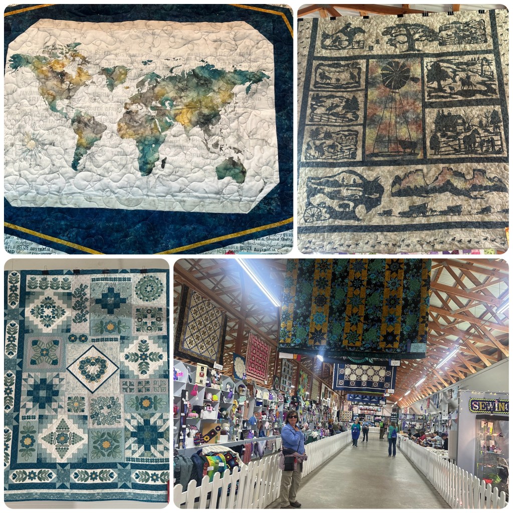
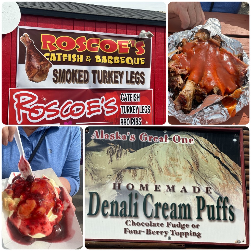
Back in Anchorage we picked up our camper and made a stop at the grocery store to stock up and then headed north to Palmer. The Alaska State Fair is on for the next week and we just can’t drive past without stopping for a while. It’s a lovely sunny day and there are crowds of people about. We have been to many State Fairs in the USA and this one is looking good. We are hardly into the grounds and Philip has spotted the smoked turkey drumsticks, (P- it has always been a must do to buy and enjoy an American County or State Fair Smoked, Slow cooked and BBQed Turkey Drumstick! It is now a tradition as I know Mark does the same. Of all the state and county fairs I have been to this would be up there with the best). I’ve spotted the funnel cakes. Lunch is sorted now we can check out everything else. Found a great exhibition hall with many fabulous quilts displayed and quilters working on projects. Had to walk through a couple of times to appreciate them all. Spoke to a couple of ladies about some of the quilts and how they were put together. One we particularly liked called “The Ranch” was laser cut appliqués. The background was only two fabrics but it was stunning.
Alaska State Fair Quilt Exhibition
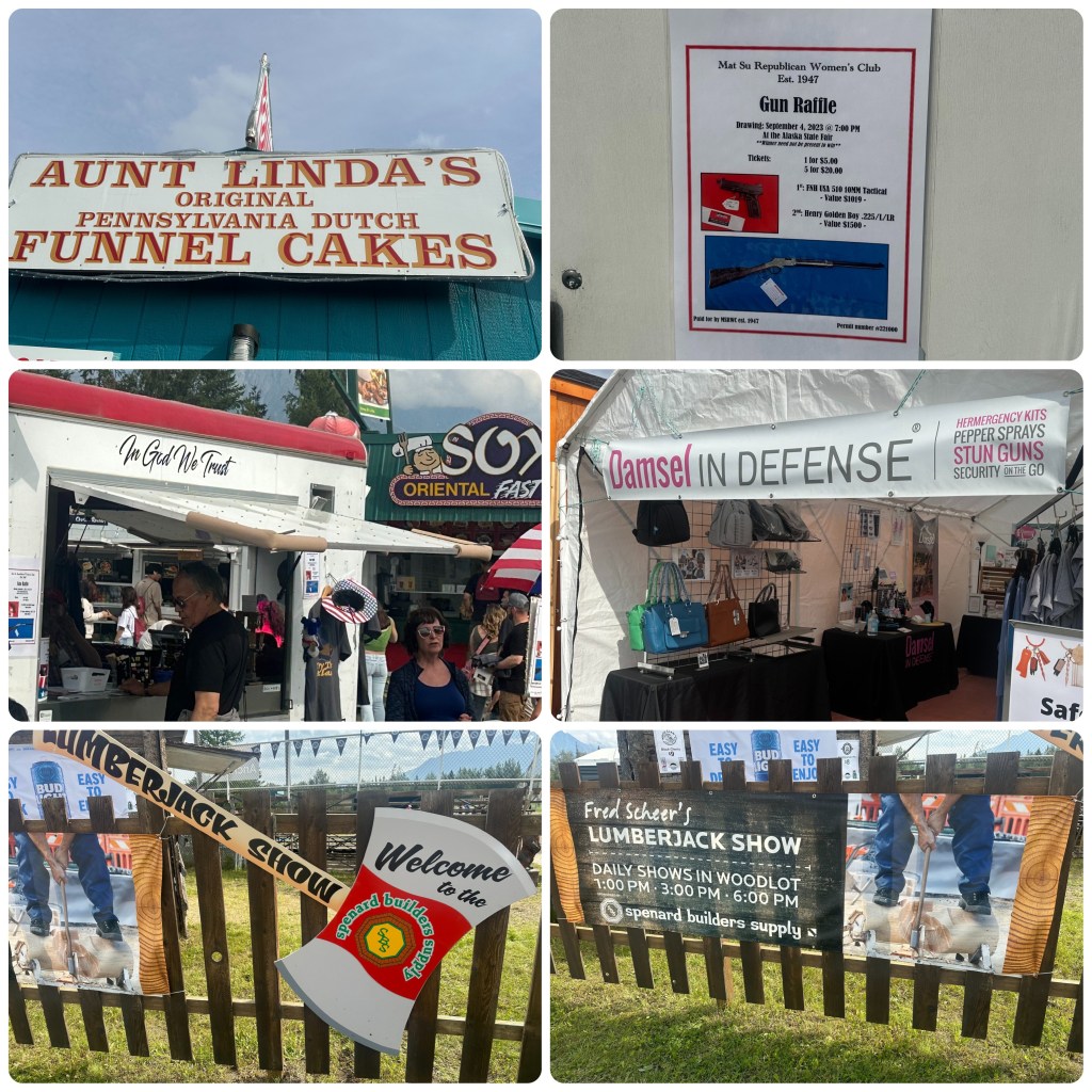
Back outside we checked out the Bison Fibre store and purchased some hiking socks to try. There are a variety of stores from tacky souvenirs to leather products, pottery to portraits and everything in between. Food and alcohol to suit every taste bud around. We sat and watched a lumberjack show before purchasing some turkey legs and pork ribs and a couple of cream puffs with cream and berry sauce to take with us for dinner tonight. After spending the afternoon at the fair we headed off down the road, driving for a couple of hours before pulling up stumps at a rest stop on the Nelchina River. On the way we passed the Matanuska Glacier, but didn’t stop this time as we have been in before and we have seen other glaciers this trip.
(P-It’s dinner time and my favourite cruise waiters don’t appear! No Sous Chef, No Pastry chef, So I guess it’s me for the main course preparation! I suggested Judith could “up the game” and become Pastry Chef, – the response I got to that suggestion will remain unpublished! )