Broome and Cape Leveque

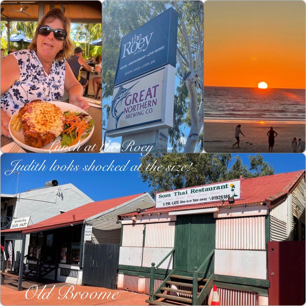
From Cape Keraudren we continued north to have had a couple of days stopover in Broome, a night at Cable beach and then out to the Broome Gateway Caravan Park. Much prefer this park where we have room to breathe unlike being crammed into Cable Beach. We did the obligatory Cable Beach Sunset but have seen much better sunsets out in the bush. We had a wander through the Courthouse Market and then walked down to the “Roey” Pub for lunch in the open air courtyard. A lovely meal in a nice setting.

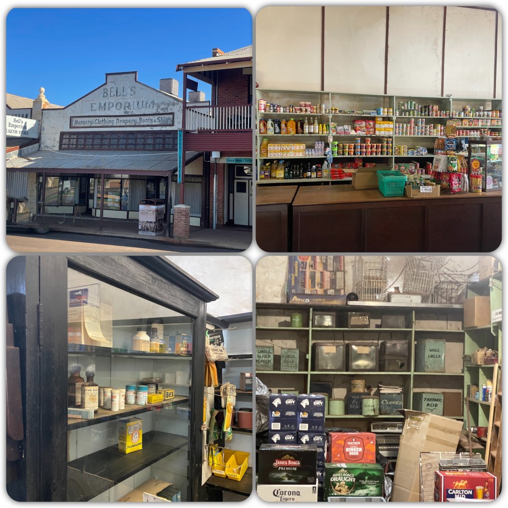
(P) I have visited Broome a few times over the years, the “Old world” charm of the Old town and China Town has almost disappeared with just a few of the old buildings left! Broome has become a popular “short stay” getaway, the local population of 14-15,000 swells with visitors bringing the population up to 50-70,000 in the town and the ever popular Cable Beach. There are many popular bars, clubs and restaurants to entertain the tourists. Whilst great to see Broome and Cable Beach, the sunsets and nature of the remote coastal areas we have been fortunate to camp at, to us are far superior than the hustle and bustle of hundreds trying to jockey for prime sunset viewing at Cable Beach. However I must mention how great the “Tenderspot” Butchery is – evidently I may have over spent there a little!)

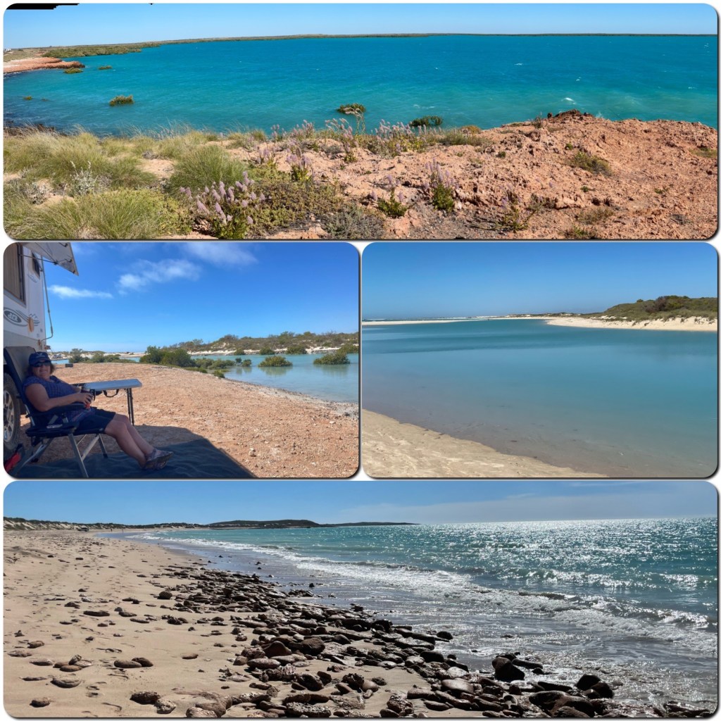
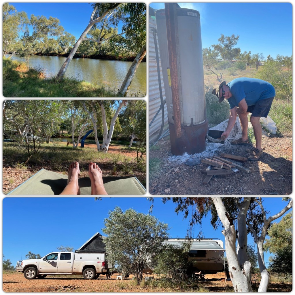
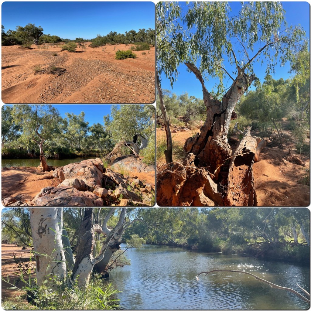
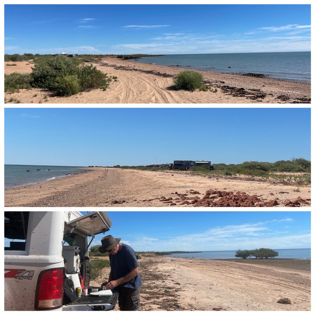
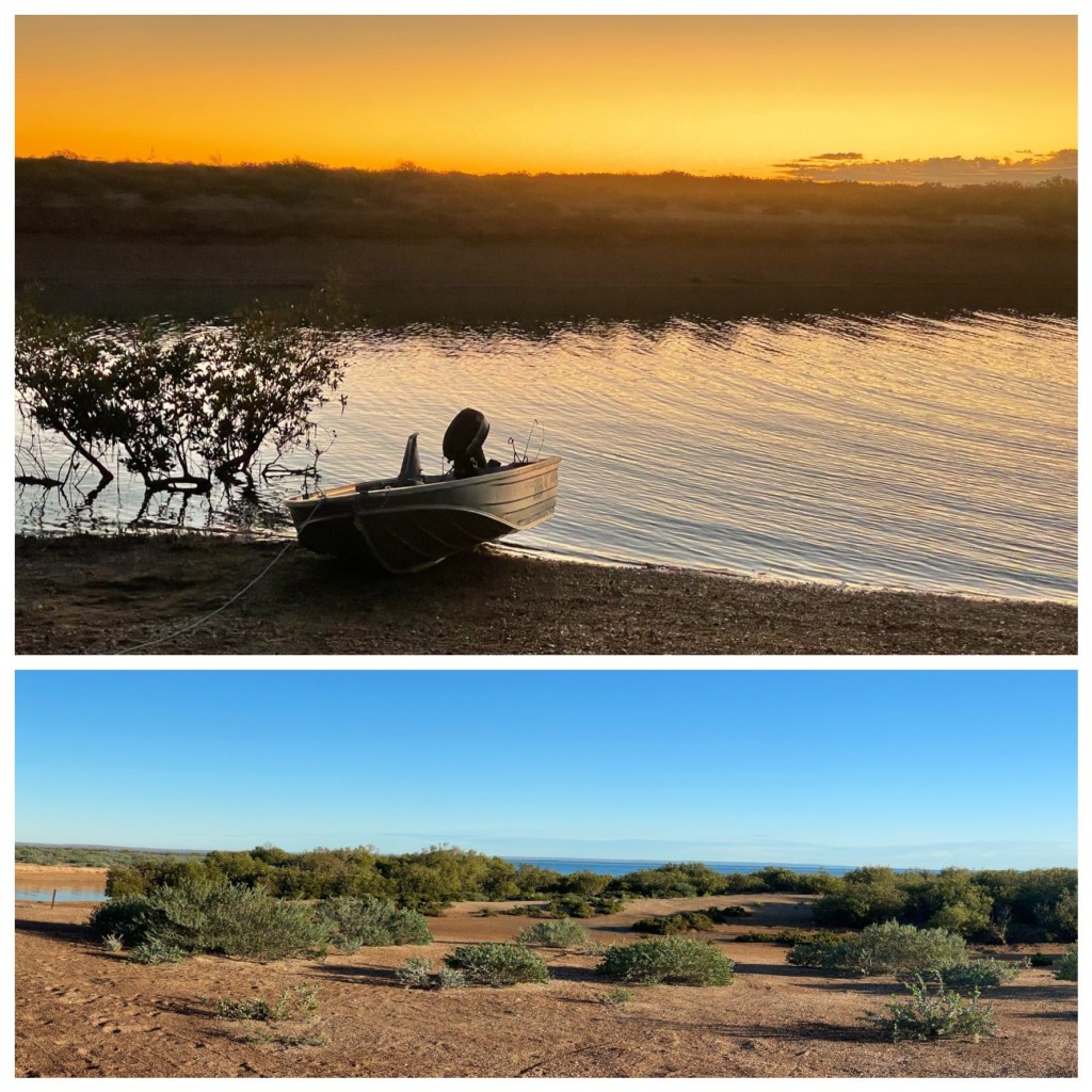
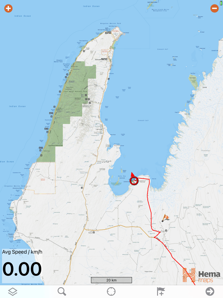
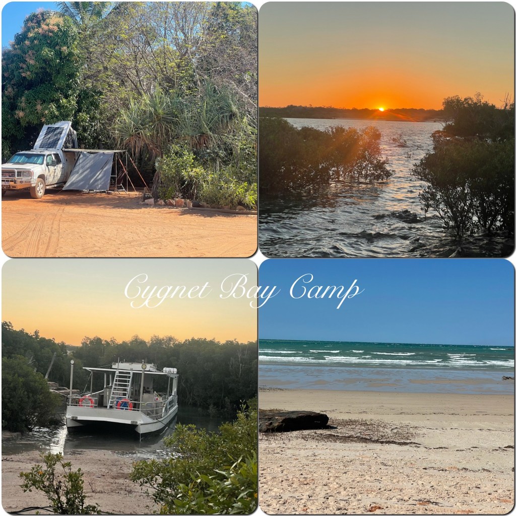
We are leaving our van at the Caravan park and heading up to Cape Leveque with our rooftop Penthouse for a few nights. We have heard so many rumours about places being closed up here so not sure what we will find but we are here so we are not going to miss the opportunity to drive up and tick a few spots off our bucket list. Our first two nights are at Cygnet Bay Bush Camp, almost at the tip of the Cape, 200k north of Broome, on a mostly sealed road. The trip is nothing to write home about, being scrubby to the edge of the road, flood plains and flat most of the way. It’s not until you take the side roads, that you start to see the gorgeous coastline. Many of the aboriginal communities are closed but the camping areas are open and if you don’t have a camping spot booked you can just get a day pass to have a look around. We arrived at Cygnet Bay Pearl Farm early afternoon and checked in. Drove out to the campground and set up. We have a beautiful little spot, shaded by big trees and sheltered from the hot sun. After lunch we walked down to the beach. This is not the most spectacular beach area but it’s a bush camp not a beach camp. We walked around the bay keeping a check out for crocodiles even though they said they hadn’t seen any for a few years. Then back to relax at our camp. Later in the afternoon we walked back to the beach to watch the sun set over the mangroves.

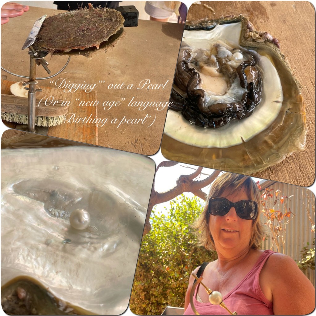
After breakfast we take the walking track around to reception in time for our Pearl Farm Tour.

This is the write up about where we re staying

“An epic story; the original Australian owned and operated pearl farm spans four generations of the Brown Family over more than 70 years.  Until recently, it has been an exclusive pearling village accessible only to our pearl farm team and the local Bardi people.  In an industry first, Cygnet Bay Pearl Farm “opened the gate” and invited travellers to share in this very special place, recently described as “one of the most unique destinations in Australia”.

The tour gives us an insight into the pearling industry up here and how this family has worked with the indigenous people to create a thriving industry here. We were shown how the oysters were seeded to produce pearls and then shown how they “birth a pearl” and have it assessed for quality, size, colour and lustre. It was a very informative tour. After the tour we wander back to our camp for a while before returning to the restaurant for lunch, which we enjoyed on the deck overlooking Cygnet Bay.

(P) I was all ready to purchase the said “new birthed pearl” for Judith but when I was ready to inspected the 10mm diameter shimmering “new born” some other male obviously keen to impress purchased it before I could fight my way through the moths in my wallet to extract the cash! Maybe another time Judith!!! )

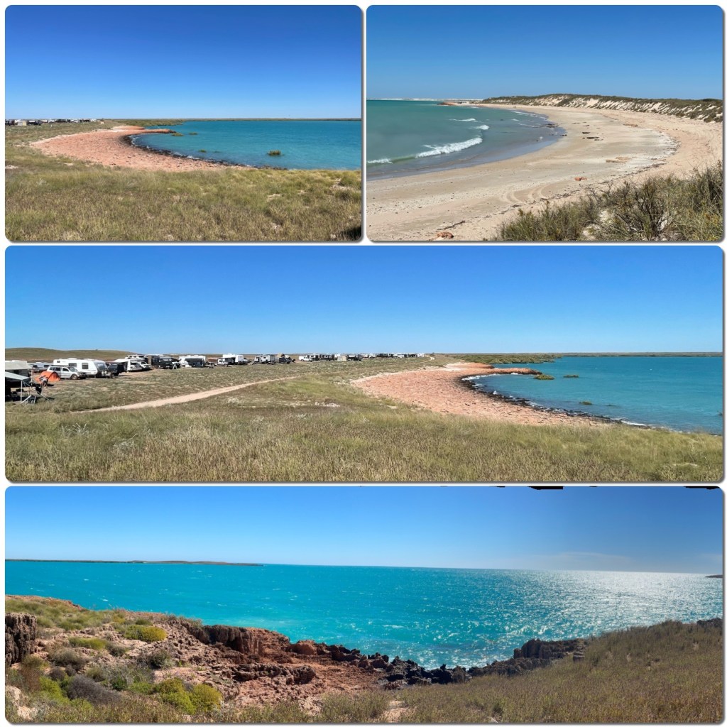
Next day we pack up and head out to visit Kooljaman, another camping area and the tip of the Cape. This again is a lovely area with beaches on both the east and western side of the cape. The eastern side being the most sheltered today. White beach, sand dunes and blue waters and safe swimming. The western side is red cliffs, white sands, sharks and no recommended swimming. Such a contrast between each side. We payed $20 to have access to the area for the day, most worthwhile to be able to see what the area is like, we noted it for a camp spot next visit.

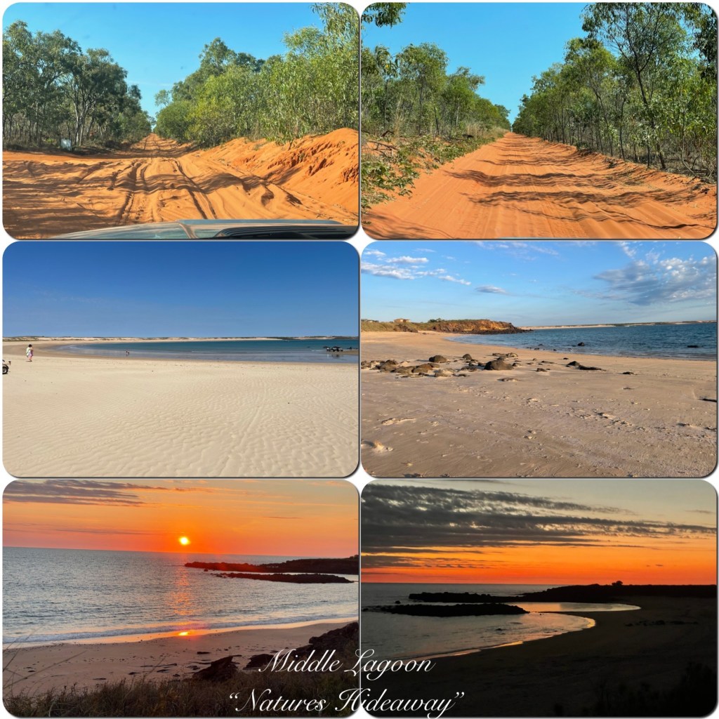
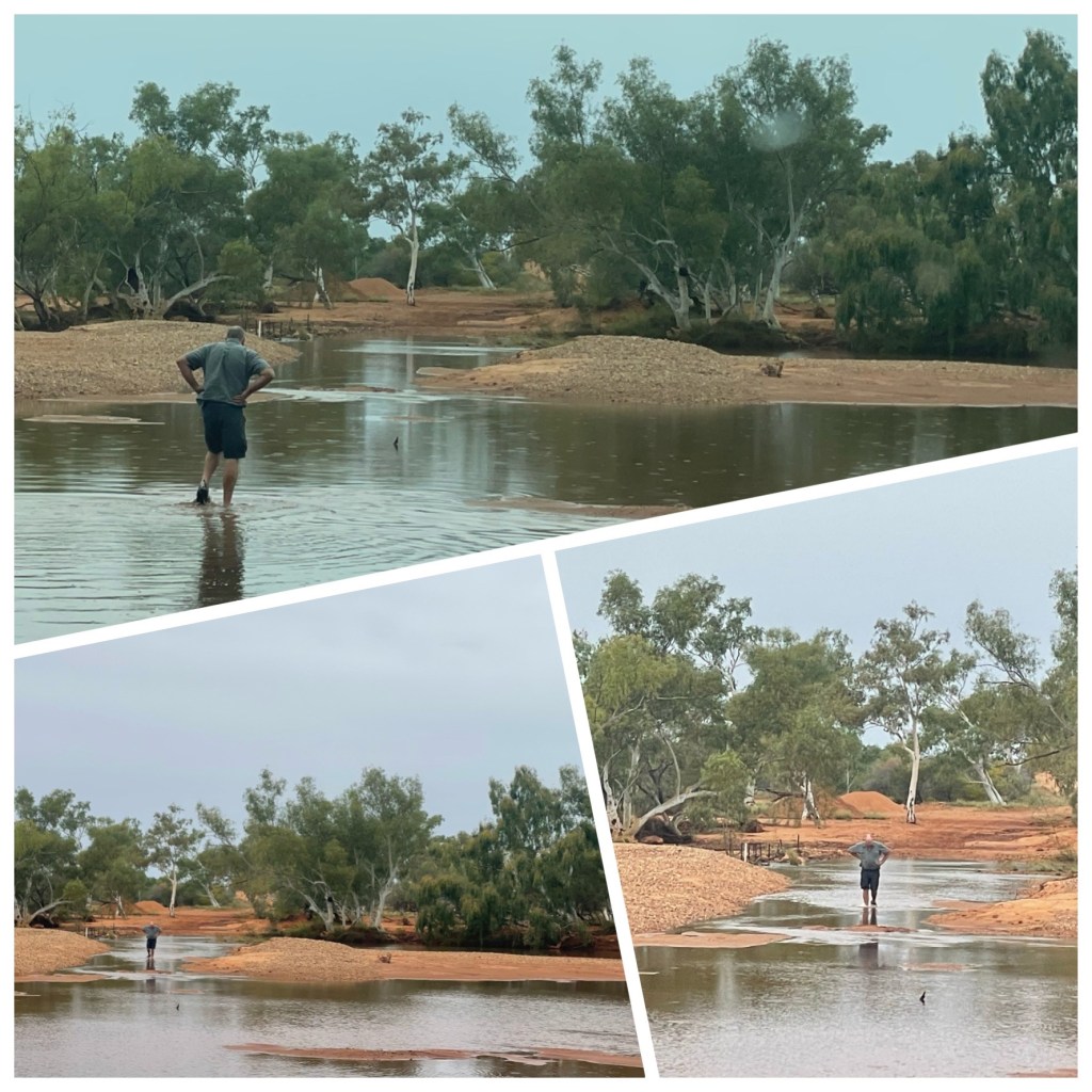
From here we head back down south until we reach the turn off to Middle Lagoon. We now have a 40 kilometre sand track into the campground where we booked yesterday for tonight. This bit of track could bring a few people undone if they didn’t know what they were doing. It was very sandy in places and a one vehicle track in but it was well worth the drive to come out at Middle Lagoon

Two lovely beaches to choose from. Sun set point to sit and watch the whales and the sunset from and warm water to swim in. We fitted in two swims, one at each beach.

Next day we have to leave as we have an appointment to keep in Derby. But we will be back this is a gorgeous spot.

(P) One would say Cape Leveque would have to rate highly as a place to revisit and spend more time. Whilst we ticked a couple of places off our bucket list, we added more!)

Cape Keraudren

Last week we have had a pretty relaxing time. From Emu Creek Station we headed back to Port Hedland for a few days to stock up on groceries and for Philip to watch some more ships enter and leave Port. This time we stayed at the Free camp at the Turf Club. Each night there would have been at least 80 vans on site. They are very strict here and to stay you must have a grey water tank and toilet on board. No facilities are provided. This didn’t seem to stop some people with out grey water and toilets from trying to stay. The camp host was very much on the ball and quickly moved people on if they didn’t comply. From the camp site it was just a quick walk up over the hill to a local lookout to sit and watch the harbour, or a few minutes walk to the supermarket. We had a couple of very lazy days here then on Wednesday 28th we did a big drive up to Cape Keraudren, (164k.) This is the southern end of 80 Mile Beach. We just thought we would drive in and see what it was like as we had heard it was a nice spot but hard to get a camp spot. As we filled out our registration at the park entrance Philip talked to a guy who told us there were plenty of spaces so we decided to stay a night. We drove the short distance in and found a lovely spot on the edge of Cootenbrand Creek. Tide is out when we arrive but before too long the tide changes and the water rushes in. Totally changes the view from our van. It’s extra nice now with the tide high. The creek fills and drains all over the space of two hours.

After a walk down to the beach with its beautiful blue waters and some shell collection we head back to the van and relax for the rest of the day. Fresh Barramundi on the camp fire for dinner tonight. Yum.

Barramundi on the Campfire
Tide Out, Tide In

Thursday morning we decide to stay another night so we take the truck out and pay our fees. Stop at Pardoo Roadhouse to fill up with fuel and buy an ice cream (it’s only 10 am but Philip tells me he hasn’t had one for days)! (P) Poor deprived Phil!!!) then head up a side road to collect some firewood for tonight’s campfire. Back to the van and I whip up some cookies for our travels, have some lunch then head out for a walk along the beach to the further two campground areas. Total walk 9 kilometres mostly along the beach and around the headland. There are lots of sparkling blue bays here, lots of people fishing, not much evidence of fish caught though. There are heaps of campsites still available even though the websites say camping is booked out. (P) never believe FB and other internet gossip sessions, we rarely book ahead and have, to date, not been refused a site where we wanted to stay. Even thru the school holidays! Maybe we will get caught out one day – we will worry about it when it happens)

After returning from our walk it’s time for a swim in the creek. The water is lovely and refreshing and the sun soon dries us off. Now it’s time for a drink and the Blog.

(P) and light the camp fire so I can cook a nice thick T Bone steak over the hot coals- gotta love camp fire cooking!

Cape Keraudren
Cape Keraudren
Area Map

Emu Creek – Take 2

After leaving Denham, Shark Bay Area, our next destination was Emu Creek Station. We stopped in at Coral Bay on the way and am I glad we are not staying there! We have both visited before and it is a beautiful place but it was wall to wall tourists, packed into the caravan parks so close the vans were almost touching. Not our idea of fun. We continued on to Emu Creek. This station is 25 kilometres off the main road and turns many tourists off. The road in is gravel but not rough. We call in to reception but no one is about so we continue on to find our spot in the campground. Almost the same spot we parked last time. Up on the main level overlooking the river and large permanent waterhole which has dropped in level considerably since we were here 6 weeks ago. There are quite a few campers here but with plenty of room around each set up, we are not crowded. This is such a relaxing spot and we are setting up for a few days of relaxation. There are families here and the kids are having a ball in the river on kayaks and floaties and a rope swing. It’s great to see them having so much fun and not a iPad or computer game in sight.

Yannarie River Crossing

Denise and Andrew, station managers, call around later in the afternoon to collect fees and have a chat. I organise to have my hair cut again on Friday morning before heading out on Saturday.

Philip gets a job while he is here, as we are camped about 100 metres from the shower block which has a donkey wood heater to heat the shower water. He has to stoke the fire throughout the day to keep the water hot. Not a terribly difficult job but the campers do like hot showers between 3 and 5 pm.

(P) it pays to “be nice to Phil” when he has a technical job like this! One lady did take the trouble to mention “ her yesterday’s shower was only Luke warm”. My reply was “it is a bush camp lucky there is a shower at all”!)

Emu Creek Campground

During our stay here we walk up one side of the Yannarie River to the river crossing and back down the river bed to Emu Creek and back to the campground, about a 5 k round trip. Last time we were here the river was impassable. Not this time, it’s dry and sandy. It’s a lovely walk along the river with quite a few wildflowers about.

Three days of relaxing, reading, stitching and walking and a great haircut again have made this stay immensely enjoyable. It’s such a lovely spot with great hosts and somewhere we can really relax.

Yannarie River
Wild Flowers

We are now on the road towards Karratha and Port Hedland and what a treat for the eyes. Acres and acre of purple Mulla Mulla, as far as the eye can see and then Sturt Desert Pea sprinkled in amongst it. I have never seen so much desert pea, it’s certainly flourishing this year and the bright splashes of red make the view so much more interesting.

(P) even tho it is a pea that I can’t eat! It would have to be one of my favourite flowers! We are so fortunate that we were preceded by a wetter than average season. No matter where you look the countryside is so colourful and picturesque! Not to mention how healthy the cattle look.

Mulla Mulla and Sturt Desert Pea

Way Out West

Wow the last two days have been a treat.

Off Road driving, sand dunes, rugged cliffs, carpets of wildflowers, crystal clear waters, whales, turtles, fantastic fish and the most westerly campsite in Australia. Where are we and what have we been doing? (P) no mention of good company Judith!)?

We have taken our rooftop tent-“penthouse” and travelled to Steep Point, the most westerly point on the Australian mainland. About 100 km of off road sand tracks and approximately 100 km of gravel roads to get to the off road area. Four hours of slow driving with tyre pressures down to 25 PSI on the sand. Most of the off road was single lane so extra precaution when vehicles are approaching. One vehicle just has to find somewhere to get off the track. But at the end of the track our campsite awaits. Sitting on the cliff top just 400 metres from most westerly point In Australia. Standing on the cliff edge ( not too close for me) we could watch fish swim off the reefs edge. Lots of fishermen dangling a line but no evidence of fish caught. Luckily we saw several whales off shore. As tonight’s sun sets we are sitting in the most westerly campsite on the Australian mainland!

Steep Point
“The Oven 3” Campsite

A highlight for me has been the mass of wildflowers carpeting the sand dunes and roadsides. Purples, yellows, pinks and whites and multiple shades of green are everywhere we look.

Carpets of Wildflowers

After a peaceful night listening to the sea roll in along the cliffs and a nice feed of bacon and eggs for breakfast we head back down the track to stop at some cliffs where we try to spot some more whales. Alas, no luck this morning. We did spot a huge turtle though drifting close to the breakers along the cliffs.

The Zuytdorp Cliffs run for 150 kilometres from Steep Point south to Kalbarri. The cliffs are named for a Dutch East India ship that was wrecked along the cliffs in 1712. At the highest point they are 250 metres high. Again we enjoy the numerous wildflowers along the track. Unfortunately our photos don’t do justice to just how spectacular they are.

Zuytdorp Cliffs

We also have a stop at Shell Beach where the entire beach is made up of trillions of tiny cockle shells, in some areas 10 metres deep. The sea water at nearby Hamelin Pool and Shell Beach is twice as salty as normal sea water. This causes a lack of competition and predators for the cockles, leading to incredible abundance of this species.

Shell Beach

(P) – Another destination now ticked off the bucket list! We have now been to the four compass point extremities of our awesome land. Pure luck and a lack of planning gave us camp # 3 at the “Ovens” campground at Steep Point booked at 9pm the previous evening where we were fortunate enough to experience this great area! (J. We now understand why it is called the Ovens. It’s the hottest spot we have been in around here, sheltered by cliffs, on rock and sun shining back off the sea. It holds the heat very well. Luckily it’s not 40 degrees or we would have melted).

Seafood abounds here also (as well as protected marine parks). The bucket full of fresh whiting caught this morning will be enjoyed for dinner this evening I am sure! Whilst we would like a little more warmth than the 21-23 degrees here Sharks Bay/ Denham has been a great 5 day stay. Tomorrow we are heading north, looking forward to warmer weather, more seafood and hoping to catch a Rodeo or two to throw into the mix of nature, mining, bush camps and whatever we can find of interest- Northward bound to destinations unknown)!

Track into Steep Point
Tasty Shark Bay Whiting

Return to WA

After an extended stay at home in Tasmania due to COVID lockdowns in Perth, we have made it back to Western Australia. After a delayed departure from Hobart and storms and lightening over the Perth airport as we arrived we finally reached our van just before midnight, we threw our bags into the van and plugged in the power and went to bed. Next morning Philip went up to the office to pay our outstanding fees (an extra week) only to be told there was no charge as we had let them know we were stuck in Tassie due to COVID and we couldn’t be expected to travel during lockdowns. This was a big surprise as we had fully expected to pay for our site while we were away.

Before leaving the park we did a quick trip to Costco to stock up on a few items before we head out of Perth. Back to the van and we saddle up and head out of the city south to Binningup to stay with friends for a few days.

Our original plan was to be back in Perth on the 29th June in time to surprise Peter for his 70th birthday but as that didn’t happen we are now staying with them so we can celebrate with Peter, Rad and friends on the 10th. What a great day we had sharing this celebration with them. Only 15 of us but boy could we all make some noise. We shared an awesome lunch that stretched from midday to 4 pm. Antipasto platters, Roast pork, lamb and beef, stuffed capsicum (yum), garlic beans, baked veggies, salads and then birthday cake, angel cake, chocolate slice, plus lots of other nibbles. We were full by the end of the day.

Monday 12th

We are up early and packed ready to depart at 6 am. Huge storms are forecast for late morning and we want to get north of Perth to miss the worst of them. After our goodbyes we head north and the closer we get to Perth the heavier the rain gets. Rain, darkness, wind and wet roads makes for a steady trip but as we leave Perth behind us the weather eases and the sun starts to poke through intermittently. Our first stop is GinGin to refuel both body and truck. We even have driveway service at this little fuel station and then nice freshly cooked toasties to stave off the hunger pangs.

Our destination today is Kalbarri, 770 k from Binningup. Way too many kilometres in a day for us but as we had made arrangements to meet up with friends, Cameron and Margaret for a few days. As this catch up was prearranged we made the effort to get there as soon as possible. With us both driving we made our destination by 3.30 and set up for several days stay. Once we were settled we wandered around the park until we found “the Bulls”. Coffees, teas and some catching up was done before Philip and I headed off for a walk before dark. We needed to stretch our legs after a long day in the car. There is still considerable damage visible here from Cyclone Seroja which struck here in early April. Homes without roofs, whole motel complexes demolished, cafes gone. But the town is now busy and full of tourists which is great to see.

Cyclone Seroja Damage

We head back to the park and stop by Cameron and Margaret who have prepared dinner for us tonight. It was lovely not having to cook after our long day. Cameron had slaved over a pot all day to make a lovely “stew” which we had with mashed potatoes, very tasty!!!. Thanks heaps.

Tuesday was stormy and windy so we all took off for a drive around the area. Ended up doing a loop down the coast to Hutt Lagoon and Port Gregory. Hutt Lagoon is famous for its pink colouration caused by the algae dunaliella Salina that turns the salt pink. This lagoon also contains the worlds largest micro algae production plant. Although not as pink as in many photos the lagoon doesn’t disappoint today. Next stop was the Lyndon Station Heritage site. This was settled in 1853 and was the first convict depot north of Fremantle. Over 60 convicts were housed here to supply labour to the nearby mine. It was closed in 1857.

Next stop was Northampton for some lunch from the local bakery and a wander along the Main Street. We stopped in to the general family store and found a great little sewing machine museum at the back of the store. Lots of old machines nicely displayed with dates and details. Then to complete the circle we headed back to Kalbarri past the entrances to the National park.

Our turn to cook dinner tonight and share more stories of each of our Travels.

Ladies in Pink at Hutt Lagoon
Lyndon Convict Depot

Wednesday 14h July

Today has dawned clear and sunny, mostly. We are heading out to Kalbarri Gorge to tackle the Loop Walk. Class 4, 9 km. We are off early and at the start of the walk by 9am. This walk begins at Natures Window and what a spectacular sight that is, especially with no other tourists about. (Lucky we got good photos early as later in the day it was packed with tourists). This walk traverses some of the cliff tops along the gorges edge before heading down into the base of the gorge. Walking and scrambling along rocky ledges, squeezing around tight corners and then opening out to walk along sandy stretches before climbing back to Nature’s Window. A fantastic 4.5 hour walk. The weather was really good, no rain showers, some cloud cover so it was pleasant walking unlike summer temperatures when it reaches 50 degrees at the base of the gorge. Spectacular scenery and some wildflowers revealed themselves at every turn. Once back to the car we drove out to the Skywalk, which everyone says is a must do. I’m not so sure of that! I did walk out onto the cantilevered walkway but it’s really not something I enjoy so left a Philip to it. Our last stop was Z Bend Lookout. Another great view of the gorge and Murchison River.

Natures Window
Kalbarri Gorge
A couple of tight spots
Z Bend Lookout and the Skywalk
Wildflowers

Ghost Town and Rock Art

15th June

We had a lazy start to the morning and after getting some washing done and packing some lunch we took off for our tour of the area. First stop was Cue. This is a lovely town full of historic buildings. We enjoyed a walk around town reading about some of these sites. My favourite building was the old Masonic Lodge which was built in 1899 of timber and corrugated iron, with a pressed tin interior. Very few buildings of this type remain in Australia. Murchison Lodge was consecrated on 21 April, 1897 and held regular meetings until 1979 when they were cancelled due to dwindling numbers. Other buildings of interest were the Shire Hall, Fire Station, Railway Station and the Rotunda in the centre of the Main Street.

Cue was named after Tom Cue, an early prospector, who became a major figure in the towns development. It is thought that gold was first found in 1892 by Michael Fitzgerald when he pegged a lease on what is known as Kintore Reef and a week later found a nugget weighing 7 kg, just near the Main Street. Tom Cue also dug up nuggets of his own. Within days over 400 men had rushed to the area, a year later the town of Cue was officially proclaimed.

Cue Town Buildings
Cue General Store
Cue General Store

After leaving town we drove out to Walga Rock which is located on Austin Downs Station, 48 k west of Cue. This is suppose to be the second largest monolith in Australia. At Walga Rock we could view a large gallery of Aboriginal rock paintings. Walga Rock was a meeting place for Aboriginal people. Over thousands of years paintings representing snakes, goannas, spears and a sailing ship were painted before people moved on. The paintings were done using ochre from nearby ochre mines which are considered to be tens of thousands of years old.

The origin of the mysterious sailing ship is unknown. One theory says that it has been made by a Dutch sailor shipwrecked on the coast and looked after by Aborigines, another is that it was made by an Afghan Camel guide.

Walga Rock

After a drive around the rock we head back down the road and into Big Bell Ghost Town. We would consider this a modern day ghost town as it operated from 1936–1955. It was established to house the influx of workers for the Big Bell Mine. During the Second World War production was suspended to free up man power for the armed services and for the production of munitions and food. The number of employees fell from 417 in 1941 to 15 in 1944. When the war ended the mine returned to full capacity and operated until 1955. Houses soon sold for as little a £60, whilst the Big Bell Hotel sold for £3500. During the 14 years of operation the mine produced 726,298 fine ounces of gold worth nearly £9,000,000.

Big Bell Ghost Town

16th June

Leaving Nallan Station today we are headed down the road to Mount Magnet. Again Mount Magnet has a lovely Main Street. It’s such a shame they are dying out and most shops are closed. The butcher remains open and we called in. Even though we don’t need any meat Philip had to buy some beef ribs. A change of plans for dinner tonight. Inside, the butcher had a lovely old 1910 cash register still in working order. He was quite happy for me to go behind the counter and take a photo of it. Next stop was the visitors centre and Mining and Pastoral Museum. This museum houses a diverse collection of artefacts and relics from a bygone era.

(P) Fresh beef ribs from the butcher (and a character he was) and straight into our 12v Oven to slow cook as we drive South down the Great Northern Highway to this evening destination ( unknown at this stage). At 4pm in went the potatoes to roast and at 5 a steamer pot of veggies- at 6.30 pm we are treated to an awesome 12 volt meal!

Mount Magnet Meats

Last evening I receive a txt from my Son suggesting Gumtree Tasmania was in financial trouble due my absence! Today the subject of improved bank account balances (and negative comments about Gumtree) whilst we are travelling was raised again. I am starting to feel victimised! The response from my wife when I suggested I would have an accumulated budget to spend when I return home best not be repeated! Poor Ole Phil!)

17 th June

Today as we drive towards Perth we go from gold fields and scrub to wheat and canola paddocks, cattle and sheep and then vineyards. Makes a change from all the miles of red dirt, dry plains, mining operations etc that we have seen over the last few weeks.

Our main stop today was at New Norcia, Australia’s only monastic town. An historical and spiritual treasure in the Australian bush, so the brochure says. I must admit it was quite unexpected to see such interesting architecture out here. The Monastery is home to a community of Benedictine Monks since 1847. There are colleges and old convent, a monastery guest house and Olive House which is still used today, a blacksmiths workshop and more. Very interesting to wander around and read the history of the buildings.

Continuing down towards Perth we stop at the quaint little town of Bindoon where we pull into the sports ground for the night. Philip got talking to a couple parked next to us and discovered they knew the same people from Tasmania and Manjimup. We had a great time talking to them and hearing about their travels over many years.

We arrived to Perth Caravan Park just before lunch and set up and sorted washing etc so it’s all done before we fly home tomorrow.

Later this afternoon we are catching up with Margaret and Cameron for a coffee before they start to head north on their travels and we head south to Tasmania for a few days.

So this will be the end of part one of our trip. We will catch you when we return to WA.

(P) for all those super concerned about our well-being, returning to supposedly “Cold Tasmania” . I wouldn’t be too concerned! It was down to Zero degrees the last couple of mornings! And max’d out at 15-16 thru the days!

Changing Countryside
Wide Loads on the Road Today

Mt Augustus to Nallan Station

Mt Augustus to Meekatharra

We are free from Mt Augustus but only one route out is available and that’s heading to Meekatharra. Fortunately that’s the direction we wanted to travel. We are up and on the road early, departing just after 7 am. We are not the first to leave, there have been several vehicles out before us. The road has dried out quite nicely but it’s pretty wet off to the sides. Lots of water laying about so some great reflections in the pools. Not far down the road we come into thick fog which lasts for some time before slowly lifting.

An unusual sight to see out here in the middle of no where is a race track for the Gascoyne Race Club. Big sign and white fences leading into the club. Last race meeting was in 2018. The race track is serviced by a large airstrip nearby and is about 30 k from Landor Station on the Gascoyne River. The river has been well over the road but is now thankfully just lapping the Ford. This is also a place where Charles Kingsford Smith stopped on his mail run ( yes the pilot of fame, after flying for Qantas, came to the west and started the Gascoyne Trucking Company)! through this area. When the river was in flood they used a flying fox to deliver the mail across the river. The remains of this can be seen around several of the trees along the river bank.

Further up the road we stop at a windmill and some outbuildings which we wander around and through. There used to be a shearing shed here once as well but all remains of that are gone now. The shearer’s quarters still remain, with a great old wood stove at one end and a large meat safe at the other end of the building. Not sure how the meat and other perishables would have kept in a tin shed with a huge cook stove and 40 degree heat during summer. It’s interesting to walk through these old places and wonder how they survived out here.

Next stop was Mt Gould Lockup. This was manned from 1888 with four officers and half a dozen Aboriginal Trackers. Serious offenders were taken on a 450k trek to Carnarvon on foot (in chains) with police on camels. Non serious offenders were held in the lockup behind the station. After crossing the Murchison river later in the day and then another smaller river but with water over the road we reached Meekatharra where we fuelled up with both fuel and an ice cream before finding a camp spot just down the road.

Roadside Reflections
Along the Road
A symbol of the Outback, Sadly in Decline

Sunday 13

An easy day today. After exploring Meekatharra for a while, there’s not much there so it didn’t take long, we drove south to Nallan Station where we are staying for 3 nights. Arriving about lunch time we found our site and settled in for a lazy afternoon. A walk around the station yards and a chat with station hand, Carl got us entry into their old Woolshed. They also have shearer’s quarters here which they let out to guests, a lovely old style kitchen facility, an outdoor bbq area and a large fire pit which was quickly claimed by a group of travellers all with Trackmaster vans. They weren’t very friendly for a chat when we ventured over later in the afternoon. We also talked to Cathy who along with her husband purchased this property 4 1/2 years ago and have had drought ever since. The station is 250 000 hectares and they run 300 head of cattle. Just the bare minimum. They would normally stock 1000 head. (P) These people really take pride in their property, the cattle in excellent condition (considering the dry) along with great fences yards etc. not to mention being great Campground hosts.)

Gate Opener Extrordinaire

Monday 14

We are leaving the van here today and doing a loop out to Lake Mason. May stop in the Rooftop tent overnight. First port of call is The Breakaways which is a short 50+ k from the homestead and deep within Nallan Station. Not sure what we will find but that’s all in the adventure. Armed with our instructions we find the turn off and follow the directions. Only having to backtrack a short distance near a windmill to get to the right gate. After a short time we arrive at the area of interest. It is amazing. The Breakaways are cliff faces that have, over time been eroded and collapsed, hence the name breakaways. The rock is very porous and caves and holes and interesting formations have been carved out of the cliffs.

The Breakaways, Nallan Station

Back on the road and we drive north through Cogla Downs, where we find another old Woolshed. Wool still on the floor and the classing table, lanolin scent in the air, electric shearing heads still on the wall. People just up and left. (P) The different management style between Nallan and Cogla are noticeably different- Nallan fit for a picture and Cogla an absolute mess, all cattle, regardless of age, we saw were unmarked and obviously have never been mustered not to mention the machinery, vehicles etc just left around the station where they broke down! We found out later that the property is owned by the Indigenous Land Council as a “training and economic development” property. What a disgrace ( in my opinion).

On to Lake Mason Station. Originally established in 1906, when it was known as Berrigun. Over time it has had numerous changes of boundaries and owners. Initially it was a cattle station before changing to sheep and wool production as its primary income for more than 80 years. In 2000 it was purchased by the government and joins Black Range lease and Kaluwiri Stations also purchased in 2000 and forms the Lake Mason Conservation Area covering an area of over 230000 hectares

Philip really wanted to visit this station and see the Woolshed that is still standing. It’s a bit of a disappointment, almost all gutted and just the shell standing. Of all the Woolsheds we have visited this is the only one with no machinery left inside. The old homestead was a step back in time with pressed tin ceilings and walls, tongue and groove walls and an outdoor laundry with copper stand in the corner. It did have an addition of an inside bathroom but also had the outside dunny. The shearer’s quarters were still standing and being used by campers. An outdoor wood stove and chimney stood solidly off to the side of the shearer’s quarters. I’m sure if it could talk there would be some tales told. Why anyone would live out here I have no idea. It’s barren, wind swept and miles from anything, but those early pioneers must have seen something to make them want to stay.

Lake Mason Station
Lake Mason Homestead

From Lake Mason we drive on to Sandstone. This is a very tidy town, lovely gardens down the centre of the street. A pub/grocery store (now that’s an interesting combination) is about all that is open. You can buy your bread and milk and have a beer before returning home. We top up with fuel and drive out the Heritage Trail that takes us through some more breakaways, (not quite as impressive as earlier today.) to London Bridge. This is part of a larger formation 800 metres long. It is formed from weathered basalt and is believed to be 350 million years old. It is gradually eroding away or falling down. Years ago it was wide enough for a horse and cart to drive over. Today it makes for a good photo opportunity.

London Bridge

We had intended to camp the night but it’s cold and windy so we keep driving back through Mt Magnet and Cue back to the van. 550 k predominantly dirt station tracks in a day is a bit much but it’s been a good day with lots of varied scenery. (P) I guess by now most who read this must realise I (and I trust Judith) enjoy our early pastoral activities and the history and stories that accompany it! I often comment “if only those walls could talk” as we wander through old relics of buildings. It is hard to imagine the tough times our early pastoralists went through ( as well as some very good times as well). Again I think some photos will be better than words!).

It’s Raining on the “Wrong” Rock

8th June

We are up and off early this morning as we have 300 plus kilometres of gravel road to reach Mt Augustus. We have debated several times whether we would visit Mt Augustus as it’s in a pretty isolated area and you really have to make the effort to visit. Anyway with the forecast wet at the coast (and not inland) it gives us the excuse to head this way. We are not disappointed, the drive through ever changing country, crossing dry creek and river beds, dry barren plains, gibber plains, lightly wooded areas, jump ups, and passing wonderful vistas has made the day enjoyable even if a little long. The road was slow, although a solid dry road it was rutted and slightly corrugated in places but we finally made Mt Augustus about 4pm. No sooner had we set up our camp here (staying two nights) than Road Closed signs were put out. That was a bit ominous and as we have no phone reception we can’t check weather reports. Not to worry the rains are suppose to be only along the coast with 3mm predicted here.

Oh Dear, We May Be Stuck

(P) Yesterday was a very scenic drive. Despite several weather checks we have potentially stuffed up the direction we have travelled! The John Williamson song “ It’s raining on the rock” sounds out true to us this morning But it’s the Wrong Damn “Rock”! They claim this rock is larger than its Central Australian cousin but to us it is invisible enshrouded in grey cloud!

Judith was suggesting a few days in one spot may be good- perhaps Mt Augustus Station and it’s camp ground wasn’t exactly the resort location in her mind? We woke this morning to rain, wet roads and fresh sloppy cow dung around the camp, after all it is a working cattle station – the muster scheduled for Monday has been postponed due to the unscheduled wet.

It’s wet, wet, wet and as the day progresses it gets wetter. Talking to staff here we had 10 mm overnight and another 30mm through the day. This makes for water lying everywhere. Heavy grey skies block our view and the road closed sign looks as though it will be in place for a few days a least. Philip is like a caged lion and this van is nowhere near big enough to keep him entertained if this rain keeps up for too long. Late morning after I have cooked apple muffins and cleaned a couple of drawers we don our Oilskin coats, Akubra hats and sandals, (it’s a great look) and paddle over to the office/shop to have a talk to staff there. She has decided to open the bar/lounge between 3 and 5 tonight so people can get out of their vans and spend some time together. As we walk back to van we get a small glimpse of the rock but it’s quickly covered in cloud again. More rain as the day wears on and Philip paces the van. Back to the bar at 3 and there are about 20 others there and we enjoy a great 2 hours finding out where others have been and are heading to. Road conditions have been compared and discussed and routes out of here debated. While we are enjoying everyone’s company the wether starts to lift and we are finally getting to see some of Mt Augustus.

Overnight we get a few more showers but we wake to a semi clear morning and a sun spiking through. After breakfast we decide to walk from the campground to Gum Grove and Kotja gorge about a 12 k round trip. This could be all we see of Mt Augustus as the road around the rock is still closed and as soon as they open the road to Meekatharra we will be heading out.

The walk into the gorge was great. Only the last 2 kilometres was climbing over rocks and along a creek bed. We sat at the end of the gorge and had a drink and something to eat before filling our water bottles from the small creek that was running from under a large rock. Back to the van after 3.5 hours walk. We are heading back to the bar later armed with Philips IPad to show a couple of the others some places that we have been and they can show us where they’ve been.

River Red Gums Kotja Gorge

Thursday 10th June

(P) I clearly note Judith has Omitted the correct date on the above Kotja Gorge walk which we did on the 10th. Why one may ask? Most probably because she forgot my Birthday!!! I just laid low on comments until she realised. Sometime between 10 and 11 am, I was wished a happy Birthday ( after I had received other greetings from friends and family who knew our Satelite Phone number). Having published the above I won’t be admitting as to how many significant dates I may or may not have forgotten!

Friday 11th.

Today we woke to semi clear skies and a light breeze which is nicely drying out the roads. After a lovely hot breakfast of hash browns eggs and bacon, some household duties and a walk to the office, we found out that the Loop road around Mt Augustus is open and the road to Meekatharra will be open tomorrow morning. At this stage that is the only way out. While at the office the manager comes out and asked Philip when we needed to be back In Perth as if it was urgent she had talked to the Shire and gotten special permission for us to leave this afternoon. That’s pretty impressive that they would go to that trouble for us. We thanked her for “going the extra mile” and said we would allow a bit of time for roads to dry and leave tomorrow morning.

Back at the van we pack some lunch and our walking shoes, drinks and hats and take off around “The Rock”. First stop is Ooramboo to view some Aboriginal engravings and then to Edney Spring. These springs and creek bed are dotted with beautiful old River Red Gums. Shining white trunks show the tortured growing cycle they have had with burls wind bumps, broken limbs and twisted trunks. But they stand strong and solid in the rocky terrain and sandy creek beds. If only they could talk what a story they could tell. The engravings or Petroglyphs are open to your own interpretation and imagination. It’s hard to pick out anything distinctive.

Next stop is the Petroglyphs trail where more rock engravings are etched into the gorge wall.

Flinstone Rock further around the rock is a lovely walk/clamber as we rock hop and climb along a creek bed. The trail leads to a large slab of rock that bridges a rocky stream. You can crawl under the rock to view more engravings. Climbing further past Flinstone Rock we followed the small stream up a rocky gorge, discovering rock pools and trickles of water flowing both over, under and around huge boulders. This is a lovely walk made even better because of the rain we have had causing the creeks to flow.

Emu Hill Lookout was our lunch stop with views over the Lyons River flood plains and back towards Mt Augustus. Our last stop on the loop was Cattle Pool. This is a permanent pool on the Lyons River.

In the end it has been a great experience being marooned on an outback station. Watching the water come and flood the campground and then slowly dissipate and experiencing Mt Augustus with water running down the rock faces is probably not what most tourists see.

Aboriginal Petroglyphs
Flinstone Rock Area
Mt Augustus
Uluru 2014. Mt Augustus 2021

Emu Creek Station

This station is a pastoral lease and cattle station which covers an area of 124988 hectares (308852 acres) and carries around 1500 head of cattle. That’s 1 beast every 83 hectares. The property was established in 1891 and initially covered an area of 202000 hectares. Sheep were first run at Emu Creek and an average of 20000 were shorn per annum in the early days.

We had decided to follow the Wool Wagon Pathway over the next few days so followed the road to Emu Creek Station. We turned off the main road and headed down the driveway until we came to the river crossing. Oh dear, this looks a bit iffy. Lots of water, boggy and sandy. Philip did a walk through of the river (P) whilst Judith became quiet, obviously anxiety was setting in! She of little trust! As if I would push the barriers a little for a bit of adventure). He decided that it wasn’t a possibility. So what to do now. There is a Shearing Shed on this property we would really like to see. Looking at the map there is an alternate road into the property it’s just 65 kilometres away, so off we went. This road in to the station was much better although there is still a creek crossing (Emu Creek) but it had no water.

Testing the River Depth

Current new caretakers Andrew and Denise, who have only been at the station for 6 weeks, are just finding their feet around the station. We met Denise as she checked us into the campground and chatted to her about the station and her work here. As we talked she mentioned in passing that she used to be a hairdresser on the east coast. Just a bit of a change of pace for her. We drove round to the campground and found our spot, on high ground. There has been lots of rain around here and the river has been high, therefore the riverside camps are still pretty soggy. It’s a lovely area around the campground though.

(P)After we set up we walked up to the Nyang Woolshed, apart from it being used for a bit of station storage the Shed and yards were just left as they were when the Station converted from wool to beef decades ago. Judith comments on the distinct Lanolin aroma still strong in the air as we enter the shed ( unfortunately I have lost my sense of smell over the last few years so just have to recall the distinct aroma Lanolin has). The 6 stand shearing machine equipment ( originally a 12 stand hand shear shed) all in place, narrow Combs, wool press, scales, Classers tables all there! Even the old gantry for loading the wool bales onto the wagons was mostly there. The old cooks kitchen all but complete and a wood fired oven mounted outdoors on a concrete slab an indication the cooking was done outdoors to keep the kitchen / dining room cooler ( or less unbearably hot in their climate. The station is in a state of slight disrepair, however the positive side to this is, it is a history time line if one makes the effort to wander around.

After checking out the Woolshed and shearer’s quarters and stock yards we wandered back into the homestead for another chat with Denise. Meanwhile I had been thinking, Denise is a hairdresser, wonder if she is doing any hair cutting. So I asked and no she wasn’t doing any but she had time in the morning and would love to give me a haircut. Awesome, I’m excited I need a cut badly.

Nyang Woolshed

Next morning we pack up lazily and at the appointed time we wander back to the homestead and there waiting in the dining room is a chair positioned ready for me. All Denise’s equipment spread out along the dresser but no Denise. We waited a while and she eventually appeared apologising that she had to finish her washing first. She is about as excited as me about doing her first haircut here at the station. (P) I was excited that I would not need Judith reminding me “I need a hair cut “ for a few more weeks!- the Emu Creek “Salon” included a hair wash in the station kitchen sink! I am sure the “station “Salon” experience will be special travel memory for Judith).

Emu Creek Hair Salon

We had a lovely 75 minutes as she cut, washed and blow dried my hair. We talked about all manner of topics from the property here, where we have been, what she would like to do around the homestead etc. Its amazing how a fresh haircut makes a person feel so much better.

While I had been enjoying this pampering Philip had been checking the weather for the next few days. It’s not looking good. Rain and storms on the coast for two days so we decide to head to Parabadoo (inland). It’s back up the blacktop to the Parabadoo turnoff where we stop for some lunch. Then on down the road. We pull into several 24 hour roadside stops hoping there might be a spot for the night but although they were nice spots with few campers already there, the way these campers had parked taking up way too much area stopped others camping as well. Some of these road warriors like their own space and prohibit others from camping around them. Its only early so we continue up the road and not far along we arrive at Cheela Plains Station Stay.

This place is on my long list of places to visit while in WA so in we go hoping we can get a spot for the night and yes there are still quite a few spots left even though they told us they were very busy with people heading away from the coast and the rain. As it’s only 3.30 and it’s still 27 degrees we decide to catch up on some washing knowing that it will be dry before bedtime.

Cheela Plains is a family owned and managed Arid country cattle station with a successful Station Stay facility which includes cabins, coach camping, caravan and tent areas, a restaurant and tours out to Beasley Gorge and surrounding areas. We enjoyed a lovely evening here and Philip caught an awesome sunrise from the top of the hill at the back of the campground. (P) Judith slept in whilst I wandered up a few hills catching a glimpse of the best part of any day. Here was a most spectacular, wild, “big sky” sunrise – I recalled the old saying “A red sky in the morning is a Shepherds warning” not thinking how true this saying would become! Whilst there I spotted the station ‘equipment retirement area’ and wandered for a look. Then came across some 50 huge mine trucks and loaders that have been retired. These are being prepared for shipping to India for recycling. A most enjoyable sunrise walk, Nature and Machinery – the perfect combination).

A Partial Car Wash at Cheela Plains
An Awesome Sunrise At Cheela Plains

Red Mud and Beachfront Camping

After leaving Port Hedland we headed down the blacktop making our way south. Not so sure it’s a good idea as the further south we go the cooler it gets. Still sitting around 25 degrees through the day so I don’t suppose I can complain too much. The next two days are just a matter of getting from point a to point b. We stopped in at the historic town of Cossack. This was quite a surprising little town. It was thriving in the 1870 and was once the areas first gold rush, pastoral and pearling port. Today it’s a living ghost town. After the move of the pearling industry to Broome, the end of the gold rush and the opening of the Point Sampson Jetty the town dissolved in 1910 and was abandoned by 1950. The bluestone buildings that remain have been restored and now welcome tourists to imagine what life would have been like in their heyday.

Tonight’s stop is 40 Mile Beach. Think white beach, 40 mile long, blue seas, boats and bronzed bodies. Nope that’s not quite what we found. It’s a lovely spot 40 mile from Karratha. Rocky foreshore, rock ledge dropping into the sea. Yes there are quite a few boats but not many bronzed bodies. People are fishing off the rocks but not catching much except for one lady who we spoke to. She admitted she didn’t know what she was doing. She was using what looked like a Kmart rod, bread and bacon for bait and had a bucket full of fish. No one else had any fish.

What amazes us about all these out of the way camp sites is that they all/or most have dump stations on site. Tasmania could learn a very good lesson from this.

Historic Cossack

Friday 4th June

Today we are headed for Giralia Station about 350 k away. There are quite a few caravans on the road today heading into a long weekend here in WA. I have decided that driving the blacktop is nowhere near as interesting as driving the gravel backroads. Set the cruise control at 100 and roll down the Highway until we meet a grey nomad (we aren’t considering ourselves that yet as we are not grey) travelling at 80 k and holding up all the traffic. The most exciting part of the day was when we pulled into Nanutarra Roadhouse to fill up with fuel. There is a line up for the diesel bowsers (2) about 8 vehicles in front of us and numerous behind us. Road trains parked in the lot and vehicles going everywhere. A bit disorganised. Vehicles must stay at bowsers until fuel is paid for. So the man in front of us fills his vehicle, saunters around his vehicle, grabs a couple of wipes and wipes down all around the filling cap, washes his windows hops in and out of his vehicle and then decides to wander over and pay for his fuel. 5 minutes later he emerges and moves his vehicle. No idea of how much he is holding up the stream of traffic now behind us.

We were much more efficient. While Philip refuelled I waited at the door to the shop for his thumbs up and paid promptly. Then Philip moved away and parked so we could use the facilities and buy an ice cream.

We turned onto Burkett Road, heading to Exmouth and then turned into Giralia Station stopping at the homestead to register. We are booked for the next two nights. Now for the drive out to the creek side/beachfront sites. It’s 35 kilometres on a bush track. The guy checking us in said they had had some rain so there were a few wet spots on the track. (He wasn’t kidding, lots of water and red mud). 35 k, 2 hours, mud, sand, creek crossings, washouts and dips. All made for a most exciting (nerve wracking) drive out to our campsite. We are now carrying quite a few extra kilos of red, thick mud coating every flat surface.

Giralia Station Camping Access Road
Oh Dear Lots of Mud

But after two hours we reach our site on the banks of the Creek at Sandalwood Landing on the edge of Gales Bay. 5 others camped at this spot but well spaced away from each other. We set up and wandered down to the creek to chat with the fishermen that have just returned empty handed. Apparently fishing is not very good here at the moment.

As night falls we have a wonderful sunset with the sky around us glowing red to orange and the milky way coming to life above us (P)as we enjoy a succulent Scotch Fillet steak and veggies all cooked over the hot coals – can’t beat a top camp spot on a beautiful evening with beautiful company and camp fire cooking) – the old abandoned gas bottle I found in the Goldfields that I cut down has been used many times- A great find! – cheaper than Gumtree!!!

Today we woke to a gorgeous sunrise with the promise of a great day ahead. Starting off the day with a cooked breakfast and a leisurely cuppa. We walked down to the mangroves to try to get out to the point but the tide is still too high so we picked up a few shells and wandered between the mangroves until we found a clearing where we could walk up to the road then back to the van.

Later we packed our lunch and drove to the beach campsite area to check it out. There are some lovely spots here today but it wouldn’t be quite so nice if it was windy. We strolled along the beach and paddled our way back to the truck where we enjoyed another tailgate lunch. Very nice watching and listening to the water as we enjoy our meal. (P) Sandwiches !!!! Well to be honest I had a fresh built “on the beach” Scotch Fillet steak sandwich and Judith had curried Tasmania Scallops with South Australian Prawns on fresh toast! I looked hard in the fridge but must have missed finding the salad today!

Great Shells
Beach Front
Sunset and Mangroves
Giralia Station Beachfront Camping

Once back at the van and when the tide is fully out we can walk out onto the sandbank at the mouth of the creek. Lots of hermit crabs, an octopus, crabs and shells. Its pretty nice being able to walk through the mangroves out into the water here. The mangroves are on sand / seashell base not mud as we normally find. (As the sun is about to reposition to give another part of our wonderful world a brand new day, I had best light the camp fire, put the Dutch oven full of vegetables on and grill some of our own home grown Tasmanian Lamb chops over the coals. (Pleased we have a good deep freeze with us- so far preventing us resorting to the emergency cans of Spam!)